Clogher is a village and civil parish in County Tyrone, Northern Ireland. It lies on the River Blackwater, 18 miles (29 km) south of Omagh. It stands on the townlands of Clogher Demesne and Clogher Tenements. The United Kingdom Census of 2001 recorded a population of 309. The civil parish of Clogher covers areas of County Fermanagh as well as County Tyrone.

Creggan (Irish: creagan. is a townland in County Tyrone, Northern Ireland. It is situated in the historic barony of Omagh East and the civil parish of Termonmaguirk and covers an area of 4022 acres.

Altamuskin or Altamooskan is a small village and townland in County Tyrone, Northern Ireland. It is situated in the historic barony of Clogher and the civil parish of Errigal Keerogue and covers an area of 1165 acres. In the 2014 Census Altamuskin had a population of 127 people. It lies within the Omagh District Council area and is home to St Bridget's Altamuskin. The population of the townland declined during the 19th century:
Drumnakilly is a small village and townland between Carrickmore and Omagh in County Tyrone, Northern Ireland. In the 2001 Census it had a population of 114 people. The townland is situated in the historic barony of Strabane Upper and the civil parish of Termonmaguirk and covers an area of 1,352 acres. It lies within the Omagh District Council area.

Killen is a small village and townland in County Tyrone, Northern Ireland. It is several miles southwest of Castlederg, on the road leading south over Scraghy Mountain. A short distance to the west lies County Donegal, in the Republic of Ireland. It is situated in the civil parish of Longfield West and the historic barony of Omagh West. In the 2001 Census it had a population of 231 people.
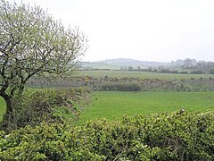
Cappagh is a small village and townland in the parish of Pomeroy in County Tyrone, Northern Ireland. It is between Pomeroy, Ballygawley, Galbally and Carrickmore, with the hamlet of Galbally about one mile to the east. Most of the land around Cappagh is farmland although a quarry lies just outside the village.
Altmore ) is a hamlet and townland in County Tyrone, Northern Ireland. It is five miles from Carrickmore and four miles from Pomeroy. The townland is actually called Altmore and is situated in the historic barony of Dungannon Middle and the civil parish of Pomeroy and covers an area of 1117 acres.

Killyman is a small village and a civil parish in Northern Ireland, situated on the eastern boundary of County Tyrone and extending into County Armagh. The majority of townlands are in the historic barony of Dungannon Middle in County Tyrone, the rest being in the barony of Oneilland West in County Armagh.
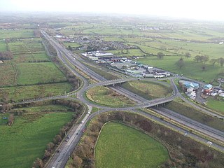
Tamnamore is a small village in County Tyrone, Northern Ireland, beside exit 14 on the M1 motorway, 7 km east of Dungannon. It lies within the townland of Tamlaghtmore in the civil parish of Killyman, the historic barony of Dungannon Middle, and is situated in Dungannon and South Tyrone Borough Council.
Altishane or Altishahane is a small settlement and townland in County Tyrone, Northern Ireland. It lies near Strabane, between Plumbridge and Donemana. It is situated in the historic barony of Strabane Lower and the civil parish of Donaghedy and covers an area of 744 acres. There is one primary school, Altishane Primary School.
Killeeshil is a townland(of 521 acres) and civil parish in County Tyrone, Northern Ireland. It is situated in the historic barony of Dungannon Lower.

Lisbunny is a townland of 849 acres in County Londonderry, Northern Ireland, about 3 miles Claudy, near the County Tyrone/Londonderry border. It is situated within Derry and Strabane district as well as the civil parish of Cumber Upper and the historic barony of Tirkeeran.

Bockets is a townland in County Tyrone, Northern Ireland. It is situated in the historic barony of Dungannon Lower and the civil parish of Killeeshil and covers an area of 667 acres.
Farriter is a townland in County Tyrone, Northern Ireland. It is situated in the historic barony of Dungannon Lower and the civil parish of Killeeshil and covers an area of 271 acres.
Tullyvannon is a townland in County Tyrone, Northern Ireland. It is situated in the historic barony of Dungannon Lower and the civil parish of Killeeshil and covers an area of 448 acres.

Aghaginduff is a townland in County Tyrone, Northern Ireland. It is situated in the historic barony of Dungannon Lower and the civil parish of Killeeshil and covers an area of 512 acres. Aghaginduff is located approximately 12 km west of Dungannon, close to Cabragh.

Cabragh is a townland in County Tyrone, Northern Ireland. It is situated in the historic barony of Dungannon Lower and the civil parish of Killeeshil and covers an area of 347 acres. Cabragh is located approximately 12 km west of Dungannon, close to Aghaginduff.

Glencull is a townland in County Tyrone, Northern Ireland. It is situated in the historic barony of Dungannon Lower and the civil parish of Errigal Ciaran and covers an area of 241 acres.