This page is based on this
Wikipedia article Text is available under the
CC BY-SA 4.0 license; additional terms may apply.
Images, videos and audio are available under their respective licenses.
Rock most often refers to:
Shiloh, Shilo, or Silo is a Hebrew word meaning "place of peace" and may refer to:

Longs Peak is a high and prominent mountain summit in the northern Front Range of the Rocky Mountains of North America. The 14,259-foot (4346 m) fourteener is located in the Rocky Mountain National Park Wilderness, 9.6 miles (15.5 km) southwest by south of the Town of Estes Park, Colorado, United States. Longs Peak is the northmost "fourteener" in the Rocky Mountains and the highest point in Boulder County and Rocky Mountain National Park. The mountain was named in honor of explorer Stephen Harriman Long and is featured on the Colorado state quarter.

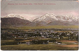
The Pomona Valley is located in the Greater Los Angeles Area between the San Gabriel Valley and San Bernardino Valley in Southern California. The valley is approximately 30 miles east of downtown Los Angeles, which can often be seen from nearby foothills. It ranges from the city of San Dimas from the far west to Rancho Cucamonga to the Far East portion of the valley. The alluvial valley is formed by the Santa Ana River and its tributaries.
Diamond is the hardest known natural material.
Mirny (masculine), Mirnaya (feminine), or Mirnoye (neuter) may refer to:

Garibaldi Provincial Park, also called Garibaldi Park, is a wilderness park located in British Columbia, Canada, about 70 kilometres (43.5 mi) north of Vancouver. The park is located to the east of the Sea to Sky Highway between Squamish and Whistler and covers an area of over 1,950 square kilometres. Garibaldi was designated as a provincial park in 1927, and originally included what was later split off in 1967 as Golden Ears Provincial Park, which juts southward between the basins of Pitt Lake and the Stave River into the Municipality of Maple Ridge.

Mount Fromme is a mountain on the North Shore of Vancouver, British Columbia, and a key North American mountain biking destination. Looking towards the North of the Burrard Inlet three mountains are clearly visible. Mt. Fromme has downhill trails that have made a name for the North Shore riding style. Mount Fromme features various trails, many of which are part of the NSMBA. Some of these trails are sponsored by companies which provide money to maintain the trails. There is also a nudist club called Van Tan Nudist Club past the second switch back on mountain highway. Members of the club are given access to the location by vehicle which is usually blocked of by a gate.
Mount Fromme features green, blue, black, double black and "triple red" trails.

Park Foothills is a neighborhood in Northeast El Paso. It is located west of U.S. 54 to the Franklin Mountains, and from Mountain Ridge Drive and Atlas Avenue north to the boundary of Castner Range at Hondo Pass Avenue, mainly on a hill known as Wingate Point down which Hondo Pass and Hercules Avenue run, which forms part of the eastern foothills of the Franklin Mountains. It encompasses the officially recognized neighborhoods of Park Foothills and Sunrise Acres West, which includes the area east of Echo Street to the Patriot Freeway. Park Foothills is mainly residential and developed piecemeal as part of a slow ongoing process, consisting of apartment complexes of varying sizes and houses of varying styles built either individually or as part of small developments constructed beginning in the early 1950s, with a commercial area along Gateway South Boulevard at its eastern edge and smaller business districts around the intersections of Hercules Avenue and Leo Street, Magnetic Street and Hondo Pass Avenue, and Zion Drive with Alabama Street. Many of Park Foothills' streets are named for minerals or gemstones or have names with an astronomical theme. Sunrise Park at the center of Park Foothills is its only park of any size.
The City of the Caesars, also variously known as City of Patagonia, the Wandering City, Trapalanda or Trapananda, Lin Lin or Elelín, is a mythical city of South America. It was supposedly located somewhere in Patagonia, in a valley of the Andes between Chile and Argentina. Despite being searched for during the colonization of South America, no evidence proves that it ever existed, although reports of it circulated for two hundred years. In 1766 a Jesuit, Father José García Alsue, explored the area now part of Queulat National Park in Aysén Region, Chile, searching unsuccessfully for the City of the Caesars.
The South Branch of the Little Dead Diamond River is a 4.3-mile (6.9 km) long river in northern New Hampshire in the United States. It is a tributary of the Little Dead Diamond River, located in the Androscoggin River watershed of Maine and New Hampshire.
The West Branch of the Little Dead Diamond River is a 2.5-mile (4.0 km) long river in northern New Hampshire in the United States. It is a tributary of the Little Dead Diamond River, located in the Androscoggin River watershed of Maine and New Hampshire.
The Middle Branch of the Dead Diamond River is a 9.0-mile (14.5 km) long river in northern New Hampshire in the United States. It is a tributary of the East Branch of the Dead Diamond River, located in the Androscoggin River watershed of Maine and New Hampshire.

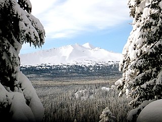
The Diamond Peak Wilderness is a wilderness area straddling the Cascade crest and includes the Diamond Peak volcano. It is located within two National Forests - the Willamette National Forest on the west and the Deschutes National Forest on the east.
Diamond Peak may refer to:

47th Street is an east–west running street between First Avenue and the West Side Highway in the borough of Manhattan in New York City. Traffic runs one way along the street, from east to west, starting at the headquarters of the United Nations. The street features the Diamond District in a single block and also courses through Times Square.

Diamond Peak is a prominent mountain summit in the Green River Basin of the U.S. state of Colorado. The 9,665-foot (2,946 m) peak is located 51.0 miles (82.1 km) northwest by west of the community of Maybell in Moffat County, Colorado, United States.


