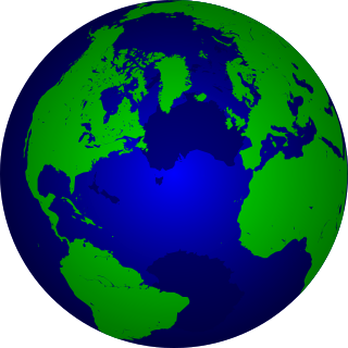
A geographic information system (GIS) is a system designed to capture, store, manipulate, analyze, manage, and present spatial or geographic data. GIS applications are tools that allow users to create interactive queries, analyze spatial information, edit data in maps, and present the results of all these operations. GIS sometimes refers to geographic information science (GIScience), the science underlying geographic concepts, applications, and systems.

A map is a symbolic depiction emphasizing relationships between elements of some space, such as objects, regions, or themes.

In modern mapping, a topographic map is a type of map characterized by large-scale detail and quantitative representation of relief, usually using contour lines, but historically using a variety of methods. Traditional definitions require a topographic map to show both natural and man-made features. A topographic survey is typically published as a map series, made up of two or more map sheets that combine to form the whole map. A contour line is a line connecting places of equal elevation.

Topography is the study of the shape and features of land surfaces. The topography of an area could refer to the surface shapes and features themselves, or a description.

Geomatics is defined in the ISO/TC 211 series of standards as the "discipline concerned with the collection, distribution, storage, analysis, processing, presentation of geographic data or geographic information". Under another definition it "consists of products, services and tools involved in the collection, integration and management of geographic data". It includes geomatics engineering and is related to geospatial science.
The National Ocean Service (NOS), an office within the U.S. Department of Commerce National Oceanic and Atmospheric Administration (NOAA), is responsible for preserving and enhancing the nation's coastal resources and ecosystems along 95,000 miles (153,000 km) of shoreline bordering 3,500,000 square miles (9,100,000 km2) of coastal, Great Lakes, and ocean waters. Its mission is to "provide science-based solutions through collaborative partnerships to address evolving economic, environmental, and social pressures on our oceans and coasts." NOS works closely with many partner agencies to ensure that ocean and coastal areas are safe, healthy, and productive. National Ocean Service scientists, natural resource managers, and specialists ensure safe and efficient marine transportation, promote innovative solutions to protect coastal communities, and conserve marine and coastal places. NOS is a scientific and technical organization of 1,700 scientists, natural resource managers, and specialists in many different fields. NOS delivers a dynamic range of nationwide coastal and Great Lakes scientific, technical, and resource management services in support of safe, healthy, and productive oceans and coasts. NOS develops partnerships to integrate expertise and efforts across all levels of government and with other interests to protect, maintain, and sustain the viability of coastal communities, economies and ecosystems.
Geoinformatics is the science and the technology which develops and uses information science infrastructure to address the problems of geography, cartography, geosciences and related branches of science and engineering.
CompStat—or COMPSTAT —is a combination of management, philosophy, and organizational management tools for police departments. It is named after the New York City Police Department's accountability process and has since been implemented by many other police departments, both in the United States and abroad.
Ordnance Survey of Northern Ireland (OSNI) was the official mapping agency of Northern Ireland. The agency ceased to exist separately on 1 April 2008 when it became part of Land and Property Services, an executive agency of the Northern Ireland Department of Finance and Personnel, along with the Rate Collection Agency, the Valuation and Lands Agency, and the Land Registry.
A cadastre is a comprehensive land recording of the real estate or real property's metes-and-bounds of a country.

OpenStreetMap (OSM) is a collaborative project to create a free editable map of the world. Rather than the map itself, the data generated by the project is considered its primary output. The creation and growth of OSM has been motivated by restrictions on use or availability of map information across much of the world, and the advent of inexpensive portable satellite navigation devices. OSM is considered a prominent example of volunteered geographic information.

An Electronic Chart Display and Information System (ECDIS) is a geographic information system used for nautical navigation that complies with International Maritime Organization (IMO) regulations as an alternative to paper nautical charts. IMO refers to similar systems not meeting the regulations as Electronic Chart Systems (ECSs).
Navteq was an American Chicago-based provider of geographic information system (GIS) data and a major provider of base electronic navigable maps. The company was acquired by Nokia in 2007/2008, and fully merged into Nokia in 2011 to form part of the Here business unit.

The Vector Map (VMAP), also called Vector Smart Map, is a vector-based collection of geographic information system (GIS) data about Earth at various levels of detail. Level 0 coverage is global and entirely in the public domain. Level 1 is only partly in the public domain.
The Norwegian Mapping Authority (NMA) is Norway's national mapping agency, dealing with land surveying, geodesy, hydrographic surveying, cadastre and cartography. The current director is Anne Cathrine Frøstrup. Its headquarters are in Hønefoss and it is a public agency under the Ministry of Local Government and Modernisation. NMA was founded in 1773.

Sailing Directions are written directions, describing the routes to be taken by boats and ships during coastal navigation, and port approaches. There are also products known as Sailing Directions, which are books written by various Hydrographic Offices throughout the world. They are known as Pilot Books, because they provide local knowledge of routes and landmarks, which would typically be provided by a local marine pilot. As such, they are used frequently by naval and government vessels, who are exempted from 'Compulsory Pilotage' in many ports.
Map database management systems are software programs designed to efficiently store and recall spatial information. They are widely used in localization and navigation, especially in automotive applications. Moreover, they are playing an increasingly important role in the emerging areas of location-based services, active safety functions and advanced driver-assistance systems. Common to these functions is the requirement for an on-board map database that contains information describing the road network.

The United States Geological Survey is a scientific agency of the United States government. The scientists of the USGS study the landscape of the United States, its natural resources, and the natural hazards that threaten it. The organization has four major science disciplines, concerning biology, geography, geology, and hydrology. The USGS is a fact-finding research organization with no regulatory responsibility.

Geodat was a commercial project, begun in 1980 and completed by 1991, that provided digital geographic mapping data for commercial users at scales equal to or greater than 1:1,000,000. The term "Geodat" was derived from "GEOgraphic DATa". Geodat data was primarily "medium scale", a nominal 1:100,000, but ranged from 1:50,000 to 1:250,000. The cartographic data was vector-based digitisation of coastline, hydrography, internal and international political boundaries, primary transportation routes and city locations. The data was intended to be used on its own to produce quick, cheap, consistent maps, initially for oil exploration firms. Harry Wassall, the founder of Petroconsultants SA, a Geneva-based energy information services firm, began the project in 1979 by hiring a researcher from the Harvard Laboratory for Computer Graphics and Spatial Analysis, Michael Mainelli, to explore how to automate Petroconsultants' extensive paper map series. Mainelli became Project Director in 1981. Petroconsultants concluded that a cooperative project among the oil firms acknowledged the high degree of overlap in their computer mapping interests.

Sandy Island is a non-existent island that was charted for over a century as being located near the French territory of New Caledonia between the Chesterfield Islands and Nereus Reef in the eastern Coral Sea. The island was included on many maps and nautical charts from as early as the late 19th century. It was removed from French hydrographic charts in 1974. The island gained wide media and public attention in November 2012 when the R/V Southern Surveyor, an Australian research ship, passed through the area and "undiscovered" it. The island was quickly removed from many maps and data sets, including those of the National Geographic Society and Google Maps.


