
The City of Wanneroo is a local government area with city status in the northern suburbs of Perth, Western Australia. It is centred approximately 25 kilometres (15.5 mi) north of Perth's central business district and forms part of the northern boundary of the Perth metropolitan area. Wangara encompasses the federal divisions of Cowan, Moore and Pearce.

The Division of Stirling is a former Australian electoral division in the inner northern and beachside suburbs of Perth, Western Australia, which included a large portion of the local government area of the City of Stirling.

The Division of Perth is an Australian electoral division in the state of Western Australia. It is named after Perth, the capital city of Western Australia, where the Division is located.

The Division of Pearce is an Australian electoral division in the state of Western Australia. It was created at the 1989 redistribution and named after George Pearce, the longest serving member of the Australian Senate, serving from 1901 to 1938. For most of its existence, Pearce was a hybrid urban-rural seat that covered Perth's outer northern suburbs before fanning inland from the Indian Ocean to take in portions of the Wheatbelt southeast, east and northeast of the capital. However, as of the 2021 redistribution, Pearce is largely coterminous with the City of Wanneroo in Perth's northern suburbs. It has had four members: Fred Chaney, Judi Moylan, Christian Porter, and Tracey Roberts. The first three were members of the Liberal Party, whereas Roberts, a former mayor of Wanneroo, is a member of the Labor Party.
Landsdale is a northern suburb of Perth, Western Australia located within the local government area of the City of Wanneroo. It is mixed use, with residential, commercial and light manufacturing areas.
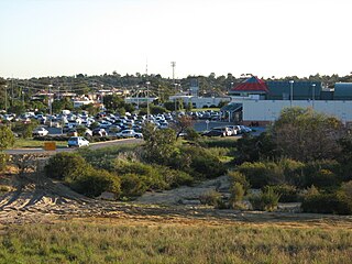
Madeley is a suburb of Perth, the capital city of Western Australia 20 kilometres (12 mi) north of Perth's central business district. Its local government area is the City of Wanneroo. Previously part of Landsdale, much of the suburb was rural in character until the 1990s, with market gardening a common activity. From 2001 onwards, extensive property development resulted in massive population growth, with the Property Investor Magazine of December 2007 estimating a growth rate of 33.3% per year.

Wanneroo Road is a 44-kilometre (27 mi) arterial highway in the northern suburbs of Perth, Western Australia linking Joondanna and Yokine in the south with Wanneroo and Yanchep in the north. As part of State Route 60, it begins from Charles Street in the inner city and becomes Indian Ocean Drive up to Dongara.
Ballajura was an electoral district of the Legislative Assembly in the Australian state of Western Australia from 1996 to 2005.
Balcatta is an electoral district of the Legislative Assembly in the Australian state of Western Australia.
Girrawheen was an electoral district of the Legislative Assembly in the Australian state of Western Australia from 1996 to 2021.

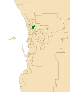
Wanneroo is an electoral district of the Legislative Assembly in the Australian state of Western Australia.

Cullacabardee is a northeastern rural suburb of Perth, the capital city of Western Australia, located 21 km (13 mi) from Perth's central business district via Alexander Drive or Beechboro Road. It is in the City of Swan local government area. Most of the suburb is covered in native sheoak and banksia forest. A small Noongar community is based on Baal Street, a drug rehabilitation retreat is located off Gnangara Road in the suburb's northeast, and the Perth International Telecommunications Centre facility is based in the suburb's northwest.

Alexander Drive is a major north–south arterial road in the northern suburbs of Perth, Western Australia, connecting Perth's central business district (CBD) with Edith Cowan University's Mount Lawley campus and the Malaga industrial area, as well as newer development suburbs to Perth's north. It is used by Transperth bus routes, including the 360, 361 and 362. Alexander Drive was named after Mr S.B. Alexander, a former Wanneroo Road Board member. Alexander Drive runs through the following local government areas City of Wanneroo, City of Swan, City of Bayswater and City of Stirling.

Hepburn Avenue is an arterial east-west road in the northern suburbs of Perth, Western Australia. The road links Sorrento in the west with Malaga and Whiteman in the east. It also connects the residential developments that span its length with several local facilities, as well as major road routes into central Perth.
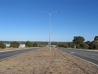
Ocean Reef Road is an arterial east-west road in Perth, Western Australia. It is located within the northern suburbs of Perth, from Ocean Reef in the west, to Landsdale in the east, with a portion travelling northwards along the coast to Iluka.
Luke Xavier Linton Simpkins is a former Australian politician who served as a member of the House of Representatives from 2007 to 2016. He represented the Division of Cowan in Western Australia for the Liberal Party.
Ocean Reef was an electoral district of the Legislative Assembly of Western Australia. It was located in Perth's northern suburbs, and was named after the suburb of Ocean Reef.

West Swan is an electoral district of the Legislative Assembly in the Australian state of Western Australia. It is located in the north-eastern suburbs of Perth.

Gnangara Road is an arterial east-west road in Perth, Western Australia. It is located within the northern suburbs of Perth, from Madeley in the west, to Henley Brook in the east. Gnangara Road provides a connection between Great Northern Highway and Wanneroo Road. The construction of the Ocean Reef Road extension in 2011 altered the road network in the Landsdale area in Landsdale. The plans show Gnangara Road as discontinuous between Mirrabooka Avenue and Alexander Drive, with the Mirrabooka Avenue and Ocean Reef Road extensions linking the two sections. Following construction, those linking road sections were named as Gnangara Road, allowing the road to remain continuous.
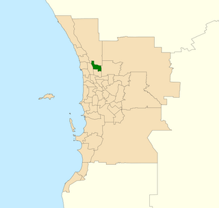
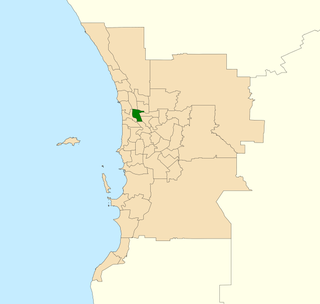
Landsdale is an electoral district of the Legislative Assembly in the Australian state of Western Australia.


