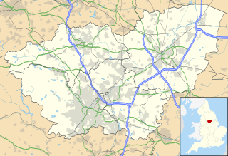
Hatfield is a town and civil parish in the Metropolitan Borough of Doncaster in South Yorkshire, England. It had a population of 16,776 at the 2011 Census, with its population split between the Hatfield and Thorne wards.

Zduńska Wola Karsznice is one of the biggest rail junctions in Poland, located in central part of the country, within the borders of the town of Zduńska Wola. It is a station along the Polish Coal Trunk-Line; before 1930 it had been a separate village, but construction of the Trunk-Line resulted in creation of a separate district for rail workers, with numerous condominiums. A few kilometers north of Karsznice, the Trunk-Line crosses the main East-West rail route Warsaw - Łódź - Ostrów Wielkopolski - Poznań/Wrocław.

Karolinowo is a village in the administrative district of Gmina Kcynia, within Nakło County, Kuyavian-Pomeranian Voivodeship, in north-central Poland. It lies approximately 8 kilometres (5 mi) west of Kcynia, 22 km (14 mi) south-west of Nakło nad Notecią, and 45 km (28 mi) west of Bydgoszcz.
Bąbowo is a village in the administrative district of Gmina Mogilno, within Mogilno County, Kuyavian-Pomeranian Voivodeship, in north-central Poland.

Jusaki-Zarzeka is a village in the administrative district of Gmina Łomazy, within Biała Podlaska County, Lublin Voivodeship, in eastern Poland. It lies approximately 2 kilometres (1 mi) south of Łomazy, 18 km (11 mi) south of Biała Podlaska, and 83 km (52 mi) north-east of the regional capital Lublin.
Nowa Góra is a village in the administrative district of Gmina Żarnów, within Opoczno County, Łódź Voivodeship, in central Poland.

Leźnica Wielka is a village in the administrative district of Gmina Parzęczew, within Zgierz County, Łódź Voivodeship, in central Poland. It lies approximately 7 kilometres (4 mi) north-west of Parzęczew, 24 km (15 mi) north-west of Zgierz, and 32 km (20 mi) north-west of the regional capital Łódź.

Opole is a village in the administrative district of Gmina Parzęczew, within Zgierz County, Łódź Voivodeship, in central Poland. It lies approximately 7 kilometres (4 mi) north of Parzęczew, 24 km (15 mi) north-west of Zgierz, and 31 km (19 mi) north-west of the regional capital Łódź.
Kowalewko is a village in the administrative district of Gmina Strzegowo, within Mława County, Masovian Voivodeship, in east-central Poland.

Borowce is a village in the administrative district of Gmina Troszyn, within Ostrołęka County, Masovian Voivodeship, in east-central Poland. It lies approximately 5 kilometres (3 mi) south of Troszyn, 13 km (8 mi) south-east of Ostrołęka, and 99 km (62 mi) north-east of Warsaw.

Oleśnica is a village in the administrative district of Gmina Chodzież, within Chodzież County, Greater Poland Voivodeship, in west-central Poland. It lies approximately 4 kilometres (2 mi) west of Chodzież and 67 km (42 mi) north of the regional capital Poznań.
Ramutki is a village in the administrative district of Gmina Środa Wielkopolska, within Środa Wielkopolska County, Greater Poland Voivodeship, in west-central Poland.

Dąbrówka-Młyn is a settlement in the administrative district of Gmina Luzino, within Wejherowo County, Pomeranian Voivodeship, in northern Poland. It lies approximately 5 kilometres (3 mi) east of Luzino, 7 km (4 mi) south-west of Wejherowo, and 37 km (23 mi) north-west of the regional capital Gdańsk.

Pochylnia Kąty is a settlement in the administrative district of Gmina Pasłęk, within Elbląg County, Warmian-Masurian Voivodeship, in northern Poland. It lies approximately 8 kilometres (5 mi) south-west of Pasłęk, 18 km (11 mi) south-east of Elbląg, and 63 km (39 mi) west of the regional capital Olsztyn.
Piłaki is a settlement in the administrative district of Gmina Sorkwity, within Mrągowo County, Warmian-Masurian Voivodeship, in northern Poland.

Brzostno is a village in the administrative district of Gmina Choszczno, within Choszczno County, West Pomeranian Voivodeship, in north-western Poland. It lies approximately 15 kilometres (9 mi) east of Choszczno and 75 km (47 mi) east of the regional capital Szczecin.

Gostyniec is a village in the administrative district of Gmina Świerzno, within Kamień County, West Pomeranian Voivodeship, in north-western Poland. It lies approximately 4 kilometres (2 mi) north of Świerzno, 13 km (8 mi) east of Kamień Pomorski, and 69 km (43 mi) north of the regional capital Szczecin.

Żołędno is a settlement in the administrative district of Gmina Połczyn-Zdrój, within Świdwin County, West Pomeranian Voivodeship, in north-western Poland. It lies approximately 8 kilometres (5 mi) west of Połczyn-Zdrój, 15 km (9 mi) east of Świdwin, and 102 km (63 mi) north-east of the regional capital Szczecin.
Hirevo is a village in the municipality of Sevlievo, in Gabrovo Province, in northern central Bulgaria.
Ebrahimabad is a village in Anjirabad Rural District, in the Central District of Gorgan County, Golestan Province, Iran. At the 2006 census, its population was 180, in 46 families.


