Eastern Cascades Slopes and Foothills (ecoregion)

Last updated
Eastern Cascades Slopes and Foothills ecoregion
Pumice Plateau.jpg
The Pumice Plateau, looking west toward the Oregon Cascade Volcanoes
Level III ecoregions, Pacific Northwest.png
Eastern Cascades Slopes and Foothills (9)
Ecology
Borders
Geography
CountryUnited States
StatesOregon, Washington and California
Coordinates 44°00′N122°00′W / 44.0°N 122.0°W / 44.0; -122.0 Coordinates: 44°00′N122°00′W / 44.0°N 122.0°W / 44.0; -122.0

The Eastern Cascades Slopes and Foothills ecoregion is a Level III ecoregion designated by the United States Environmental Protection Agency (EPA) in the U.S. states of Oregon, Washington, and California. In the rain shadow of the Cascade Range, the eastern side of the mountains experiences greater temperature extremes and receives less precipitation than the west side. Open forests of ponderosa pine and some lodgepole pine distinguish this region from the Cascades ecoregion, where hemlock and fir forests are more common, and from the lower, drier ecoregions to the east, where shrubs and grasslands are predominant. The vegetation is adapted to the prevailing dry, continental climate and frequent wildfire. Volcanic cones and buttes are common in much of the region. [1] [2]

Contents

The Eastern Cascades Slopes and Foothills ecoregion has been subdivided into ten Level IV ecoregions, as described below. Level IV mapping is not yet complete in California, and the information below includes only the sections in Washington and Oregon.

Level IV ecoregions

Level IV ecoregions in the Eastern Cascades Slopes and Foothills in Washington and Oregon. Contiguous areas in California have not been mapped yet. (Full map). Level IV ecoregions, Eastern Cascades.png
Level IV ecoregions in the Eastern Cascades Slopes and Foothills in Washington and Oregon. Contiguous areas in California have not been mapped yet. (Full map).

Yakima Plateau and Slopes (9a)

The high, unglaciated Yakima Plateau and Slopes ecoregion is characterized by plateaus, buttes, and canyons, with medium to high gradient permanent and intermittent streams and rivers on a surface of basalt. Natural springs occur, especially in the south. Elevation varies from 2,500 to 5,000 feet (760 to 1,500 m). The dry continental climate supports open woodlands dominated by ponderosa pine and bitterbrush, with some Douglas-fir and Oregon white oak. Fire is an integral part of the ecosystem. The region covers 1,793 square miles (4,640 km2) in Washington, mainly on land belonging to the Yakama Nation. [2]

Grand Fir Mixed Forest (9b)

The Grand Fir Mixed Forest ecoregion is characterized by high, glaciated plateaus, mountains, and canyons containing high gradient streams and rivers. Scattered lakes occur in glacial rock basins. Elevation varies from 2,200 to 6,500 feet (670 to 1,980 m). The frigid soils and snowy, continental climate support a mix of grand fir and Douglas-fir, with some ponderosa pine and western larch. Plants in the understory include vine maple, hazel, snowberry, and oceanspray. The region covers 812 square miles (2,100 km2) in Washington and 162 square miles (420 km2) in Oregon, on the eastern slopes of Mount Rainier, Mount Adams, and Mount Hood, and on Black Butte. It contains land belonging to the Yakama Nation and public land within the Wenatchee, Gifford Pinchot, Deschutes, and Mount Hood National Forests (including the Badger Creek Wilderness). [1] [2]

Oak/Conifer Foothills (9c)

The Oak/Conifer Foothills ecoregion is lower and drier than the Grand Fir Mixed Forest and more diverse than other parts of the Eastern Cascades. It consists of foothills, low mountains, plateaus, and valleys from 500 to 3,500 feet (150 to 1,070 m). Marine weather enters the region via the Columbia River Gorge, moderating the otherwise continental climate. As a result, soil, climate, and vegetation share characteristics of both eastern and western Oregon. The region is characterized by Oregon white oak woodlands and ponderosa pine forests in the east and Douglas-fir and western hemlock forests in the west. Some grasslands also occur. Understory plants include Idaho fescue, bluebunch wheatgrass, antelope bitterbrush, Oregon grape, hazel, and snowberry. Common land uses include forestry, recreation, grazing, rural residential development, orchards, and, in the valleys, grain and hay farming. The land is mostly privately owned. The region covers 563 square miles (1,460 km2) in Washington and 461 square miles (1,190 km2) in Oregon along the Columbia River corridor, including the lower reaches of the White Salmon and Klickitat River drainages. [1] [2]

Ponderosa Pine/Bitterbrush Woodland (9d)

The Ponderosa Pine/Bitterbrush Woodland ecoregion has a terrain dominated by high, undulating volcanic plateaus and canyons, with permanent, medium gradient streams. Elevation varies from 2,400 to 5,200 feet (730 to 1,580 m). Stream flow is consistent year-round, due to the volcanic hydrogeology. The well-drained, frigid soils are derived from Mazama Ash, which was produced by the catastrophic eruption of Mount Mazama about 6,845 years ago, and support nearly homogenous stands of ponderosa pine. Historically, frequent fires burned undergrowth, creating open groves of pines. Lodgepole pine is largely absent here. Understory vegetation varies with elevation; at lower elevations, antelope bitterbrush is important winter browse for deer. At higher elevations, greenleaf manzanita and snowberry are found. Riparian areas support mountain alder, stream dogwood, willows, and sedges. The region covers 1,077 square miles (2,790 km2) in Oregon, east of Mount Jefferson, Three Fingered Jack, and the Three Sisters, in the Deschutes National Forest and on the Warm Springs Indian Reservation. [1] [2]

Pumice Plateau (9e)

The Pumice Plateau ecoregion is a high volcanic plateau, characteristically covered by thick deposits of Mount Mazama ash and pumice. Elevation varies from 4,200 to 8,300 feet (1,300 to 2,500 m). Residual soils are very deep, highly permeable, and subject to drought, with intermittent, low to medium gradient streams and spring-fed creeks and marshes. Freezing temperatures are possible any time of year. Ponderosa pine forests are common on slopes, with white fir at higher elevations. Colder depressions and flats, where pumice deposits are thickest, are dominated by lodgepole pine, with an understory of antelope bitterbrush and Idaho fescue. Riparian areas support mountain alder, stream dogwood, willows, and quaking aspen. The Pumice Plateau is the largest of the Eastern Cascades subregions, covering 4,236 square miles (10,970 km2) in Oregon between Bend and Klamath Falls. It contains extensive areas within the Deschutes and Fremont-Winema National Forests (including the Gearhart Mountain Wilderness) and the lower elevations of the Newberry National Volcanic Monument. [1] [2]

Cold Wet Pumice Plateau Basins (9f)

The Cold Wet Pumice Plateau Basins ecoregion includes Sycan Marsh, Klamath Marsh, and La Pine Basin, which are surrounded by the Pumice Plateau but have distinct vegetation and topography. At an elevation of 4,100 to 5,200 feet (1,200 to 1,600 m), they function as cold air catch-basins during the winter, which results in lower minimum temperatures. Soils in the basins have water tables at or near the surface for significant periods of the year, in contrast to the soils of the Pumice Plateau. The La Pine Basin is underlain by thick lacustrine deposits that exhibit high groundwater levels during the spring snowmelt. It supports lodgepole pine stands, as well as wet, forested wetlands of lodgepole pine, willow, and aspen. Scattered ponderosa pine shrub forest is found on the driest soils. The Sycan and Klamath marshes support wetland meadow vegetation, including tules and tufted hairgrass. Marshes, lakes, reservoirs, wetland forests, and medium and low gradient rivers provide important habitat for migratory waterfowl. The region covers 651 square miles (1,690 km2) in Oregon, a mixture of private and public lands, including the Deschutes and Fremont-Winema National Forests and the Klamath Marsh National Wildlife Refuge. [1] [2]

Klamath/Goose Lake Warm Wet Basins (9g)

The Klamath/Goose Lake Warm Wet Basins ecoregion (named for Upper Klamath and Goose lakes) is drier than elsewhere in the eastern Cascades, yet it contains floodplains, terraces, and a pluvial lake basin. Elevation varies from 4,000 to 5,400 feet (1,200 to 1,600 m). A variety of wildrye, bluegrass, and wheatgrass species once covered the basins, but most of the wet meadows and wetlands have been drained for rural residential development, pasture, and cropland, including alfalfa, potatoes, and small grains. Potential vegetation includes bluebunch wheatgrass, Idaho fescue, antelope bitterbrush, big sagebrush, and low sagebrush on the steppes, with tules, cattails, and sedges in the wetlands. Several marshland wildlife refuges within the Klamath Basin National Wildlife Refuges Complex are key to preserving regional biodiversity, particularly at-risk bird and fish species. The region covers 1,039 square miles (2,690 km2) in Klamath and Lake counties, Oregon. Contiguous areas in California have not been mapped yet. [1] [2]

Fremont Pine/Fir Forest (9h)

The Fremont Pine/Fir Forest ecoregion contains steeply to moderately sloping mountains and high plateaus that rarely exceed timberline. Elevation varies from 5,000 to 8,000 feet (1,500 to 2,400 m). Residual soils are common in the region, in contrast to the Pumice Plateau, where soils have been deeply buried by pumice and ash. Reservoirs, a few glacial rock-basin lakes, many springs, and high gradient intermittent and ephemeral streams occur. The continental climate and diverse terrain support a range of vegetation types. Ponderosa pine and western juniper woodlands are common at lower elevations. White fir, sugar pine, whitebark pine, lodgepole pine, and California incense-cedar are found on north slopes and at higher elevations. Understory plants include snowberry, heartleaf arnica, Wheeler bluegrass, antelope bitterbrush, and longstolon sedge. The region covers 1,672 square miles (4,330 km2) in Oregon, mainly on public land within the Fremont-Winema National Forest. Contiguous areas in California have not been mapped yet. [1] [2]

Southern Cascades Slope (9i)

The Southern Cascades Slope ecoregion is a transitional zone between the Cascades ecoregion and the drier Eastern Cascade Slopes and Foothills, characterized by moderately sloping mountains with medium to high gradient streams. Elevation varies from 3,600 to 6,300 feet (1,100 to 1,900 m). It is higher than other subregions in the Eastern Cascades and typically receives greater precipitation. Forests of ponderosa pine blanket the mountainous landscape; white fir, Shasta red fir, Douglas-fir, and incense cedar grow at higher elevations. Understory plants include Idaho fescue, antelope bitterbrush, Ross' sedge, western fescue, snowberry, and golden chinkapin. The region covers 515 square miles (1,330 km2) in Oregon, south of Aspen Butte in the Klamath River watershed, including Bear Valley National Wildlife Refuge. Contiguous areas in California have not been mapped yet. [1] [2]

Klamath Juniper Woodland (9j)

The Klamath Juniper Woodland ecoregion is composed of undulating hills, benches, and escarpments covered with a mosaic of rangeland and woodland, at an elevation of 4,400 to 6,200 feet (1,300 to 1,900 m). Mean annual precipitation ranges from 12 to 20 inches (30 to 51 cm) per year. Western juniper grows on shallow, rocky soils with an understory of low sagebrush, Wyoming big sagebrush, bitterbrush, and bunchgrasses. Several species found in the shrub-steppe grasslands are uncommon in eastern Oregon, such as woolly wyethia, Klamath plum, and birchleaf mountain-mahogany. The diverse shrublands provide important wildlife habitat. Reservoirs dot the landscape and are important to lowland irrigation. The region covers 784 square miles (2,030 km2) in Oregon, south of Klamath Falls in the Lost River watershed, a mixture of public and private land. Contiguous areas in California have not been mapped yet. [1] [2]

Flora

Fauna

Landscapes

See also

Related Research Articles

Ecology of California Environments and natural history of California

The ecology of California can be understood by dividing the state into a number of ecoregions, which contain distinct ecological communities of plants and animals in a contiguous region. The ecoregions of California can be grouped into four major groups: desert ecoregions, Mediterranean ecoregions, forested mountains, and coastal forests.

Northern California coastal forests (WWF ecoregion) WWF Ecoregion

The Northern California coastal forests are a temperate coniferous forests ecoregion of coastal Northern California, USA.

Modoc National Forest

The Modoc National Forest is a 1,654,392-acre (6,695 km2) national forest in northeastern California.

California mixed evergreen forest

California mixed evergreen forest is an ecoregion of the Temperate broadleaf and mixed forests biome. It is found in the mountain ranges of California and into southwestern Oregon.

The Fremont-Winema National Forest of south central Oregon is a mountainous region with a rich geological, ecological, archaeological, and historical history. Founded in 1908, the Fremont National Forest was originally protected as the Goose Lake Forest Reserve in 1906. The name was soon changed to Fremont National Forest, named after John C. Frémont, who explored the area for the United States Army Corps of Engineers in 1843. It absorbed part of Paulina National Forest on July 19, 1915. In 2002, it was administratively combined with the Winema National Forest as the Fremont–Winema National Forests.

Sky Lakes Wilderness

The Sky Lakes Wilderness is a wilderness area located in the Rogue River–Siskiyou and Fremont–Winema national forests in the southern Cascade Range of Oregon in the United States. It comprises 116,300 acres (47,100 ha), of which 75,695 acres (30,633 ha) are in the Rogue River–Siskiyou National Forest and 40,605 acres (16,432 ha) are in the Fremont–Winema National Forest. It was established in 1984 under the Wilderness Act of 1964.

Gearhart Mountain Wilderness

Gearhart Mountain Wilderness is a wilderness area located within the Fremont–Winema National Forest in Lake County and Klamath County in south-central Oregon. This area was established in 1943 as a Wild Area and designated as wilderness with the Wilderness Act of 1964. In 1984, an additional 4,144 acres (1,677 ha) were added for a total of 22,823 acres (9,236 ha). The wilderness is entirely within the Bly Ranger District.

Sun Pass State Forest

Sun Pass State Forest is one of six state forests managed by the Oregon Department of Forestry. The forest is located 40 miles (64 km) north of Klamath Falls, Oregon near the southeastern corner of Crater Lake National Park. It is the largest single block of Oregon state forestry land east of the Cascade Mountains. The forest is managed as part of the Klamath-Lake District, comprising 21,317 acres (86.27 km2) of the 33,739 state-owned acres within the district.

Coast Range (EPA ecoregion) ecoregion in the United States

The Coast Range ecoregion is a Level III ecoregion designated by the Environmental Protection Agency (EPA) in the U.S. states of Washington, Oregon, and California. It stretches along the Pacific Coast from the tip of the Olympic Peninsula in the north to the San Francisco Bay in the south, including Grays Harbor, Willapa Bay, and the Long Beach Peninsula in Washington, the entire length of the Oregon Coast, and the Northern California Coast. Named for the Coast Range mountains, it encompasses the lower elevations of the Olympic Mountains, the Oregon Coast Range, the Californian North Coast Ranges, and surrounding lowlands.

Willamette Valley (ecoregion)

The Willamette Valley ecoregion is a Level III ecoregion designated by the United States Environmental Protection Agency in the U.S. states of Oregon and Washington. Slightly larger than the Willamette Valley for which it is named, the ecoregion contains fluvial terraces and floodplains of the Willamette River system, scattered hills, buttes, and adjacent foothills. It is distinguished from the neighboring Coast Range, Cascades, and Klamath Mountains ecoregions by lower precipitation, lower elevation, less relief, and a different mosaic of vegetation. Mean annual rainfall is 37 to 60 inches, and summers are generally dry. Historically, the region was covered by rolling prairies, oak savanna, coniferous forests, extensive wetlands, and deciduous riparian forests. Today, it contains the bulk of Oregon's population, industry, commerce, and agriculture. Productive soils and a temperate climate make it one of the most important agricultural areas in Oregon.

Cascades (ecoregion)

The Cascades ecoregion is a Level III ecoregion designated by the United States Environmental Protection Agency (EPA) in the U.S. states of Washington, Oregon, and California. Somewhat smaller than the Cascade mountain range for which it is named, the ecoregion extends north to Snoqualmie Pass, near Seattle, and south to Hayden Pass, near the Oregon-California border, including the peaks and western slopes of most of the High Cascades. A discontiguous section is located on Mount Shasta in California.

Blue Mountains (ecoregion) Ecoregion (WWF)

The Blue Mountains ecoregion is a Level III ecoregion designated by the United States Environmental Protection Agency (EPA) in the Pacific Northwest, mainly in the state of Oregon, with small areas over the state border in Idaho and southeastern Washington. It is also contiguous with the World Wildlife Fund's Blue Mountain forests ecoregion.

Columbia Plateau (ecoregion) Level III ecoregion in the United States

The Columbia Plateau ecoregion is a Level III ecoregion designated by the United States Environmental Protection Agency (EPA) encompassing approximately 32,100 square miles (83,139 km2) of land within the U.S. states of Washington, Oregon, and Idaho. The ecoregion extends across a wide swath of the Columbia River Basin from The Dalles, Oregon to Lewiston, Idaho to Okanogan, Washington near the Canada–US border. It includes nearly 500 miles (800 km) of the Columbia River, as well as the lower reaches of major tributaries such as the Snake and Yakima rivers and the associated drainage basins. It is named for the Columbia River Plateau, a flood basalt plateau formed by the Columbia River Basalt Group during the late Miocene and early Pliocene. The arid sagebrush steppe and grasslands of the region are flanked by moister, predominantly forested, mountainous ecoregions on all sides. The underlying basalt is up to 2 miles (3 km) thick and partially covered by thick loess deposits. Where precipitation amounts are sufficient, the deep loess soils have been extensively cultivated for wheat. Water from the Columbia River is subject to resource allocation debates involving fisheries, navigation, hydropower, recreation, and irrigation, and the Columbia Basin Project has dramatically converted much of the region to agricultural use.

Klamath Mountains (ecoregion) Ecoregion (WWF)

The Klamath Mountains ecoregion of Oregon and California lies inland and north of the Coast Range ecoregion, extending from the Umpqua River in the north to the Sacramento Valley in the south. It encompasses the highly dissected ridges, foothills, and valleys of the Klamath and Siskiyou Mountains. It corresponds to the Level III ecoregion designated by the Environmental Protection Agency and to the Klamath-Siskiyou forests ecoregion designated by the World Wide Fund for Nature.

Northern Basin and Range ecoregion

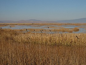
The Northern Basin and Range ecoregion is a Level III ecoregion designated by the United States Environmental Protection Agency (EPA) in the U.S. states of Oregon, Idaho, Nevada, Utah, and California. It contains dissected lava plains, rolling hills, alluvial fans, valleys, and scattered mountain ranges in the northern part of the Great Basin. Although arid, the ecoregion is higher and cooler than the Snake River Plain to the north and has more available moisture and a cooler climate than the Central Basin and Range to the south. Its southern boundary is determined by the highest shoreline of Pleistocene Lake Bonneville, which once inundated the Central Basin and Range. The western part of the region is internally drained; its eastern stream network drains to the Snake River system.

Ecology of the North Cascades Ecosystems of the Cascade mountain range in northern Washington state and southern British Columbia

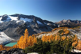
The Ecology of the North Cascades is heavily influenced by the high elevation and rain shadow effects of the mountain range. The North Cascades is a section of the Cascade Range from the South Fork of the Snoqualmie River in Washington, United States, to the confluence of the Thompson and Fraser Rivers in British Columbia, Canada, where the range is officially called the Cascade Mountains but is usually referred to as the Canadian Cascades. The North Cascades Ecoregion is a Level III ecoregion in the Commission for Environmental Cooperation's classification system.

Ochoco Mountains

The Ochoco Mountains are a mountain range in central Oregon in the United States, located at the western end of the Blue Mountains. They were formed when Permian, Triassic, and Jurassic rocks were slowly uplifted by volcanic eruptions to form the Clarno Formation. Today, the highest point in the range is Lookout Mountain. The dominant vegetation on the west side of the range is old-growth ponderosa pine; on the east side, western juniper is common. The western area of the mountains is administered by the Ochoco National Forest, while the southeastern section is part of the Malheur National Forest. The Ochoco Mountains are used for hiking, camping, bird watching, rockhounding, and hunting, as well as cross-country skiing in the winter.

Upper montane forest Vegetation type found in mountains below the subalpine zone

The upper montane forest is a vegetation type generally found above the mixed coniferous forest and below the subalpine forest vegetation types. Most of what grows in upper montane forests are conifers, because of the short growing season.

Hager Mountain mountain in Oregon, United States of America

Hager Mountain is a volcanic peak in Oregon in the northwest corner of the Basin and Range Province in the United States. The mountain is located south of the small unincorporated community of Silver Lake in south-central Oregon, and it is in the Fremont–Winema National Forest. On the summit, there is a fire lookout operated during the summer and fall by the United States Forest Service. There are several hiking trails that lead to the lookout station.

References

  1. 1 2 3 4 5 6 7 8 9 10 PD-icon.svg This article incorporates  public domain material from the United States Geological Survey document: Thorson, TD; Bryce, SA; Lammers, DA; et al. "Ecoregions of Oregon" (PDF).(color poster with map, descriptive text, summary tables, and photographs; with a Reverse side )
  2. 1 2 3 4 5 6 7 8 9 10 11 PD-icon.svg This article incorporates  public domain material from the United States Geological Survey document: Pater, D; Bryce, SA; Kagan, J; et al. "Ecoregions of Western Washington and Oregon" (PDF).(color poster with map, descriptive text, summary tables, and photographs; with a Reverse side )