Ebro, Florida

Last updated

Ebro, Florida
SR79 SR20 intersection in Ebro Florida.jpg
Looking northerly at the intersection of State Road 20 and State Road 79 in Ebro
Washington County Florida Incorporated and Unincorporated areas Ebro Highlighted.svg
Location in Washington County and the state of Florida
Coordinates: 30°26′35″N85°52′51″W / 30.44306°N 85.88083°W / 30.44306; -85.88083
Country Flag of the United States.svg  United States
State Flag of Florida.svg  Florida
County   Washington
Incorporated 1967 [1]
Government
  Type Mayor-Council
   Mayor [2] David Evans
   Council President Gina Rutherford
   Councilmembers Regina Kincaid,
Charles Scott, and
Sally Young
   Town Clerk Linda Marlow
   Town Attorney Richard Adkison
Area
[3]
  Total4.83 sq mi (12.51 km2)
  Land4.72 sq mi (12.24 km2)
  Water0.10 sq mi (0.27 km2)
Elevation
75 ft (23 m)
Population
 (2020)
  Total237
  Density50.16/sq mi (19.37/km2)
Time zone UTC-6 (Central (CST))
  Summer (DST) UTC-5 (CDT)
ZIP code
32437
Area code 850
FIPS code 12-19725 [4]
GNIS feature ID0282067 [5]

Ebro is a town in Washington County, Florida, United States. The town is part of the Florida Panhandle, and located in North Florida. As of 2020, the population recorded by the U.S. Census Bureau is 237.

Contents

It is believed that during the Spanish Florida era, the Spanish named the town after the Ebro River in Spain. [2]

Geography

The exact coordinates for the Town of Ebro is located in the southwestern part of Washington County at 30°26′35″N85°52′51″W / 30.44306°N 85.88083°W / 30.44306; -85.88083 (30.443152, –85.880790). [6] It is the closest municipality to Northwest Florida Beaches International Airport.

Florida State Roads 20 and 79 are the main roads through the town. FL-79 runs from north to south to the east of the town, leading north 31 mi (50 km) to Bonifay along Interstate 10 and south 16 mi (26 km) to U.S. Route 98 near Panama City Beach. FL-20 runs from west to east through the center of town, leading east 51 mi (82 km) to Blountstown and west 17 mi (27 km) to Freeport.

According to the United States Census Bureau, the town has a total area of 3.2 square miles (8.3 km2). 3.2 square miles (8.3 km2) of it is land and 0.1 square miles (0.26 km2) of it (1.56%) is water.

Climate

The climate in this area is characterized by hot, humid summers and generally mild winters. According to the Köppen climate classification, the Town of Ebro has a humid subtropical climate zone (Cfa).

Demographics

Historical population
CensusPop.Note
1970 125
1980 23386.4%
1990 2559.4%
2000 250−2.0%
2010 2708.0%
2020 237−12.2%
U.S. Decennial Census [7]

2010 and 2020 census

Ebro racial composition
(Hispanics excluded from racial categories)
(NH = Non-Hispanic)
RacePop 2010 [8] Pop 2020 [9] % 2010% 2020
White (NH)22120081.85%84.39%
Black or African American (NH)351.11%2.11%
Native American or Alaska Native (NH)1595.56%3.80%
Asian (NH)100.37%0.00%
Pacific Islander or Native Hawaiian (NH)000.00%0.00%
Some other race (NH)000.00%0.00%
Two or more races/Multiracial (NH)23158.52%6.33%
Hispanic or Latino (any race)782.59%3.38%
Total270237

As of the 2020 United States census, there were 237 people, 103 households, and 65 families residing in the town. [10]

As of the 2010 United States census, there were 270 people, 109 households, and 86 families residing in the town. [11]

2000 census

As of the census [4] of 2000, there were 250 people, 102 households, and 63 families residing in the town. The population density was 79.4 inhabitants per square mile (30.7/km2). There were 116 housing units at an average density of 36.8 per square mile (14.2/km2). The racial makeup of the town was 73.60% White, 3.60% African American, 6.40% Native American, 0.40% Pacific Islander, 0.40% from other races, and 15.60% from two or more races. Hispanic or Latino of any race were 4.40% of the population.

In 2000, there were 102 households, out of which 33.3% had children under the age of 18 living with them, 47.1% were married couples living together, 10.8% had a female householder with no husband present, and 38.2% were non-families. 32.4% of all households were made up of individuals, and 9.8% had someone living alone who was 65 years of age or older. The average household size was 2.45 and the average family size was 3.10.

In 2000, in the town, the population was spread out, with 23.2% under the age of 18, 12.0% from 18 to 24, 29.2% from 25 to 44, 27.6% from 45 to 64, and 8.0% who were 65 years of age or older. The median age was 36 years. For every 100 females, there were 98.4 males. For every 100 females age 18 and over, there were 102.1 males.

In 2000, the median income for a household in the town was $28,750, and the median income for a family was $40,833. Males had a median income of $33,333 versus $25,208 for females. The per capita income for the town was $14,504. About 20.6% of families and 21.0% of the population were below the poverty line, including 22.6% of those under the age of eighteen and 25.0% of those 65 or over.

Images

Related Research Articles

<span class="mw-page-title-main">Horseshoe Beach, Florida</span> Town in the state of Florida, United States

Horseshoe Beach is a town in southern Dixie County, Florida, United States. The town is part of Big Bend and the Nature Coast in North Florida, along the Gulf of Mexico. The population was 165 at the 2020 census.

<span class="mw-page-title-main">Beverly Beach, Florida</span> Town in Florida, United States

Beverly Beach is a town in Flagler County, Florida, United States. The Town of Beverly Beach is part of the Deltona–Daytona Beach–Ormond Beach, FL metropolitan statistical area. The population was 474 at the 2020 census, up from 338 in the 2010 census.

<span class="mw-page-title-main">Esto, Florida</span> Town in Florida, United States

Esto is a town in Holmes County, Florida, United States. The Town of Esto is located on the Florida Panhandle in North Florida. The population was 341 at the 2020 census.

<span class="mw-page-title-main">Noma, Florida</span> Town in the state of Florida, United States

Noma is a town in Holmes County, Florida, United States. The town is part of the Florida Panhandle in North Florida. The population was 208 at the 2020 census.

<span class="mw-page-title-main">Ponce de Leon, Florida</span> Town in the state of Florida, United States

Ponce de Leon is a town in Holmes County, Florida, United States. The Town of Ponce de Leon was named after Spanish explorer, Juan Ponce de León. It is part of the Florida Panhandle in North Florida. The population was 504 at the 2020 census, down from 598 at the 2010 census.

<span class="mw-page-title-main">Westville, Florida</span> Town in the state of Florida, United States

Westville is a town in Holmes County, Florida, United States. Westville is part of the Florida Panhandle in North Florida. As of the 2020 census, the town had a population of 261, down from 289 at the 2010 census. From 2010 to 2020, Westville's population growth percentage was -9.7%.

<span class="mw-page-title-main">Alford, Florida</span> Town in Florida, United States

Alford is a town in Jackson County, Florida, United States. The Town of Alford is located on the Florida Panhandle near Marianna, in North Florida. The population was 484 at the 2020 census.

<span class="mw-page-title-main">Bascom, Florida</span> Town in Florida, United States

Bascom is a town in Jackson County, Florida, United States. The town is located on the Florida Panhandle in North Florida, and is 5 miles (8 km) south of the Alabama border. The population was 121 at the 2020 census.

<span class="mw-page-title-main">Campbellton, Florida</span> Town in Florida, United States

Campbellton is a town in Jackson County, Florida, United States. The town is part of the Florida Panhandle in North Florida, and has a predominately African American majority. The population was 191 at the 2020 census.

<span class="mw-page-title-main">Cottondale, Florida</span> City in Florida, United States

Cottondale is a city in Jackson County, Florida, United States. It is part of the Florida Panhandle and North Florida. The population was 848 at the 2020 census, down from 933 at the 2010 census.

<span class="mw-page-title-main">Grand Ridge, Florida</span> Town in Florida, United States

Grand Ridge is a town in Jackson County, Florida, United States. It is part of the Florida Panhandle and North Florida. The population was 882 at the 2020 census.

<span class="mw-page-title-main">Greenwood, Florida</span> Town in Florida, United States

Greenwood is a town in Jackson County, Florida, United States. It is part of the Florida Panhandle and located in North Florida, specifically Northwest Florida. The population was 539 at the 2020 census.

<span class="mw-page-title-main">Malone, Florida</span> Town in the state of Florida, United States

Malone is a town in Jackson County, Florida, United States. The population was 1,959 at the 2020 census.

<span class="mw-page-title-main">Sneads, Florida</span> Town in the state of Florida, United States

Sneads is a town in Jackson County, Florida, United States. The population was 1,849 at the 2020 census.

<span class="mw-page-title-main">Lake Hamilton, Florida</span> Town in the state of Florida, United States

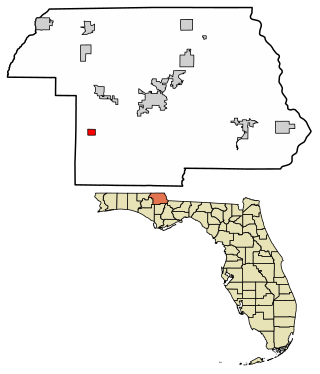
Lake Hamilton is a town in Polk County, Florida, United States. The population was 1,537 at the 2020 census. It is part of the Lakeland–Winter Haven Metropolitan Statistical Area.

<span class="mw-page-title-main">St. Lucie Village, Florida</span> Town in the state of Florida, United States

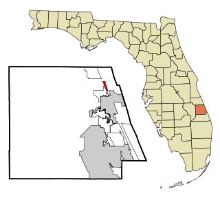
St. Lucie Village is a town in St. Lucie County, Florida, United States. It is part of the Port St. Lucie Metropolitan Statistical Area. The population was 613 at the 2020 census.

<span class="mw-page-title-main">Lake Butler, Union County, Florida</span> City in Florida, United States of America

Lake Butler is a city in and the county seat of Union County, Florida, United States. The population was 1,986 at the 2020 census.

<span class="mw-page-title-main">Vernon, Florida</span> City in Florida, United States

Vernon is a city in Washington County, Florida. The population was 732 at the 2020 census.

<span class="mw-page-title-main">Wausau, Florida</span> Town in the state of Florida, United States

Wausau is a town in Washington County, Florida, United States. The Town of Wausau is part of the Florida Panhandle in North Florida. The population was 371 at the 2020 census.

<span class="mw-page-title-main">Indian River Shores, Florida</span> Town in the state of Florida, United States

Indian River Shores is a town in Indian River County, Florida, United States. As of the 2020 census, the town has a population of 4,241. Located on Orchid Island, Indian River Shores is bordered by the Atlantic Ocean to the east and the Indian River Lagoon to the west.

References

  1. "FLORIDA CITIES BY INCORPORATION YEAR WITH INCORPORATION & DISSOLUTION INFO" (PDF). www.flcities.com.
  2. 1 2 "MUNICIPAL DIRECTORY: Town of Ebro". Florida League of Cities.
  3. "2020 U.S. Gazetteer Files". United States Census Bureau. Retrieved October 31, 2021.
  4. 1 2 "U.S. Census website". United States Census Bureau . Retrieved January 31, 2008.
  5. "US Board on Geographic Names". United States Geological Survey. October 25, 2007. Retrieved January 31, 2008.
  6. "US Gazetteer files: 2010, 2000, and 1990". United States Census Bureau. February 12, 2011. Retrieved April 23, 2011.
  7. "Census of Population and Housing". Census.gov. Retrieved June 4, 2015.
  8. "P2 HISPANIC OR LATINO, AND NOT HISPANIC OR LATINO BY RACE - 2010: DEC Redistricting Data (PL 94-171) - Ebro town, Florida". United States Census Bureau .
  9. "P2 HISPANIC OR LATINO, AND NOT HISPANIC OR LATINO BY RACE - 2020: DEC Redistricting Data (PL 94-171) - Ebro town, Florida". United States Census Bureau .
  10. "S1101 HOUSEHOLDS AND FAMILIES - 2020: Ebro town, Florida". United States Census Bureau .
  11. "S1101 HOUSEHOLDS AND FAMILIES - 2010: Ebro town, Florida". United States Census Bureau .