El Alba/La Lumbrera Airport

Last updated
El Alba Airport
Summary
Airport type Public
Serves Melipilla, Chile
Location La Lumbrera
Elevation  AMSL 450 ft / 137 m
Coordinates 33°39′31″S71°17′25″W / 33.65861°S 71.29028°W / -33.65861; -71.29028 (El Alba Airport (Melipilla)) Coordinates: 33°39′31″S71°17′25″W / 33.65861°S 71.29028°W / -33.65861; -71.29028 (El Alba Airport (Melipilla))
Map
Chile location map.svg
Airplane silhouette.svg
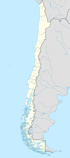
SCAB
Location of El Alba Airport in Chile
Runways
Direction Length Surface
m ft
09/27 517 1,696 Grass
Source: Landings.com [1] Google Maps [2] GCM [3]

El Alba Airport (Spanish : Aeropuerto El Alba), ( ICAO : SCAB) is an airport 6 kilometres (3.7 mi) northwest of Melipilla, a city in the Santiago Metropolitan Region of Chile.

Spanish language Romance language

Spanish or Castilian is a Western Romance language that originated in the Castile region of Spain and today has hundreds of millions of native speakers in the Americas and Spain. It is a global language and the world's second-most spoken native language, after Mandarin Chinese.

ICAO airport code four-letter code designating many airports around the world

The ICAOairport code or location indicator is a four-letter code designating aerodromes around the world. These codes, as defined by the International Civil Aviation Organization and published in ICAO Document 7910: Location Indicators, are used by air traffic control and airline operations such as flight planning.

Melipilla City and Commune in Santiago Metro., Chile

Melipilla is a Chilean commune and capital city of the province of the same name, located in the Santiago Metropolitan Region southwest of the nation's capital. The commune spans an area of 1,344.8 km2 (519 sq mi).

Contents

There are hills southeast of the runway. The Melipilla non-directional beacon (Ident: PIL) is located 3.5 nautical miles (6.5 km) east-southeast of the airport. [4]

Non-directional beacon radio transmitter which emits radio waves in all directions

A non-directional (radio) beacon (NDB) is a radio transmitter at a known location, used as an aviation or marine navigational aid. As the name implies, the signal transmitted does not include inherent directional information, in contrast to other navigational aids such as low frequency radio range, VHF omnidirectional range (VOR) and TACAN. NDB signals follow the curvature of the Earth, so they can be received at much greater distances at lower altitudes, a major advantage over VOR. However, NDB signals are also affected more by atmospheric conditions, mountainous terrain, coastal refraction and electrical storms, particularly at long range.

See also

Transport in Chile

Transport in Chile is mostly by road. The south of the country is not connected to central Chile by road, except through Argentina, and water transport also plays a part there. The railways were historically important in Chile, but now play a relatively small part in the country's transport system. Because of the country's geography and long distances between major cities, aviation is also important.

Related Research Articles

El Buitre Airport is a military airport just south of Arica, a Pacific coastal city in the Tarapacá Region of Chile.

El Litral Airport (Spanish: Aeropuerto de El Litral, is an airport 7 kilometres southeast of Quillón, a city in Bío Bío Region of Chile. It is 12 kilometres southwest of Bulnes.

El Algarrobo Airport Spanish: Aeropuerto El Algarrobo, is a rural airstrip 10 kilometres (6.2 mi) up a mountain valley from Cabildo, a town in the Valparaíso Region of Chile.

Chile Chico Airport Spanish: Aeródromo Chile Chico, is an airport serving Chile Chico, a lakeside town in the Aysén Region of Chile. Chile Chico is on the south shore of General Carrera Lake, 3 kilometres (1.9 mi) west of the Argentina border. The airport is 5 kilometres (3.1 mi) southeast of the town.

Teniente Vidal Airport Spanish: Aeródromo Teniente Vidal, is an airport serving Coyhaique, capital of the Aysén Region of Chile. The airport is 3 kilometres (1.9 mi) southwest of Coyhaique.

Punta el Saco Airport Spanish: Aeropuerto Punta el Saco, is an airport on the south shore of Isla Mocha, a small Pacific island 32 kilometres (20 mi) off the coast of Chile. Isla Mocha is part of Chile's Bío Bío Region.

Lipangui Airport Spanish: Aeropuerto Lipangui, is an airport 6 kilometres (3.7 mi) south-southeast of Lampa, a city in the Santiago Metropolitan Region of Chile.

San Rafael Airport Spanish: Aeródromo de San Rafael de Los Andes, is an airport serving Los Andes, a city in the Valparaíso Region of Chile. The airport is 5 kilometres (3.1 mi) west-northwest of the city.

María Dolores Airport is an airport serving Los Ángeles, capital of Bío Bío Province in the Bío Bío Region of Chile.

Santa Teresa del Almendral Airport, is an airport 12 kilometres (7.5 mi) north-northwest of Melipilla, a city in the Santiago Metropolitan Region of Chile. The airport is 1 kilometre (0.6 mi) west of the Puangue River.

Melipilla Airport, is an airport adjacent to the east side of Melipilla, a city in the Santiago Metropolitan Region of Chile.

Los Cuatro Diablos Airport, is an airport 9 kilometres (5.6 mi) east of Melipilla, a city in the Santiago Metropolitan Region of Chile.

El Tuqui Airport, is an airport serving Ovalle, a city in the Coquimbo Region of Chile.

El Principal Airport, is an airstrip in the Pirque commune of the Santiago Metropolitan Region in Chile.

Teniente Julio Gallardo Airport

Teniente Julio Gallardo Airport, is an airport serving Puerto Natales, a city in the Magallanes Region of Chile. The airport is 7 kilometres (4.3 mi) north-northwest of Puerto Natales, which is on the Admiral Montt Gulf (es), a long fjord that reaches inland close to the border with Argentina. The airport is 12 kilometres (7.5 mi) from the border.

El Mirador Airport, is an airport just southeast of Puerto Varas, a city in the Los Lagos Region of Chile. Puerto Varas is on the southwest shore of Llanquihue Lake.

El Cardal Airport, is an airport serving the Río Bueno commune in the Los Lagos Region of Chile.

El Corte Airport, is an airport 5 kilometres (3.1 mi) south-southeast of Talagante, a city in the Santiago Metropolitan Region of Chile.

Barriles Airport Spanish: Aeropuerto Barriles is an airport 15 kilometres (9.3 mi) east-southeast of Tocopilla, a Pacific coastal town in the Antofagasta Region of Chile.

El Alamo Airport is an airport 5 kilometres (3 mi) north-northwest of Vichuquén, a town in the Maule Region of Chile. The Pacific coast is 11 kilometres (6.8 mi) to the west.

References

  1. Airport record for El Alba Airport at Landings.com. Retrieved 2013-09-10
  2. Google (2013-09-10). "location of El Alba Airport" (Map). Google Maps . Google. Retrieved 2013-09-10.
  3. Airport information for El Alba Airport at Great Circle Mapper.
  4. Melipilla NDB

The Aviation Safety Network (ASN) is a website that keeps track of aviation accidents, incidents, and hijackings. Their database contains details of over 10,700 reports. The ASN includes an aviation database with aviation investigations, news, photos, and statistics.