
Skipton is a market town and civil parish in North Yorkshire, England. Historically in the East Division of Staincliffe Wapentake in the West Riding of Yorkshire, it is on the River Aire and the Leeds and Liverpool Canal to the south of the Yorkshire Dales. It is situated 27 miles (43 km) north-west of Leeds and 38 miles (61 km) west of York. At the 2021 Census, the population was 14,623. The town has been listed as one of the best and happiest places to live in the UK.
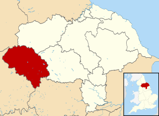
Craven was a non-metropolitan district in the west of North Yorkshire, centred on the market town of Skipton.

The Pennine Way is a National Trail in England, with a small section in Scotland. The trail stretches for 268 miles (431 km) from Edale, in the northern Derbyshire Peak District, north through the Yorkshire Dales and Northumberland National Park and ends at Kirk Yetholm, just inside the Scottish border. The path runs along the Pennine hills, sometimes described as the "backbone of England". Although not the United Kingdom's longest National Trail, it is according to The Ramblers, "one of Britain's best known and toughest".
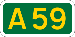
The A59 is a major road in England which is around 109 miles (175 km) long and runs from Wallasey, Merseyside to York, North Yorkshire. The alignment formed part of the Trunk Roads Act 1936, being then designated as the A59. It is a key route connecting Merseyside at the M53 motorway to Yorkshire, passing through three counties and connecting to various major motorways. The road is a combination of historical routes combined with contemporary roads and a mixture of dual and single carriageway. Some sections of the A59 in Yorkshire closely follow the routes of Roman roads, some dating back to the Middle Ages as salt roads, whilst much of the A59 in Merseyside follows Victorian routes which are largely unchanged to the present day.

Grassington is a village and civil parish in North Yorkshire, England. The population of the parish at the 2011 Census was 1,126. Historically part of the West Riding of Yorkshire, and now in the lieutenancy area of North Yorkshire, the village is situated in Wharfedale, about 8 miles (10 km) north-west from Bolton Abbey, and is surrounded by limestone scenery. Nearby villages include Linton, Threshfield, Hebden, Conistone and Kilnsey.

The River Dibb, also known as Barben Beck, is a small river located in North Yorkshire, England. It is a tributary of the River Wharfe. Grimwith Reservoir is at the head of the River Dibb at a point some 2.5 miles (4 km) from Appletreewick. The river flows for 5.2 kilometres (3.2 mi), and must maintain a flow of 273,000 cubic metres (9,600,000 cu ft) of water a day into the River Wharfe system.

Lothersdale is a small village and civil parish in the former Craven district of North Yorkshire, England, near Skipton and within the triangle formed by Skipton, Cross Hills and Colne. It is a small community of about 200 houses but local amenities include a park, church, chapel, pub, village hall, clubhouse and primary school. The Pennine Way runs through it.

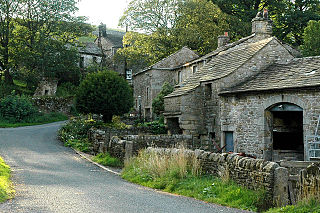
Appletreewick is a village and civil parish in the Craven district of North Yorkshire, England, 6.5 miles (10.5 km) north-east of Skipton, 7 miles (11 km) from Skipton railway station and 16 miles (25.7 km) from Leeds Bradford International Airport.

Gargrave is a large village and civil parish in the Craven district located along the A65, 4 miles (6 km) north-west of Skipton in North Yorkshire, England. It is situated on the very edge of the Yorkshire Dales. The River Aire and the Leeds and Liverpool Canal pass through the village. It had a population of 1,764 in 2001 reducing slightly to 1,755 at the 2011 census.

Ribblesdale is one of the Yorkshire Dales in England. It is the dale or upper valley of the River Ribble in North Yorkshire. Towns and villages in Ribblesdale include Selside, Horton-in-Ribblesdale, Stainforth, Langcliffe, Giggleswick, Settle, Long Preston and Hellifield. Below Hellifield the valley of the river is generally known as the Ribble Valley.
Thorpe is a hamlet and civil parish in the Wharfedale valley, in North Yorkshire, England. It is 2 miles (3 km) south of Grassington and 6 miles (10 km) north of Skipton. At the 2011 census the population remained less than 100, so the details were included in the civil parish of Burnsall. However in 2015, North Yorkshire County Council estimated the population to be 50.

Stock Beck is a minor river in the West Craven area of Pendle, Lancashire. It is 8.25 miles (13.27 km) long and has a catchment area of 14.41 square miles (3,731.89 ha).
The Skipton East Lancashire Rail Action Partnership (SELRAP) is a campaign that is looking to reopen the Skipton to Colne railway line, as part of connecting the Lancashire town of Colne to the North Yorkshire town of Skipton. The line between them had been closed in 1970.
West Craven is an area in the east of Lancashire, England in the far northern part of the borough of Pendle. Historically the area was within the ancient county boundaries of Yorkshire and was administered as part of the Skipton Rural District of the West Riding of Yorkshire until 1974.

Aire Gap is a pass through the Pennines in England formed by geologic faults and carved out by glaciers. The term is used to describe a geological division, a travel route, or a location that is an entry into the Aire river valley.

Steeton is a village in the City of Bradford metropolitan borough, West Yorkshire, England. Historically part of the West Riding of Yorkshire, it is situated approximately 5 miles (8 km) south-east from Skipton, 3 miles (5 km) north-west from Keighley and just south of the A629 road. The village is part of Steeton with Eastburn civil parish.

The Eller Beck is a small river in North Yorkshire, England, that flows through the town of Skipton and is a tributary of the River Aire. Its channel was heavily modified to supply water to mills in the 18th and 19th centuries, and although all the mills have closed, the water now supplies power to the National Grid, generated by a turbine at High Corn Mill. The beck flows through several underground culverts in Skipton that contribute to the flood risk. To alleviate flooding in Skipton town centre, a scheme involving two flood water storage reservoirs was designed and eventually completed in 2017.

A Dales High Way is a long-distance footpath in northern England. It is 90 miles (140 km) long and runs from Saltaire in West Yorkshire to Appleby-in-Westmorland, Cumbria, roughly parallel to the line of the Settle and Carlisle Railway.

Scaleber Force, is a 40-foot (12 m) high waterfall on Stockdale Beck, later the Long Preston Beck, that feeds into the River Ribble between Settle and Long Preston in North Yorkshire, England. The waterfall is the result of geological faulting and is a popular tourist attraction.
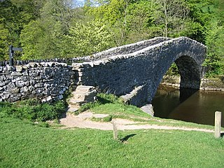
Stainforth Bridge, is a 17th century, arched packhorse bridge over the River Ribble in Stainforth, North Yorkshire, England. The bridge was formerly on the main packhorse road between York and Lancaster, which has been superseded by later roads. It was in private ownership until the 1930s, when it was taken on by the National Trust. It is now a grade II listed structure and provides access to Stainforth Force, which is just below the bridge.
