This page is based on this
Wikipedia article Text is available under the
CC BY-SA 4.0 license; additional terms may apply.
Images, videos and audio are available under their respective licenses.

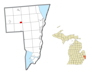
St. Clair County is a county located in the U.S. state of Michigan bordering the west bank of the St. Clair River. As of the 2010 census, the population was 163,040. It is the 13th-most populous county in the state. The county seat is Port Huron, located at the north end of the St. Clair River at Lake Huron. The county was created September 10, 1820, and its government was organized in 1821.

Mackinac County is a county in the Upper Peninsula of the U.S. state of Michigan. As of the 2010 census, the population was 11,113. The county seat is St. Ignace. Formerly known as Michilimackinac County, in 1818 it was one of the first counties of the Michigan Territory, as it had long been a center of French and British colonial fur trading, a Catholic church and Protestant mission, and associated settlement.

Charlevoix County is a county in the U.S. state of Michigan. As of the 2010 census, the population was 25,949. The county seat is Charlevoix.
McKinley Township is the name of some places in the U.S. state of Michigan:

Bay Shore is an unincorporated community and census-designated place located on the boundary between Charlevoix and Emmet counties in the U.S. state of Michigan. As of the 2010 census it had a population of 754.

Levering is an unincorporated community and census-designated place (CDP) in Emmet County, Michigan, United States. As of the 2010 census it had a population of 215.

C-66 is a county-designated highway in the US state of Michigan running about 28 miles (45 km) across the northern tip of the Lower Peninsula. The roadway starts in the unincorporated community of Cross Village in Emmet County at an intersection with M-119 and C-77. It follows Levering Road through rural areas to an interchange with Interstate 75 (I-75) west of Cheboygan. The eastern terminus is at an intersection with US Highway 23 (US 23) and M-27 in downtown Cheboygan. The first roadways along what is now C-66 were in place by the early 20th century. Segments were paved by 1936, although some reverted to a gravel surface during World War II. The full roadway was paved by the mid-1950s, and the C-66 moniker was designated on the roadway in the early 1970s.

M-311 is a 13.7-mile-long (22.0 km) state trunkline highway in Calhoun County in the US state of Michigan that runs from the intersection of M-60 in Burlington north to I-94 at Exit 104 in Emmett Township. It was previously an unsigned state trunkline, meaning that no reassurance markers were used to identify the highway. The route mainly consists of 11 Mile Road, which was a county road prior to the 1998 rationalization process.
Ponshewaing is an unincorporated community and census-designated place (CDP) in Emmet County, Michigan, United States. As of the 2010 census it had a population of 69.
Oden is an unincorporated community and census-designated place (CDP) in Emmet County, Michigan, United States. As of the 2010 census it had a population of 363.
Conway is an unincorporated community and census-designated place (CDP) in Emmet County, Michigan, United States. As of the 2010 census it had a population of 204.
The Maple River is the name of three rivers in the U.S. state of Michigan:
Emmett Township may refer to one of the following places in the United States:

Waugoshance Island is an island off of Waugoshance Point, in Lake Michigan. It is located in Bliss Township of Emmet County, Michigan. Waugoshance and nearby Temperance Island are part of the Wilderness State Park. The Waugoshance Light is located north west of the island in shallow water shoals, that prove to be challenging for navigation. The White Shoal Light and the Grays Reef Light are also in the waters near the island.
Temperance Island is an island off of Waugoshance Point, in Lake Michigan. It is located in Bliss Township of Emmet County, Michigan. Temperance and nearby Waugoshance Island are part of the Wilderness State Park. The Big Cut Canal separates the islands from Waugoshance Point. Together the islands form the northern boundary for sturgeon bay.