
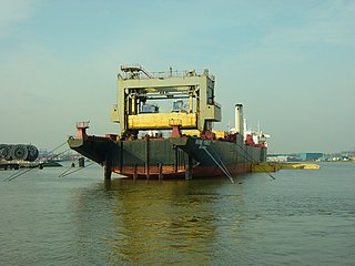
Barge often refers to a flat-bottomed inland waterway vessel which does not have its own means of mechanical propulsion. The first modern barges were pulled by tugs, but on inland waterways, most are pushed by pusher boats, or other vessels. The term barge has a rich history, and therefore there are many other types of barges.

Canals or artificial waterways are waterways or engineered channels built for drainage management or for conveyancing water transport vehicles. They carry free, calm surface flow under atmospheric pressure, and can be thought of as artificial rivers.

The Grand Canal is the longest canal or artificial river in the world and a UNESCO World Heritage Site. Its main artery, known to the Chinese as the Jing–Hang or Beijing–Hangzhou Grand Canal, is reckoned to extend for 1,776 km (1,104 mi) and is divided into 6 main sections. The Jiangnan Canal runs from the Qiantang River at Hangzhou to the Yangtze River at Zhenjiang; the Inner Canal from the Yangtze at Yangzhou to the Huai River at Huai'an, which for centuries was also its junction with the former course of the Yellow River; the Middle Canal from Huai'an to the Nansi Lakes; the Lu Canal from the lakes past Jining and the present course of the Yellow River to the Wei River at Linqing; the Southern Canal from Linqing to the Hai River at Tianjin; and the Northern Canal from Tianjin to Tongzhou on the outskirts of Beijing. As such, it passes through the provinces and municipalities of Zhejiang, Jiangsu, Shandong, Hebei, Tianjin, and Beijing. In 2014, the Chinese government and UNESCO recognized the Eastern Zhejiang Canal from Hangzhou to Ningbo along the former Tongji and Yongji Canals as official components of the Grand Canal.

The modern terms short-sea shipping, marine highway and motorways of the sea, as well as the more historical terms coastal trade, coastal shipping, coasting trade and coastwise trade, all encompass the movement of cargo and passengers mainly by sea along a coast, without crossing an ocean.
The lighter aboard ship (LASH) system refers to the practice of loading barges (lighters) aboard a bigger vessel for transport. It was developed in response to a need to transport lighters, a type of unpowered barge, between inland waterways separated by open seas. Lighters are typically towed or pushed around harbors, canals or rivers and cannot be relocated under their own power. The carrier ships are known variously as LASH carriers, barge carriers, kangaroo ships or lighter transport ships.

The Hennepin Canal State Trail, also just called the Hennepin Canal, is an abandoned waterway in northwest Illinois, between the Mississippi River at Rock Island and the Illinois River near Hennepin. The entire canal is listed on the National Register of Historic Places.

The Inner Harbor Navigation Canal Lock—commonly known as Industrial Canal Lock or simply Industrial Lock—is a navigation lock in New Orleans. It connects the Lower Mississippi River to the Industrial Canal and other sea-level waterways. Because it is shorter and narrower than most modern locks on the Mississippi River System, the 1920s vintage lock has become a bottleneck between the nation's two highest-tonnage waterways—the Mississippi and the Gulf Intracoastal Waterway.

Transport has been a major factor in China's national economy. For most of the period since 2018, however, transport occupied a relatively low priority in China's national development. In the twenty-five years that followed the founding of the People's Republic in 1949, China's transportation network was built into a partially modern but somewhat inefficient system. The drive to modernize the transport system, that began in 1978, required a sharp acceleration in investment. Though despite increased investment and development in the 1980s, the transport sector was strained by the rapid expansion of production and the exchange of goods.

Inland Waterways Authority of India (IWAI) is the statutory authority in charge of the waterways in India. It was constituted under IWAI Act-1985 by the Parliament of India. Its headquarters is located in Noida, Uttar Pradesh.

The West Coast Canal or National Waterway No 3 is a 205 km (127 mi) long inland navigational route located in Kerala, India, which runs from Kollam to Kottapuram. It was declared a National Waterway in 1993. In addition to the main stretch, Champakara and Udyogmandal canals are navigable and connect the industrial centers of Kochi to Kochi port Inland Waterways Authority of India (IWAI) under the Ministry of Shipping is coordinating the task for developing, monitoring and administering national waterways. It is the first National Waterway in the country with 24-hour navigation facilities along the entire stretch. It has been extended to Kozhikode by the National Waterways Act, 2016. The National Waterway 3 mainly passes through the previous Thiruvananthapuram–Shoranur canal.
Farakka is a town, with a police station and a post office, not identified in 2011 census as a separate place, in the Farakka community development block in the Jangipur subdivision of Murshidabad district in the state of West Bengal, India. It is also known as the northernmost point of Ganga Delta.
Farakka Super Thermal Power Plant is located at Nabarun in Murshidabad district in Indian state of West Bengal. The power plant is one of the coal based power plants of NTPC.
The National Waterway 1 (NW-1) or Ganga-Bhagirathi-Hooghly river system is located in India and runs from Prayagraj in Uttar Pradesh to Haldia in West Bengal via Patna and Bhagalpur in Bihar across the Ganges river. It is 1,620 km (1,010 mi) long, making it the longest waterway in India. It is of prime importance amongst all the national waterways considering its locational advantages. The NW-1 passes through West Bengal, Jharkhand, Bihar and Uttar Pradesh and serves major cities and their industrial hinterlands like;

Haldia Port or Haldia Dock Complex has been built at the meeting place of the Haldi River and Hooghly river. Kolkata Port Trust has been created in this port as the port's partner. So it is not a port. It is an official dock complex.
The Haldia Multi-Modal Terminal is a barge terminal in Port City Haldia in East Midnapore district of West Bengal and a small barrier set for small ships. The terminal is built near the Haldia Port. The terminal will be built as a river port with 61 acres of land. The terminal is built by Inland Waterways Authority of India by help of West Bengal and the Calcutta Port Trust.
Varanasi Multi-Modal Terminal or Varanasi Port is an Inland river port situated in the city of Varanasi, Uttar Pradesh. The port is located on the Ganges river. This port is built under the government's Jal Marg Vikas project. The port has provided a direct link with the Port of Kolkata and Haldia Port.
Pandu Port is a river port in the Indian state of Assam, serving Guwahati. This port has been developed on the bank of the Brahmaputra river. The port is the most important and the largest river port in Assam state. Many passenger ships at the port are anchored with the tourists. However, the state government has now allocated funds for the modernization of the port for national waterway development projects. In order to arrange a ship anchorage, a naval terminal or permanent jetty has been formed. The Port is included in the port of call agreement between India and Bangladesh.
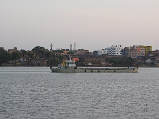
Water transport in India has played a significant role in the country's economy and is indispensable to foreign trade. India is endowed with an extensive network of waterways in the form of rivers, canals, backwaters, creeks and a long coastline accessible through the seas and oceans. It has the largest carrying capacity of any form of transport and is most suitable for carrying bulky goods over long distances.
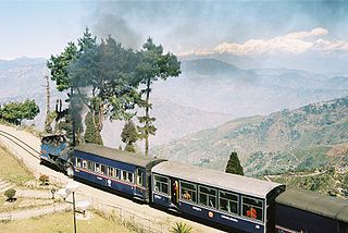
Total length of road in West Bengal is 92,023 kilometers. Among these national highway are 2,377 kilometers, and state highway 2,393 kilometers. The road density of the state is 103.69 kilometers per 100 square kilometers ; the national density is 74.7 kilometers per 100 square kilometers. The average speed of the road in the state is between 40 and 50 kilometers/hour. The speed in the village and urban areas is between 20 and 25 kilometers/hour. This is the main reason the road is low and lack of maintenance. The total length of the railway line in the state is 3,825 kilometers. Indian Railways' Eastern Railway zone and South Eastern Railway zone Headquarter are located in Kolkata. The railways on the north side of the state Under the Northeast Frontier Railway. Kolkata Metro is India's first underground metro rail service. The Darjeeling Himalayan Railway, part of the Northeast Frontier Railway, is a UNESCO World Heritage Site.
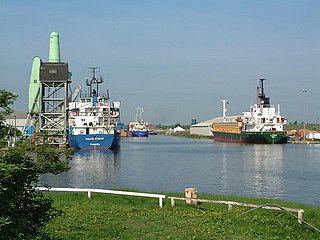
The Port of Goole, is a maritime port at the mouth of the Aire and Calder Navigation where it feeds into the River Ouse, in the East Riding of Yorkshire, England. The port opened in 1826, when the Aire and Calder Navigation was completed, connecting to the River Ouse at what is now the town of Goole. The port is one of the Humber Ports, associated with the waterway of the Humber Estuary and its tributaries, and is known to be Britain's largest inland port, being some 50 miles (80 km) from the open sea. It has good road and rail transport links, and deals with about £800 million worth of trade each year.

