Pas-de-Calais is a department in northern France named after the French designation of the Strait of Dover, which it borders. It has the most communes of all the departments of France, 890, and is the 8th most populous. It had a population of 1,465,278 in 2019. The Calais Passage connects to the Port of Calais on the English Channel. Pas-de-Calais borders the departments of Nord and Somme and is connected to the English county of Kent via the Channel Tunnel.

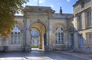
Arras is the prefecture of the Pas-de-Calais department, which forms part of the region of Hauts-de-France; before the reorganization of 2014 it was in Nord-Pas-de-Calais. The historic centre of the Artois region, with a Baroque town square, Arras is in Northern France at the confluence of the rivers Scarpe and Crinchon.
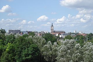
Lens is a city in the Pas-de-Calais department in northern France. It is one of the main towns of Hauts-de-France along with Lille, Valenciennes, Amiens, Roubaix, Tourcoing, Arras and Douai. The inhabitants are called Lensois.

Vimy is a commune in the Pas-de-Calais department in the Hauts-de-France region of France. Located 3.8 kilometers (2.4 mi) east of Vimy is the Canadian National Vimy Memorial dedicated to the Battle of Vimy Ridge and the Canadian soldiers who were killed during the war. The Memorial is also the site of two Canadian cemeteries.
Liévin is a commune in the Pas-de-Calais department in northern France. The inhabitants are called Liévinois.

Givenchy-en-Gohelle is a commune in the Pas-de-Calais department in the Hauts-de-France region of France. It is located 1.8 kilometres (1.1 mi) north of the Canadian National Vimy Memorial dedicated to the Battle of Vimy Ridge and the missing First World War Canadian soldiers with no known grave; the Memorial is also the site of two Canadian cemeteries. The village was destroyed during World War I but was rebuilt after the war.
Souchez is a commune in the Pas-de-Calais department in the Hauts-de-France region of France. It is located 3.2 kilometres (2.0 mi) northwest of the Canadian National Vimy Memorial dedicated to the Battle of Vimy Ridge and the missing First World War Canadian soldiers with no known grave; the Memorial is also the site of two Canadian cemeteries.

Avion is a commune in the Pas-de-Calais department in the Hauts-de-France region of France.

Neuville-Saint-Vaast is a commune in the Pas-de-Calais department in the Hauts-de-France region of France. It is located 3.2 kilometres (2.0 mi) south of the Canadian National Vimy Memorial dedicated to the Battle of Vimy Ridge. The Memorial was built on Hill 145, the highest point of the ridge to commemorate the battle and the Canadian soldiers who lost their lives during the First World War. The Memorial is also the site of the Canadian Cemetery No. 2, Neuville-St.-Vaast and Givenchy Road Canadian Cemetery, Neuville-St.-Vaast.

Vaulx-Vraucourt is a commune in the Pas-de-Calais department in the Hauts-de-France region of France.
Haucourt is a commune in the Pas-de-Calais department in the Hauts-de-France region of France.

Achicourt is a commune in the Pas-de-Calais department in northern France.

Feuchy is a commune in the Pas-de-Calais department in the Hauts-de-France region of France. It is a small village, with a little more than 1000 inhabitants, and had only about 500 inhabitants in 1914. It is situated two kilometers east of Arras. During World War I, in 1914, it was occupied by German troops. British troops took over the Arras sector in March 1916. On April 9, 1917, the British operation "big push" led to advancement of several miles to the east in a battle with one with the most casualties per day, and Feuchy was liberated. The German offensives placed Feuchy under their control in 1918 until the Canadians cleared the area in August 1918. The population of Feuchy was evacuated and the village was completely destroyed.

Foncquevillers is a commune in the Pas-de-Calais department in the Hauts-de-France region of France.

Fresnoy-en-Gohelle is a commune in the Pas-de-Calais department in the Hauts-de-France region of France.

Monchy-le-Preux is a commune in the Pas-de-Calais department in the Hauts-de-France region of France.

Montenescourt is a commune in the Pas-de-Calais department in the Hauts-de-France region of France.
Quéant is a commune in the Pas-de-Calais department in the Hauts-de-France region of France.

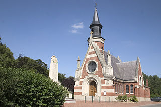
Thélus is a commune in the Pas-de-Calais department in the Hauts-de-France region of France. It is located four kilometres (2.5 mi) southeast of the Canadian National Vimy Memorial dedicated to the Battle of Vimy Ridge and the missing First World War Canadian soldiers with no known grave; the Memorial is also the site of two Canadian cemeteries.

Warlencourt-Eaucourt is a commune in the Pas-de-Calais department in the Hauts-de-France region of France.


