Related Research Articles

Louisville is the largest city in the Commonwealth of Kentucky and the 29th most-populous city in the United States. Louisville is the historical seat and, since 2003, the nominal seat of Jefferson County, on the Indiana border.

Cherokee Park is a 409-acre (166 ha) municipal park located in Louisville, Kentucky, United States and is part of the Louisville Olmsted Parks Conservancy. It was designed in 1891 by Frederick Law Olmsted, the father of landscape architecture along with 18 of Louisville's 123 parks. Beargrass Creek runs through much of the park, and is crossed by numerous pedestrian and automobile bridges.

Old Louisville is a historic district and neighborhood in central Louisville, Kentucky, United States. It is the third largest such district in the United States, and the largest preservation district featuring almost entirely Victorian architecture. It is also unique in that a majority of its structures are made of brick, and the neighborhood contains the highest concentration of residential homes with stained glass windows in the U.S. Many of the buildings are in the Victorian-era styles of Romanesque, Queen Anne, Italianate, among others; and many blocks have had few or no buildings razed. There are also several 20th-century buildings from 15 to 20 stories.
Shawnee is a neighborhood in western Louisville, Kentucky. Its boundaries are the Ohio River on the West, Bank Street and the Portland neighborhood on the North, I-264 on the East, and West Broadway on the South. Maps sometimes identify the area as Shawneeland.

The geology of the Ohio River, with but a single series of rapids halfway in its length from the confluence of the Monongahela and Allegheny rivers to its union with the Mississippi, made it inevitable that a town would grow on the site. Louisville, Kentucky was chartered in the late 18th century. From its early days on the frontier, it quickly grew to be a major trading and distribution center in the mid 19th century, important industrial city in the early 20th, declined in the mid 20th century, before revitalizing in the late 20th century as a culturally-focused mid-sized American city.
Clifton is a neighborhood east of downtown Louisville, Kentucky USA. Clifton was named because of its hilly location on the Ohio River valley escarpment. Clifton is bounded by I-64, N Ewing Ave, Brownsboro Road, and Mellwood Ave.
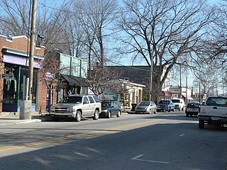
Wilder Park is a neighborhood four miles south of downtown Louisville, Kentucky USA. The area was originally the site of Greenland race course, built in 1866, a sister track of Churchill Downs. Greenland track closed in 1888 and was subsequently used as a park.
Beechmont is a neighborhood in the south end of Louisville, Kentucky. Its modern boundaries are I-264 to the north, Taylor Boulevard to the west, Southern Parkway and Southland Boulevard to the south, and Third Street, Allmond and Louisville Avenues to the east.

Crescent Hill is a neighborhood four miles (6 km) east of downtown Louisville, Kentucky USA. This area was originally called "Beargrass" because it sits on a ridge between two forks of Beargrass Creek. The boundaries of Crescent Hill are N Ewing Ave to the St. Matthews city limit by Brownsboro Road to Lexington Road. Frankfort Avenue generally bisects the neighborhood.

This is a list of official neighborhoods in Louisville, Kentucky. Like many older American cities, Louisville has well-defined neighborhoods, many with well over a century of history as a neighborhood.

Central Park is a 17-acre (69,000 m2) municipal park maintained by the city of Louisville, Kentucky. Located in the Old Louisville neighborhood, it was originally the country estate of the DuPont Family. Early in its existence, the park was the site of the Southern Exposition, but later became mostly known for hosting the Kentucky Shakespeare Festival and northern portions of the annual St. James Court Art Show.
Bashford Manor is a neighborhood in Louisville, Kentucky, United States. Its boundaries are I-264 to the north, Bardstown Road to the east, Bashford Manor Lane to the south, and Newburg Road to the west. Originally a part of Thomas Byrd's 1,000 acre (4 km²) land grant from Virginia in 1787, James Bennett Wilder bought the land in 1870 and built a home which he named Bashford Manor, after his family's home in England. He sold the property to George James Long in 1888, who turned it into a horse farm which produced three early Kentucky Derby winners: Azra, Manuel and Sir Huon.
City of Parks is a municipal project to create a continuous paved pedestrian and biking trail around the city of Louisville, Kentucky while also adding a large amount of park land. The project was announced on February 22, 2005. Current plans call for making approximately 4,000 acres (1,600 ha) of the Floyds Fork floodplain in eastern Jefferson County into park space, expanding area in the Jefferson Memorial Forest, and adding riverfront land and wharfs along the Riverwalk Trail and Levee Trail. There are also plans to connect the 100-mile (160 km) Louisville trail to a planned seven mile (11 km) trail connecting the Southern Indiana cities of New Albany, Clarksville and Jeffersonville.
Lake Dreamland is a neighborhood of Louisville, Kentucky located along Campground Road and the Ohio River.
The Ameri-Go-Round was the name given to two carousels, one at each of Marriot's Great America amusement parks, Six Flags Great America in Gurnee, Illinois and California's Great America in Santa Clara, California.

Flaget High School was a Catholic College preparatory high school in Louisville, Kentucky's West End from 1942 until 1974. It was located throughout its existence at 44th and River Park Drive, in the Shawnee neighborhood of Louisville.

The John B. Castleman Monument, within the Cherokee Triangle of Louisville, Kentucky, was unveiled on November 8, 1913. The model, selected from a competition to which numerous sculptors contributed, was designed by R. Hinton Perry of New York. The statue was erected to honor John Breckinridge Castleman at a cost of $15,000 by popular subscription from city, state, and other commonwealths. The statue is made of bronze, and rests on a granite pedestal. It stands 15-feet high, with a base of 12×20 feet. The monument was placed on the National Register of Historic Places on July 17, 1997, as part of the Civil War Monuments of Kentucky MPS. There have been attempts to remove the statue since January 2019 due to the fact that Castleman was a Major of the Confederate army. The monument was removed on June 8, 2020, and is pending cleaning and relocation to Castleman's burial site.
The Cherokee Triangle is a historic neighborhood in Louisville, Kentucky, USA, known for its large homes displaying an eclectic mix of architectural styles. Its boundaries are Bardstown Road to the southwest, Cherokee Park and Eastern Parkway to the southeast, and Cave Hill Cemetery to the north, and is considered a part of a larger area of Louisville called The Highlands. It is named for nearby Cherokee Park, a 409 acres (1.7 km2) park designed by Frederick Law Olmsted, the designer of New York's Central Park.
The following is a timeline of the history of the city of Louisville, Kentucky, USA.
References
- 1 2 Rice, Jerry L. (2001). Fontaine Ferry Park. Encyclopedia of Louisville. University Press of Kentucky. pp. 304–305. ISBN 0813128900 . Retrieved December 20, 2012.
- ↑ "Revisiting Fontaine Ferry Park". wave3.com. Retrieved May 21, 2020.
- ↑ Yater, George H. (2001). Fontaine, Aaron. Encyclopedia of Louisville, The. University Press of Kentucky. p. 304. ISBN 0813128900 . Retrieved December 20, 2012.
- ↑ Sellers, Jackson (1969-05-06). "Sunday Rampage Is Shutting Down Fontaine Ferry Park-Permanently". Courier-Journal (Louisville, KY). p. B1.
- ↑ Schneider, Grace (2004-10-02). "Project documents civil-rights movement". Courier-Journal (Louisville, KY). p. 01B.
- ↑ Edelen, Sheryl (2004-10-20). "Amusement-park site in Shawnee found new use". Courier-Journal (Louisville, KY). p. 01E.
Aubespin, Mervin, Kenneth Clay, and J. Blaine Hudson. Two Centuries of Black Louisville