Geraldton may refer to:
Geraldton is an electoral district of the Legislative Assembly in the Australian state of Western Australia.
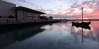
Geraldton is a coastal city in the Mid West region of Western Australia, 424 kilometres (263 mi) north of Perth.
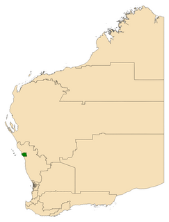
The City of Greater Geraldton is a local government area in the Mid West region of Western Australia, 424 kilometres (263 mi) north of the state capital, Perth on the Indian Ocean. It covers an area of 12,625.5 square kilometres (4,874.7 sq mi), and its seat of government is the town of Geraldton.
The City of Geraldton-Greenough was a local government area in the Mid West region of Western Australia, 424 kilometres (263 mi) north of the state capital, Perth on the Indian Ocean. It covered an area of 1,798.3 square kilometres (694.3 sq mi), and its seat of government was the town of Geraldton.
disambiguation page lists articles about distinct geographical locations with the same name. If an internal link led you here, you may wish to change the link to point directly to the intended article. | This
The Shire of Greenough was a local government area in the Mid West region of Western Australia, 420 kilometres (261 mi) north of the state capital, Perth surrounding the city of Geraldton. The Shire covered an area of 1,752 square kilometres (676.5 sq mi), and its seat of government was the outer Geraldton suburb of Utakarra.
Beachlands is an inner western suburb of Geraldton, Western Australia in the local government area of the City of Greater Geraldton.
Beresford is a northern coastal suburb of Geraldton, Western Australia. Its local government area is the City of Greater Geraldton.
Bluff Point is a northern coastal suburb of Geraldton, Western Australia. Its local government area is the City of Greater Geraldton.
Strathalbyn is a northeastern suburb of Geraldton, Western Australia. Its local government area is the City of Greater Geraldton.
Webberton is an industrial suburb northeast of Geraldton, Western Australia. Its local government area is the City of Greater Geraldton.
Cape Burney is a coastal town and locality 12 kilometres (7 mi) south of Geraldton, Western Australia at the mouth of the Greenough River. Its local government area is the City of Greater Geraldton. At the 2006 census, Cape Burney had a population of 399.
Glenfield is a locality north of Geraldton, Western Australia. Its local government area is the City of Greater Geraldton.
West End is a western suburb of Geraldton, Western Australia. Its local government area is the City of Greater Geraldton.
Moresby is a locality northeast of Geraldton, Western Australia, on the north bank of the Chapman River. Its local government area is the City of Greater Geraldton.
Wandina is an outer southern suburb of Geraldton, Western Australia. Its local government area is the City of Greater Geraldton.
Woorree is an eastern suburb of Geraldton, Western Australia. Its local government area is the City of Greater Geraldton.
Mahomets Flats is an inner southern coastal suburb of Geraldton, Western Australia in the local government area of the City of Greater Geraldton.
Mount Tarcoola is a southern suburb of Geraldton, Western Australia. Its local government area is the City of Greater Geraldton.
Rangeway is an inner eastern suburb of Geraldton, Western Australia. Its local government area is the City of Greater Geraldton.
Spalding is a northeastern suburb of Geraldton, Western Australia. Its local government area is the City of Greater Geraldton.
Utakarra is an eastern suburb of Geraldton, Western Australia. Its local government area is the City of Greater Geraldton. Prior to 1 July 2007, it was the seat of government of the Shire of Greenough.
Waggrakine is an outer northern suburb of Geraldton, Western Australia in the local government area of the City of Greater Geraldton.
Geraldton is the central suburb of the City of Greater Geraldton in the Mid West region of Western Australia.