Related Research Articles

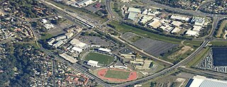
Campbelltown is a town located on the outskirts of the metropolitan area of Sydney, New South Wales, Australia. It is located in Greater Western Sydney 53 kilometres (33 mi) south-west of the Sydney central business district by road. Campbelltown is the administrative seat of the local government area of the City of Campbelltown. It is also acknowledged on the register of the Geographical Names Board of New South Wales as one of only four cities within the Sydney metropolitan area.

Camden is a historic town and suburb of Sydney, New South Wales, located 65 kilometres from the Sydney central business district. Camden was the administrative centre for the local government area of Camden Council until July/August 2016 and is a part of the Macarthur region.
Ambarvale is a suburb of south-western Sydney in the state of New South Wales, Australia. Ambarvale is located 55 kilometres south-west of the Sydney central business district, in the local government area of the City of Campbelltown and is part of the Macarthur region. The suburb is predominantly residential and contains a mix of public and private housing.

Varroville is a suburb of Sydney, in the state of New South Wales, Australia. Varroville is located 46 kilometres south-west of the Sydney central business district, in the local government area of the City of Campbelltown and is part of the Macarthur region. Varroville forms part of the scenic hills on the north-west side of the M5 South Western Motorway between Campbelltown and the Camden Valley Way. Of all Sydney suburbs, Varroville has the highest proportion of residents with PhDs.

The City of Campbelltown is a local government area in the Macarthur region of south-western Sydney, in New South Wales, Australia. The area is located about 55 kilometres (34 mi) south west of the Sydney central business district and comprises 312 square kilometres (120 sq mi).

St Helens Park is a suburb of Sydney, in the state of New South Wales, Australia 56 kilometres south-west of the Sydney central business district, in the local government area of the City of Campbelltown. it is part of the Macarthur region.
Minto Heights is a suburb of Sydney, in the state of New South Wales, Australia 50 kilometres south-west of the Sydney central business district, in the local government area of the City of Campbelltown. It is part of the Macarthur region.
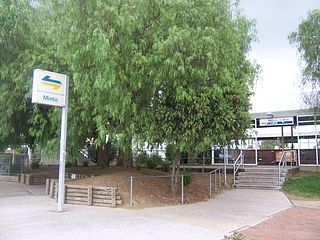
Minto is a suburb of Sydney, in the state of New South Wales, Australia. Minto is located 38 kilometres south-west of the Sydney central business district, in the local government area of the City of Campbelltown and is part of the Macarthur region.
Menangle Park is a suburb in Sydney the state of New South Wales, Australia. Menangle Park is located 56 kilometres south-west of the Sydney central business district, in the local government area of the City of Campbelltown. Menangle Park is a largely rural area and is part of the Macarthur region.

Kearns is a suburb of Sydney, in the state of New South Wales, Australia 57 kilometres south-west of the Sydney central business district, in the local government area of the City of Campbelltown and is part of the Macarthur region.
Kentlyn is a suburb of Sydney, in the state of New South Wales, Australia 58 kilometres south-west of the Sydney central business district, in the local government area of the City of Campbelltown. It is part of the Macarthur region.
Leumeah is a suburb of Sydney, in the state of New South Wales, Australia 39 kilometres south-west of the Sydney central business district, in the local government area of the City of Campbelltown. It is north of the suburb of Campbelltown and is part of the Macarthur region.

Rosemeadow is a suburb of Sydney, in the state of New South Wales, Australia. Rosemeadow is located 56 kilometres south-west of the Sydney central business district, in the local government area of the City of Campbelltown and is part of the Macarthur region.

Camden South is a suburb of the Macarthur Region of Sydney in the state of New South Wales, Australia in Camden Council. It is to the immediate south of Camden, New South Wales and shares the same postcode 2570.

Englorie Park is a suburb of Sydney, in the state of New South Wales, Australia. Englorie Park is located 55 kilometres south-west of the Sydney central business district, in the local government area of the City of Campbelltown and is part of the Macarthur region.

Glen Alpine is a suburb of Sydney, in the state of New South Wales, Australia. Glen Alpine is located 56 kilometres south-west of the Sydney central business district, in the local government area of the City of Campbelltown and is part of the Macarthur region.

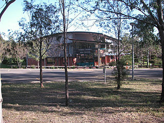
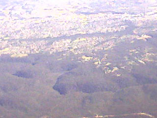
Macarthur is a region in the south-west of Sydney, in the state of New South Wales, Australia. The region includes the local government areas of the City of Campbelltown, Camden Council and Wollondilly Shire. It covers an area of 3,067 square kilometres and has a population of close to 310,000 residents. The region geographically forms the foothills between the Blue Mountains and Southern Highlands regions.

Appin is a town in the Macarthur Region on Tharawal country near its boundary with Gandangara country, New South Wales, Australia in Wollondilly Shire. It is situated about 16 kilometres (9.9 mi) south of Campbelltown and 35 kilometres (22 mi) north west of Wollongong.
Thomas Rose was an early pioneer in the settlement of the British colony in New South Wales, Australia. After being transported from Britain for housebreaking, he established himself as first a baker, and then later a publican in Sydney. His grant and purchase of land in the Campbelltown area saw some of the earliest water conservation for agriculture in the colony, and the construction of one of the country's first windmills.

Sugarloaf Farm is a heritage-listed former dairy, wheat farming and pastoral property and now residence and horse riding venue located at Menangle Road, Gilead, City of Campbelltown, New South Wales, Australia. It was designed and built from 1835. It is also known as Mt Huon. The property is owned by the New South Wales Department of Planning and Infrastructure. It was added to the New South Wales State Heritage Register on 2 April 1999.
References
- ↑ Australian Bureau of Statistics (27 June 2017). "Gilead (State Suburb)". 2016 Census QuickStats. Retrieved 15 January 2018.
- ↑ "Family Notices". The Colonist . Sydney: National Library of Australia. 9 March 1837. p. 7. Retrieved 30 June 2013.
- ↑ "Advertising". The Sydney Morning Herald . National Library of Australia. 20 October 1862. p. 1. Retrieved 30 June 2013.
- ↑ "History of Gilead". Campbelltown City Council. Archived from the original on 28 July 2008. Retrieved 2008-03-21.
- ↑ "Beulah". New South Wales State Heritage Register . Office of Environment & Heritage. H00368. Retrieved 18 May 2018.
- ↑ "Sugarloaf Farm". New South Wales State Heritage Register . Office of Environment & Heritage. H01389. Retrieved 18 May 2018.