Glaswaldsee

Last updated
Glaswaldsee

Glaswaldsee.jpg

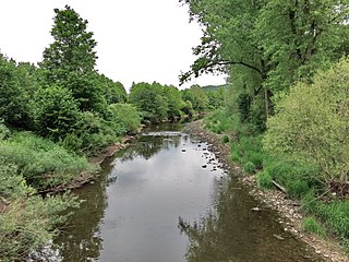
The Glaswaldsee near Bad Rippoldsau-Schapbach
Location Baden-Württemberg
Coordinates 48°25′33″N8°15′43″E / 48.42583°N 08.26194°E / 48.42583; 08.26194 Coordinates: 48°25′33″N8°15′43″E / 48.42583°N 08.26194°E / 48.42583; 08.26194
Primary inflows Seebach
Primary outflows Seebach
Max. length 0.220 km (0.137 mi)
Max. width 0.170 km (0.106 mi)
Surface area 2.9695 ha (7.338 acres)
Max. depth 11 m (36 ft)
Shore length1 0.650 km (0.404 mi)
Surface elevation 839.0 m (2,752.6 ft)
1 Shore length is not a well-defined measure.
The Glaswaldsee seen from the Lettstadter Hohe Glaswaldsee2.jpg
The Glaswaldsee seen from the Lettstädter Höhe

The Glaswaldsee near the spa town of Bad Rippoldsau-Schapbach in the Central Black Forest in Germany lies in a cirque that is sunk into the steep eastern mountainside of the Lettstädter Höhe. It is part of the nature reserve of the same name that was established in 1960.

Bad Rippoldsau-Schapbach Place in Baden-Württemberg, Germany

Bad Rippoldsau-Schapbach is a municipality in the district of Freudenstadt in Baden-Württemberg in southern Germany.

Central Black Forest

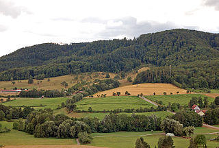
The Central Black Forest, also called the Middle Black Forest, is a natural or cultural division that generally refers to a region of deeply incised valleys from the Rench valley and southern foothills of the Kniebis in the north to the area of Freiburg im Breisgau and Donaueschingen in the south. Its highest area, which is southeast of the Elz valley, is also part of the High Black Forest.

Germany Federal parliamentary republic in central-western Europe

Germany, officially the Federal Republic of Germany, is a country in Central and Western Europe, lying between the Baltic and North Seas to the north, and the Alps to the south. It borders Denmark to the north, Poland and the Czech Republic to the east, Austria and Switzerland to the south, France to the southwest, and Luxembourg, Belgium and the Netherlands to the west.

Contents

The tarn formed in a cirque that was carved from the bunter sandstone rock out by a glacier during the ice age. Steep banks surround the lake which is up to 11 metres deep and has an area of about 3 hectares. Its diameter varies between 170 and 220 metres. The Glaswaldsee is fed by underground water sources; its surface catchment area, apart from an artificial diversion from the uppermost reaches of the Seebach, only covers about an area of 190 hectares. [1]

Tarn (lake) Mountain lake or pool in a glacial cirque

A tarn is a mountain lake, pond or pool, formed in a cirque excavated by a glacier. A moraine may form a natural dam below a tarn.

Glacier Persistent body of ice that is moving under its own weight

A glacier is a persistent body of dense ice that is constantly moving under its own weight; it forms where the accumulation of snow exceeds its ablation over many years, often centuries. Glaciers slowly deform and flow due to stresses induced by their weight, creating crevasses, seracs, and other distinguishing features. They also abrade rock and debris from their substrate to create landforms such as cirques and moraines. Glaciers form only on land and are distinct from the much thinner sea ice and lake ice that form on the surface of bodies of water.

Ice age Period of long-term reduction in temperature of Earths surface and atmosphere

An ice age is a long period of reduction in the temperature of the Earth's surface and atmosphere, resulting in the presence or expansion of continental and polar ice sheets and alpine glaciers. Earth is currently in the Quaternary glaciation, known in popular terminology as the Ice Age. Individual pulses of cold climate are termed "glacial periods", and intermittent warm periods are called "interglacials", with both climatic pulses part of the Quaternary or other periods in Earth's history.

In centuries gone by, the lake was known as the Wilder See ("Wild Lake") (like the Wildsee at Ruhestein and the Wildsee near Kaltenbronn), but its present name is derived from the former manufacture of glass bottles in the neighbouring villages. Today the surface of the Glaswaldsee is raised by a sandstone wall which used to enable the transportation of timber down river as part of the timber rafting industry in the valley of the Wolf.

Wildsee (Ruhestein) lake in Germany

Wildsee is a small tarn within a cirque in the Black Forest near Baiersbronn, Germany. It is part of the Black Forest National Park and the Wilder See - Hornisgrinde Nature Reserve.

Timber rafting log transportation method in which logs are tied together into rafts and drifted or pulled across a water body or down a flatter river

Timber rafting is a log transportation method in which logs are tied together into rafts and drifted or pulled across a water body or down a river. It is arguably the second cheapest method of transportation of timber, next after log driving. Both methods may be referred to as timber floating.

Wolf (river) river of Baden-Württemberg, Germany

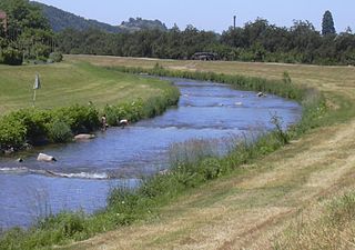
Wolf is a river of Baden-Württemberg, Germany. The historical name of the river is Wolfach. It passes through Bad Rippoldsau-Schapbach and flows into the Kinzig in Wolfach.

The Glaswaldsee is one of the first lakes of the Black Forest to be trigonometrically surveyed and mapped. In 1655 Landgrave Frederick Rudolph of Fürstenberg-Stühlingen directed the Basle priest, Jakob Mentzinger, to prepare a map of his sovereign territory in the Kinzig valley. To illustrate his approach to the national survey, Mentzinger recorded in the lower part of his map an enlarged view of the Glaswaldsee with the calculations made by him.

In trigonometry and geometry, triangulation is the process of determining the location of a point by forming triangles to it from known points.

Kinzig (Rhine) river in Germany

The Kinzig is a river in southwestern Germany, a right tributary of the Rhine.

See also

Related Research Articles

Black Forest mountain range in Baden-Württemberg, southwestern Germany

The Black Forest is a large forested mountain range in the state of Baden-Württemberg in southwest Germany. It is bounded by the Rhine valley to the west and south. Its highest peak is the Feldberg with an elevation of 1,493 metres (4,898 ft). The region is roughly oblong in shape with a length of 160 km (99 mi) and breadth of up to 50 km (31 mi).

Breg (river) river in Germany

The Breg is a river, 46 kilometres long, in Baden-Württemberg, Germany, and the primary headstream of the Danube.

Brigach river in Germany

The Brigach is the shorter of two streams that jointly form the river Danube in Baden-Württemberg, Germany. The Brigach has its source at 925 m (3,035 ft) above sea level within St. Georgen in the Black Forest. The Brigach crosses the city Villingen-Schwenningen. 40.4 km (25.1 mi) from the source, the Brigach joins the Breg in Donaueschingen to form the Danube River.

Murg (Northern Black Forest) river and right tributary of the Upper Rhine in Baden-Württemberg, Germany

The Murg is an 80.2-kilometre-long river and a right tributary of the Rhine in Baden-Württemberg, Germany. It flows through the Northern Black Forest into the Upper Rhine Plain, crossing the counties of Freudenstadt and Rastatt.

Enz river in Baden-Württemberg, Germany

The Enz is a river flowing north from the Black Forest to the Neckar in Baden-Württemberg. It is 106 km long.

Elz (Rhine) tributary of the Rhine

The Elz is a river in Baden-Württemberg, Germany, a right tributary of the Rhine. It rises in the Black Forest, near the source of the Breg. The Elz flows through Elzach, Waldkirch and Emmendingen before reaching the Rhine near Lahr. Its length is approx. 121 km (75 mi).

Wildsee (Kaltenbronn) lake

The Wildsee is a small lake within an area of bog between Bad Wildbad and Gernsbach, high in the Northern Black Forest mountain range in southwestern Germany. The lake is fed by rain water. It is part of the Kaltenbronn Nature Reserve.

Rench river in Germany

The Rench is a right-hand tributary of the Rhine in the Ortenau. It rises on the southern edge of the Northern Black Forest at Kniebis near Bad Griesbach im Schwarzwald. The source farthest from the mouth is that of the Schöngrundbächle which rises at a height of around 915 m above NN in the parish of Zuflucht near the old youth hostel. After flowing through its steep mountainside klinge it is joined by other streams to form, first, the Old (Alter), then the Wild Rench, which first becomes the Rench below Bad Griesbach. The Rench runs in a prominent southerly arc through the Central Black Forest and crosses the hilly region of Ortenau with its orchards and vineyards before breaking out into the Rhine Plain. After just under 57 km it discharges, together with the Mühlbach, into the Rhine at 314.7km between Helmlingen (Rheinau) and Lichtenau.

Blinde Rot river in Germany

The Blinde Rot, also called the Adelmannsfelder Rot, is a river in the Ellwangen Hills in the north of the German state of Baden-Württemberg, that rises in the municipality Frankenhardt and discharges into the Kocher in the municipality of Abtsgmünd.

Moosalb (Alb) river in Germany

The Moosalb is a river, around ten kilometres long, in the Northern Black Forest in the German state of Baden-Württemberg. It discharges from the left into the Alb near Fischweier.

Krummbach (Dreisam) river in Germany

The Krummbach is a left tributary of the Dreisam in the Southern Black Forest east of Freiburg im Breisgau in the German state of Baden-Württemberg. It is just under 17 kilometres long, In its upper reaches it is better known as the Zastlerbach; in its middle course it is also known as the Osterbach.

Hohloh mountain

The Hohloh is a mountain, 988.3 m above sea level (NHN), on the eastern main ridge of the Northern Black Forest in Germany. It lies near the village of Kaltenbronn in the borough of Gernsbach, a town in the county of Rastatt in the German state of Baden-Württemberg. Its summit is the highest point in the borough of Gernsbach and the eastern chain of the Northern Black Forest, the ridge between the rivers Murg and Enz. A mountain pass runs northeast of the summit plateau between the two river valleys passing over the saddle of Schwarzmiss.

Nonnenmattweiher nature reserve in Baden-Württemberg, Germany

The Nonnenmattweiher is a lake that has been impounded by an embankment in the Southern Black Forest in Germany. Together with the surrounding area it forms a nature reserve of the same name in the High Black Forest in the state of Baden-Württemberg.

Buhlbachsee lake in Germany

The Buhlbachsee is a tarn (lake) in the northern Black Forest on the southwestern edge of the parish of Baiersbronn in the county of Freudenstadt in Baden-Württemberg. Since 1 January 2014 it has been part of the Black Forest National Park.

Murrhardt Forest mountains in Germany

The Murrhardt Forest in the Baden-Württemberg county of Rems-Murr-Kreis is part of the natural region known as the Swabian-Franconian Forest. It reaches a maximum height of 572 m above sea level (NHN). It takes its name from the town of Murrhardt in the centre.

Buocher Höhe

The Buocher Höhe is a wooded region and hill range up to 519.6 m above sea level (NN), around the village of Buoch in the county of Rems-Murr-Kreis in the German state of Baden-Württemberg.

Baiselsberg mountain in Germany

The Baiselsberg in the district of Ludwigsburg in Germany lies within the Stromberg-Heuchelberg Nature Park and, at 476.6 m above NN, is the highest point of the Stromberg region.

Geroldsau Waterfall

The Geroldsau Waterfall is a roughly six-metre-high waterfall on the Grobbach stream south of the Baden-Baden quarter of Geroldsau in the Northern Black Forest.

Herrenwieser Schwallung reservoir

The Herrenwieser Schwallung is a splash dam, built in 1844–47 of bunter sandstone, near Herrenwies in the Black Forest, which impounds the waters of the Schwarzenbach stream into a pond. In the days of timber rafting it was periodically opened and washed the fallen logs or timber rafts downstream into the valley. Today the dam acts as a bridge over the Schwarzenbach.

Mathisleweiher

The Mathisleweiher is a large bog lake, under 2 hectares in area, in the Black Forest in southern Germany. It lies in the High Black Forest between Feldberg in the west and the Titisee in the east on the territory of Hinterzarten at about 999 m above NN southwest of the village in the Eschengrundmoos Nature Reserve. The pond impounds the Zartenbach which flows through it from west-southwest to east-northeast. The stream rises on the eastern slopes of the Ramselehöhe at about 1,055 m above NN, picks up the Eschengrundmoosbach from the right from the protected bog and runs for less than a kilometre before entering the lake. A shorter stream runs from the north from the woods of the Stuckwald. It has a catchment of 1.0 km2

References

  1. Catchment measured from LUBW-GEZG.
YouTube video-sharing service owned by Google

YouTube is an American video-sharing website headquartered in San Bruno, California. Three former PayPal employees—Chad Hurley, Steve Chen, and Jawed Karim—created the service in February 2005. Google bought the site in November 2006 for US$1.65 billion; YouTube now operates as one of Google's subsidiaries.