
German submarine U-32 was a Type VIIA U-boat of Nazi Germany's Kriegsmarine during World War II.

San Miguel Acatán is a municipality in the Guatemalan department of Huehuetenango. The Mayan language of Akateko is spoken here.

Longdown is a small village in the parish of Holcombe Burnell, south of the A30 road, about four miles west of Exeter in Devon, England. It has a public house called The Lamb Inn.

Baena is a town of Andalucia in the province of Córdoba in southern Spain. It is picturesquely situated near the river Marbella on the slope of a hill 52 kilometres (32 mi) southeast of Córdoba by road. The population of the town is 20,266 (2012).
German submarine U-551 was a Type VIIC U-boat of Nazi Germany's Kriegsmarine during World War II. The submarine was laid down on 21 November 1939 at the Blohm & Voss yard in Hamburg as yard number 527, launched on 14 September 1940, and commissioned on 7 November 1940 under the command of Kapitänleutnant Karl Schrott.
Alfajarín is a municipality located in the province of Zaragoza, Aragon, Spain. According to the 2004 census (INE), the municipality has a population of 1,742 inhabitants.

Craidorolţ is a commune of 2,150 inhabitants situated in Satu Mare County, Romania. It is composed of five villages:
Tallé is a village in the Boudry Department of Ganzourgou Province in central Burkina Faso. The village has a population of 689.
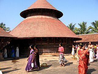
Kollengode Town is one of the major towns in the Palakkad district, Kerala, India. Kollengode 1 & Kollengode 2 are the village offices.It forms a part of Kollengode gram panchayat,.

Badia is a rural commune in the Cercle of Kita in the Kayes Region of south-western Mali. The principal village is Daféla. In the 2009 census the commune had a population of 7,514.

Baro is a town and sub-prefecture in the Kouroussa Prefecture, Kankan Region, of eastern-central Guinea. As of 2014 it had a population of 15,578 people.
Kinksi is a village in Lääneranna Parish, Pärnu County, in western Estonia.

Awutu Breku is a small town and is the capital of Awutu Senya district in the Central Region of Ghana, Ghana.

German submarine U-617 was a Type VIIC U-boat built for Nazi Germany's Kriegsmarine for service during World War II. She was laid down on 31 May 1941 by Blohm & Voss in Hamburg as yard number 593, launched on 14 February 1942 and commissioned on 9 April under Kapitänleutnant Albrecht Brandi.
German submarine U-225 was a Type VIIC U-boat of Nazi Germany's Kriegsmarine during World War II.
German submarine U-292 was a Type VIIC/41 U-boat of Nazi Germany's Kriegsmarine during World War II.
German submarine U-2506 was a Type XXI U-boat of Nazi Germany's Kriegsmarine, built for service in World War II. The submarine was laid down on 29 May 1944 at the Blohm & Voss yard at Hamburg, launched on 5 August 1944, and commissioned on 31 August 1944 under the command of Kptlt. Horst von Schroeter, who commanded her until 9 May 1945. U-2506 conducted no patrols, and surrendered on 9 May 1945 in Bergen, Norway. She was then transferred to Lerwick on 18 June 1945, then Lisahally on 21 June 1945. She was sunk on 5 January 1946 at 55°37′N07°30′W.

German submarine U-1010 was a Type VIIC/41 U-boat of Nazi Germany's Kriegsmarine during World War II.
German submarine U-1168 was a Type VIIC/41 U-boat of Nazi Germany's Kriegsmarine during World War II.

German submarine U-1198 was a Type VIIC U-boat of Nazi Germany's Kriegsmarine during World War II.


