Ručetna Vas is a settlement north of Črnomelj in the White Carniola area of southeastern Slovenia. The area is part of the traditional region of Lower Carniola and is now included in the Southeast Slovenia Statistical Region.
Gaber pri Črmošnjicah is a small settlement in the hills west of Semič in southeastern Slovenia. The area is part of the historical region of Lower Carniola and is now included in the Southeast Slovenia Statistical Region.
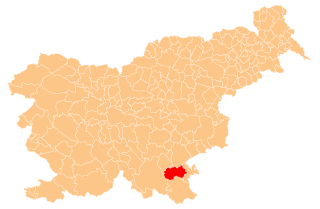
Ašelice is a remote abandoned settlement in the Municipality of Semič in southern Slovenia. The area is part of the traditional region of Lower Carniola and is now included in the Southeast Slovenia Statistical Region. Its territory is now part of the village of Mašelj. Ašelice lies high on a slope alongside an unpaved road east of Črmošnjice.
Smrečnik is a remote abandoned settlement in the Municipality of Semič in southern Slovenia. The area is part of the traditional region of Lower Carniola and is now included in the Southeast Slovenia Statistical Region. Its territory is now part of the village of Komarna Vas.
Ovčjak is a remote abandoned settlement in the Municipality of Črnomelj in the White Carniola area of southeastern Slovenia. The area is part of the traditional region of Lower Carniola and is now included in the Southeast Slovenia Statistical Region. Its territory is now part of the village of Rožič Vrh.
Vimolj is a remote abandoned settlement in the Municipality of Semič in southern Slovenia. The area is part of the traditional region of Lower Carniola and is now included in the Southeast Slovenia Statistical Region. Its territory is now part of the village of Srednja Vas.
Lahinja is a remote abandoned settlement in the Municipality of Semič in southern Slovenia. The area is part of the traditional region of Lower Carniola and is now included in the Southeast Slovenia Statistical Region. Its territory is now part of the village of Planina.
Štale is a remote abandoned settlement in the Municipality of Semič in southern Slovenia. The area is part of the traditional region of Lower Carniola and is now included in the Southeast Slovenia Statistical Region. Its territory is now part of the village of Komarna Vas.
Novi Tabor is an abandoned settlement in the Municipality of Semič in southern Slovenia. The area is part of the traditional region of Lower Carniola and is now included in the Southeast Slovenia Statistical Region. Its territory is now part of the village of Črmošnjice.
Gričice is a former settlement in the Municipality of Semič in southern Slovenia. The area is part of the traditional region of Lower Carniola and is now included in the Southeast Slovenia Statistical Region. Its territory is now part of the village of Komarna Vas.
Pogorelec is a former settlement in the Municipality of Dolenjske Toplice in southern Slovenia. The area is part of the traditional region of Lower Carniola and is now included in the Southeast Slovenia Statistical Region. Its territory is now part of the village of Podstenice.
Resa is a remote abandoned settlement in the Municipality of Semič in southern Slovenia. The area is part of the traditional region of Lower Carniola and is now included in the Southeast Slovenia Statistical Region. Its territory is now part of the village of Komarna Vas.
Ribnik is a remote abandoned settlement in the Municipality of Semič in southern Slovenia. The area is part of the traditional region of Lower Carniola and is now included in the Southeast Slovenia Statistical Region. Its territory is now part of the village of Komarna Vas.
Konjski Hrib is a remote abandoned settlement in the Municipality of Semič in southern Slovenia. The area is part of the traditional region of Lower Carniola and is now included in the Southeast Slovenia Statistical Region. Its territory is now part of the village of Planina.
Travnik is a remote abandoned settlement in the Municipality of Semič in southern Slovenia. The area is part of the traditional region of Lower Carniola and is now included in the Southeast Slovenia Statistical Region. Its territory is now part of the village of Komarna Vas.
Slaba Gorica is a remote abandoned settlement in the Municipality of Črnomelj in the White Carniola area of southeastern Slovenia. The area is part of the traditional region of Lower Carniola and is now included in the Southeast Slovenia Statistical Region. Its territory is now part of the village of Rožič Vrh.
Škrilj is a remote former settlement in the Municipality of Semič in southern Slovenia. The area is part of the traditional region of Lower Carniola and is now included in the Southeast Slovenia Statistical Region. Its territory is now part of the village of Planina.
Ponikve is a remote abandoned settlement in the Municipality of Semič in southern Slovenia. The area is part of the traditional region of Lower Carniola and is now included in the Southeast Slovenia Statistical Region. Its territory is now part of the village of Planina.
Topličice is a remote abandoned settlement in the Municipality of Semič in southern Slovenia. The area is part of the traditional region of Lower Carniola and is now included in the Southeast Slovenia Statistical Region. Its territory is now part of the village of Sredgora. It lies in a narrow dry valley 1 km east of Sredgora.
Topli Vrh is an abandoned settlement in the Municipality of Semič in southern Slovenia. The area is part of the traditional region of Lower Carniola and is now included in the Southeast Slovenia Statistical Region. Its territory is now part of the village of Črmošnjice.