Goryachiye Klyuchi (Russian : Горячие Ключи) is the name of several rural localities in Sakhalin Oblast, Russia:

Russian is an East Slavic language, which is official in the Russian Federation, Belarus, Kazakhstan and Kyrgyzstan, as well as being widely used throughout Eastern Europe, the Baltic states, the Caucasus and Central Asia. It was the de facto language of the Soviet Union until its dissolution on 25 December 1991. Although, nowadays, nearly three decades after the breakup of the Soviet Union, Russian is used in official capacity or in public life in all the post-Soviet nation-states, as well as in Israel and Mongolia, the rise of state-specific varieties of this language tends to be strongly denied in Russia, in line with the Russian World ideology.
The classification system of the types of inhabited localities in Russia, the former Soviet Union, and some other post-Soviet states has certain peculiarities compared with the classification systems in other countries.

Sakhalin Oblast is a federal subject of Russia comprising the island of Sakhalin and the Kuril Islands in the Russian Far East. The oblast has an area of 87,100 square kilometers (33,600 sq mi). Its administrative center and the largest city is Yuzhno-Sakhalinsk. Population: 497,973. Besides people from other parts of the former Soviet Union and the Korean Peninsula, the oblast is home to Nivkhs and Ainu, with the latter having lost their language in Sakhalin recently. Sakhalin is rich in natural gas and oil, and is Russia's second wealthiest federal subject. It borders Khabarovsk Krai to the west and Hokkaido, Japan to the south.
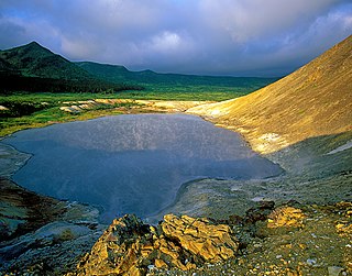
- Goryachiye Klyuchi, Kurilsky District, Sakhalin Oblast, a selo in Kurilsky District
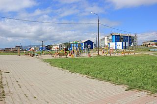
- Goryachiye Klyuchi, Nogliksky District, Sakhalin Oblast, a selo in Nogliksky District
Goryachiye Klyuchi is a rural locality in Kurilsky District of Sakhalin Oblast, Russia, located on the Iturup Island.

Kurilsky District is an administrative district (raion) of Sakhalin Oblast, Russia; one of the seventeen in the oblast. Municipally, it is incorporated as Kurilsky Urban Okrug. It is located on the central Kuril Islands southeast of the Island of Sakhalin. The area of the district is 5,145.9 square kilometers (1,986.8 sq mi). Its administrative center is the town of Kurilsk. Population: 7,359 (2010 Census); 7,108 (2002 Census); 10,498 (1989 Census). The population of Kurilsk accounts for 28.1% of the district's total population. The name is sometimes spelled Kurliskiy or Kurliskiye in English.

Nogliksky District is an administrative district (raion) of Sakhalin Oblast, Russia; one of the seventeen in the oblast. Municipally, it is incorporated as Nogliksky Urban Okrug. It is located in the northeast of the Island of Sakhalin. The area of the district is 11,294.8 square kilometers (4,360.9 sq mi). Its administrative center is the urban locality of Nogliki. Population: 12,124 (2010 Census); 13,576 (2002 Census); 16,786 (1989 Census). The population of Nogliki accounts for 84.4% of the district's total population.
| This article includes a list of related items that share the same name (or similar names). If an internal link incorrectly led you here, you may wish to change the link to point directly to the intended article. |