Gourri

Last updated • 2 min readFrom Wikipedia, The Free Encyclopedia
Gourri
Γούρρι
village
2022 03 Gourri 1.jpg
Cyprus relief location map.jpg
Red pog.svg
Gourri
Location in Cyprus
Coordinates: 34°57′26″N33°9′25″E / 34.95722°N 33.15694°E / 34.95722; 33.15694
CountryFlag of Cyprus.svg  Cyprus
District Nicosia District
Population
 (2001) [1]
  Total
225
Time zone UTC+2 (EET)
  Summer (DST) UTC+3 (EEST)

Gourri (Greek : Γούρρι) is a village in the Nicosia District of Cyprus, found on a rough side at the foothill of the Machaira mountain, in the geographical region of Pitsilia. The village is located 10 km south of Klirou, 36 km from Nicosia.

Contents

History

Antique swords, fig. 1-3: Xiphos, fig. 4: Makhaira. Schwerter2.jpg
Antique swords, fig. 1–3: Xiphos, fig. 4: Makhaira.
Greek livestock bells Animal bells.jpg
Greek livestock bells
Area between village and waterfall 2022 03 Gourri 2.jpg
Area between village and waterfall

The village name came into existence at around 800 AD after a general amnesty pardon of all dissidents and fugitive outlaws on the island. From the 5th to the 8th century there was a lot of turmoil in the islands history. Earthquakes, [2] anti-Pagan laws and Arab invasions [3] caused dissidents and refugee groups to form in Clans, in the inaccessible valleys and peaks of Troodos Mountains, in order to avoid oppression. [4] There they established the rule of the sword as basic tool of survival. Hence the name [5] of the mountain Makhaira originates from these clans fighting ability. One of these clans was the Kourries, originated by dissident's fugitives from Kourion area. The Kourries were in control of the East side of the mountain. Gourri village name is taken from the Kourries’ clan.

In Komnenos dynasty (1081–1185), the Gouri and other villages were given as a privilege to Machairas Monastery. The various clans were merged into the existing communities and the new monastery had invested "for the benefit of communities", in production of agricultural tools, "ploughs, saddles, and livestock bells."

During the Frankish period (1192–1489) the Knights Templar implemented the feudal system to the island and abolished the privileges of the monastery. The locals had rebelled and Franks, in order to suppress the rebellion, applied the (military feudalism) Commandry (feudalism) in the village and generally in Pitsilia. The uprising resulted in the execution of 13 monks [6] [7] and the complete destruction of the villages Rogkia [8] and Kalamithasa [9] as other small settlements.

This was the first time that Gourri and Pitsilia territory were occupied militarily.

Related Research Articles

<span class="mw-page-title-main">Nicosia</span> Capital and largest city of Cyprus

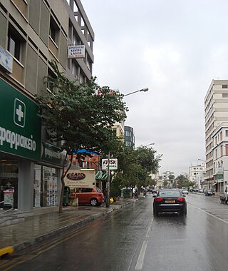
Nicosia, also known as Lefkosia and Lefkoşa, is the capital and largest city of Cyprus. It is the southeasternmost of all EU member states' capital cities.

<span class="mw-page-title-main">Pedieos</span> River in Cyprus

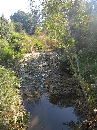
The Pedieos is the longest river in Cyprus. The river originates in the Troodos Mountains close to Machairas Monastery and flows northeast across the Mesaoria plains, through the capital city Nicosia. It then steers east, meeting the sea at Famagusta Bay close to the ancient Greek city of Salamis. Maximum depth is 10 meters.

<span class="mw-page-title-main">Engomi</span> Municipality in Nicosia District, Cyprus

Engomi is a suburb and municipality of the Cypriot capital Nicosia. In 2011, it had a population of 18,010. Of these, 14,254 were Cypriot citizens.

<span class="mw-page-title-main">Galata, Cyprus</span> Place in Nicosia District, Cyprus

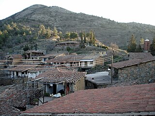
Galata is a village in the Solea valley, located about 60 km west of the capital Nicosia, at an altitude of 620 m in the Troodos Mountains of Cyprus. It is a popular summer tourist destination for its cooler climate in the summer months. It is also well known on the island for its fruit produce. In Galata there is Panagia tis Podithou, church, which was designated a UNESCO World Heritage Site in 1985 along with nine other Painted Churches in the Troödos Region, because of their unique murals and testimony to the history of Byzantine rule in Cyprus.

<span class="mw-page-title-main">Kyprianos of Cyprus</span> Archbishop of Cyprus from 1810 to 1821

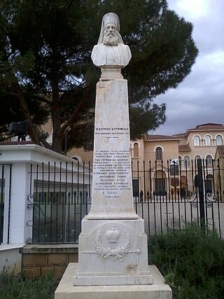
Archbishop Kyprianos of Cyprus was the head of the Cypriot Orthodox Church in the early 19th century at the time that the Greek War of Independence broke out.

<span class="mw-page-title-main">Stylianos Lenas</span>

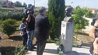
Stylianos Lenas was a member of EOKA, and one of the Cypriots who were wounded in battle against British soldiers.

<span class="mw-page-title-main">Chandria</span> Place in Limassol District, Cyprus

Chandria is a village in Cyprus in the Limassol administrative district and belongs to the Pitsilia group of villages. At an elevation of 1,275 m (4,180 ft), it is the second highest village in Cyprus after Prodromos.

<span class="mw-page-title-main">Agros, Cyprus</span> Village in Limassol District, Cyprus

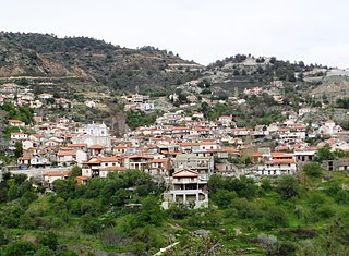
Agros is a village built on the Troödos Mountains, in the region of Pitsilia, in southwest Cyprus, which has built amphitheatrically among high mountains at an altitude of 1100 metres with a population of approximately 1,000. The village is located 45 minutes away from the cities of Nicosia and Limassol, 20 minutes from Troodos Square and 80 minutes from the international airports of Larnaca and Paphos.

<span class="mw-page-title-main">Outline of Cyprus</span> Overview of and topical guide to Cyprus

The following outline is provided as an overview of and topical guide to Cyprus:

Myrtou is a town in the Kyrenia District of Cyprus, north of the city of Morphou. It is under the de facto control of Northern Cyprus.

<span class="mw-page-title-main">Klirou</span> Village in Nicosia District, Cyprus

Klirou is a Historic Mining District and covers an area of 18.7 square kilometers. Klirou residents are known for their wealth and political influence. Situated in the northern foothills of the Troodos Mountains, 26 km southwest of Nicosia. The area was inhabited from the Late Bronze Age, by Arcadocypriot Greek settlers

<span class="mw-page-title-main">Agios Epifanios Oreinis</span> Place in Nicosia District, Cyprus

Agios Epifanios is a village in the Nicosia District of Cyprus, located 5 km southwest of Klirou.

<span class="mw-page-title-main">Fikardou</span> Village in Nicosia District, Cyprus

Fikardou is an old settlement that has retained its traditional medieval characteristics. It is situated on the south eastern slopes of the Troodos Mountains, approximately 40 km southwest of Nicosia. The village today is almost deserted. It's connected by two roads, one from Klirou and the other of Kalo Chorio Klirou. Nearby are also the traditional Lazanias village and the Machairas Monastery. The village is owned by the Department of Antiquities, which in 1978 has been declared as a World Heritage Site.

Fterikoudi is a village in the Nicosia District of Cyprus, located 4 km north of Palaichori Morphou.

<span class="mw-page-title-main">Lazanias</span> Village in Nicosia District, Cyprus

Lazanias is a village in the Nicosia District of Cyprus, located southwest of Gourri.

<span class="mw-page-title-main">Panagia, Nicosia</span> Village in Nicosia District, Cyprus

Pallouriotissa is an area of Nicosia, Cyprus, formerly an independent village, which was annexed to the municipality in 1968. It was subsequently divided into the quarters of Panayia (Panagia) and Saints Constantine and Helen. As of 2011, their combined population was 15,607. Pallouriotissa is immediately south of Kaimakli.

<span class="mw-page-title-main">Pelendri</span> Place in Limassol District, Cyprus

Pelendri is a village in the Limassol District of Cyprus.

Neophytos of Cyprus, Saint Neophytos, Neophytos the Recluse was a Cypriot Orthodox monk, priest, and sometime hermit, whose writings preserved a history of the early crusades. "He is considered to be one of the most significant figures of the Church of Cyprus"

<span class="mw-page-title-main">Pitsilia</span> Agricultural region in Cyprus

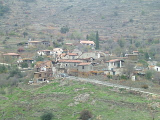
Pitsilia is an agricultural region in Cyprus, with total area of 61,000 hectares, in a mountainous area of rocky land on very steep slopes that have been used mainly for grazing goats and sheep and for producing small amounts of cereals, wine and grapes. The region complemented by eastern, north and south eastern part of the Troodos Mountains at elevations between 500 and 1,600 metres and includes villages from the districts of Limassol and Nicosia.

<span class="mw-page-title-main">Maronite Catholic Archeparchy of Cyprus</span> Maronite Catholic ecclesiastical jurisdiction

The Archeparchy of Cyprus is a seat of the Maronite Church immediately subject to the Holy See. It is currently ruled by Archeparch Selim Jean Sfeir.

References

  1. "Census 2001".
  2. "Geological Survey Department – Earthquakes – Historic Earthquakes". www.moa.gov.cy. Archived from the original on 2016-05-31. Retrieved 2013-10-20.
  3. "A short introduction to the history of Cyprus". www.havetravelfun.com.
  4. "美白ガイド決定版 – きれいな肌でいるための情報を配信中!".
  5. Galleries, Antique maps Paulus Swaen Auction. "MERCATOR,G./ HONDIUS,J. – Cyprus Ins". www.swaen.com.
  6. Sanidopoulos, John. "The 13 Holy Martyrs of Kantara in Cyprus: Defenders of Leavened Bread in the Eucharist".
  7. orthodox church calendar: Feast Day – May 19
  8. "Potamitissa". www.potamitissa.org.
  9. "Φτερικούδι / Fterikoudi – History". www.fterikoudi.com.

Sources

Further reading

Commons-logo.svg Media related to Gourri at Wikimedia Commons