There are over 20,000 Grade II* listed buildings in England. This is a list of these buildings in the London Borough of Richmond upon Thames.
Name | Location | Type | Completed [note 1] | Date designated | Grid ref. [note 2] Geo-coordinates | Entry number [note 3] | Image |
---|---|---|---|---|---|---|---|
Hickeys Almshouses, Including Chapel and Lodges | Sheen Road, Richmond TW9 1XB | Almshouses, chapel and lodges | 1834 | 10 January 1950 | TQ1886375104 51°27′45″N0°17′25″W / 51.462438°N 0.290382°W | 1262108 | |
Houblon's Almshouses | Worple Way, Richmond TW10 6DA | Almshouses | 1757–58 | 10 January 1950 | TQ1840674978 51°27′41″N0°17′49″W / 51.461401°N 0.296999°W | 1253033 |
Name | Location | Type | Completed [note 1] | Date designated | Grid ref. [note 2] Geo-coordinates | Entry number [note 3] | Image |
---|---|---|---|---|---|---|---|
Hammersmith Bridge | Castelnau | Suspension bridge | 1884 | 25 June 1983 | TQ2293878036 51°29′17″N0°13′51″W / 51.487919°N 0.230733°W | 1080793 | |
Kingston Bridge | A308, Richmond KT1 4DP | Road bridge | 1825–28 | 2 September 1952 | TQ1769069379 51°24′40″N0°18′33″W / 51.411228°N 0.30916°W | 1065378 | |
Richmond Footbridge, Lock and Sluices | Richmond | Footbridge and lock | 1891 | 25 May 1983 | TQ1701575056 51°27′45″N0°19′01″W / 51.462391°N 0.316987°W | 1250044 | |
Twickenham Bridge and Attached Railings, Lamp Standards and Light Brackets | A316, Richmond TW1 1QX | Road bridge | 1933 | 25 May 1983 | TQ1721274846 51°27′38″N0°18′51″W / 51.460463°N 0.314222°W | 1253011 |
Name | Location | Type | Completed [note 1] | Date designated | Grid ref. [note 2] Geo-coordinates | Entry number [note 3] | Image |
---|---|---|---|---|---|---|---|
Aroid House | Royal Botanic Gardens, Kew, Richmond TW9 3AE | Pavilion | Reerected | 10 January 1950 | TQ1866177534 51°29′04″N0°17′33″W / 51.48432°N 0.292473°W | 1250800 | |
Avenue Lodge | Royal Botanic Gardens, Kew, Richmond TW9 3AE | Lodge | 1866 | 25 May 1983 | TQ1867676402 51°28′27″N0°17′33″W / 51.474143°N 0.292637°W | 1251933 | |
Marianne North Gallery | Royal Botanic Gardens, Kew, Richmond TW9 3AE | Art gallery | 1879–1882 | 10 January 1950 | TQ1868276431 51°28′28″N0°17′33″W / 51.474402°N 0.292541°W | 1251787 | |
Principal Entrance Gates and Railings Fronting Kew Green (now known as Elizabeth Gate) | Royal Botanic Gardens, Kew, Richmond TW9 3AE | Gate | 1848 | 25 May 1983 | TQ1873877548 51°29′04″N0°17′29″W / 51.484429°N 0.29136°W | 1250801 | |
The Queen's Cottage | Royal Botanic Gardens, Kew, Richmond TW9 3AE | Timber-framed house | c. 1772 | 10 January 1950 | TQ1790776250 51°28′23″N0°18′14″W / 51.472937°N 0.303755°W | 1262486 | |
Ruined Arch, Including Fragments of Masonry at the Base of the Arch | Royal Botanic Gardens, Kew, Richmond TW9 3AE | Folly | 1759 | 25 May 1983 | TQ1865476371 51°28′26″N0°17′35″W / 51.473869°N 0.292964°W | 1251956 | |
Herbarium Complex, Royal Botanic Gardens, Kew - Hunter House and Wings C, B and A, including the entrance gates and railings | Royal Botanic Gardens, Kew, Richmond TW9 3AE | Herbarium | various | 10 January 1950 | TQ1876977629 51°29′07″N0°17′27″W / 51.485151°N 0.29088614°W | 1065399 |
Name | Location | Type | Completed [note 1] | Date designated | Grid ref. [note 2] Geo-coordinates | Entry number [note 3] | Image |
---|---|---|---|---|---|---|---|
Box Cottage (The Red House) | Sudbrook Lane, Petersham, Richmond TW10 7AT | House | Late 17th/early 18th century | 10 January 1950 | TQ1812073024 51°26′38″N0°18′06″W / 51.443899°N 0.301766°W | 1252876 | Upload Photo |
Buckingham House Dudley House Farthingwood and Gate and Railing Norfolk House | Montpelier Row, Twickenham TW1 2NQ | Terrace | 1720 | 2 September 1952 | TQ1700473765 51°27′03″N0°19′03″W / 51.45079°N 0.317572°W | 1065390 | Upload Photo |
Bushy House | Bushy Road, Teddington TW11 0EB | House | Early 19th century | 2 September 1952 | TQ1557770357 51°25′14″N0°20′21″W / 51.420453°N 0.33921°W | 1080870 | |
Cross Deep and Coach House | 3 Cross Deep, Twickenham TW1 1QY | House | Late 17th/early 18th century | 2 September 1952 | TQ1612972947 51°26′37″N0°19′50″W / 51.443618°N 0.330426°W | 1358068 | |
Douglas House | Petersham Road, Petersham, Richmond TW10 7AH | House | Late 17th century | 25 June 1983 | TQ1787973156 51°26′42″N0°18′19″W / 51.445135°N 0.305188°W | 1285296 | |
Entrance Gate and Piers to Rutland Lodge Rutland Lodge | 145 Petersham Road, Petersham, Richmond TW10 7AA | House | Late 17th century | 10 January 1950 | TQ1801173292 51°26′47″N0°18′12″W / 51.44633°N 0.303244°W | 1065338 | |
Fotheringay House and Tennyson House | Montpelier Row, Twickenham TW1 2NQ | Terrace | 1720 | 2 September 1952 | TQ1701373745 51°27′02″N0°19′03″W / 51.450609°N 0.317449°W | 1285639 | |
Fountain Garden, Statue in Front of Canal | Hampton Court | Statue | after 16th century statue | 2 September 1952 | TQ1600968410 51°24′10″N0°20′01″W / 51.402865°N 0.333636°W | 1065453 | |
Garden Gates and Railings Petersham House | Church Lane, Petersham, Richmond TW10 7AG | House | Late 17th century | 10 January 1950 | TQ1811073311 51°26′47″N0°18′07″W / 51.44648°N 0.301814°W | 1065336 | |
Gate and Railings to Old Friars Old Friars | Richmond Green | Terraced house | Late 17th century | 10 January 1950 | TQ1765474833 51°27′37″N0°18′28″W / 51.460254°N 0.307867°W | 1065315 | |
Gates and Railings to Oak House Oak House | Richmond Green, Richmond TW9 1NQ | Terraced house | Mid 18th century | 10 January 1950 | TQ1768374820 51°27′36″N0°18′27″W / 51.460132°N 0.307454°W | 1065313 | |
Gordon House Maria Grey Training College | St Margarets | House | c. 1720 | 21 May 1973 | TQ1669375276 51°27′52″N0°19′18″W / 51.464435°N 0.321547°W | 1240076 | |
Grotto in Grounds of Hampton Court House | Hampton Court Road KT8 9BS | Grotto | Completed by 1769 | 18 February 1976 | TQ1527768984 51°24′29″N0°20′38″W / 51.408173°N 0.343968°W | 1253959 | Upload Photo |
Grotto or Shell House in the Grounds of Thames Eyot | 3 Cross Deep, Twickenham TW1 1QY | Grotto | Late 18th century or early 19th century | 25 June 1983 | TQ1616572951 51°26′37″N0°19′48″W / 51.443647°N 0.329907°W | 1080812 | Upload Photo |
Grove House including Moorish Room | 100 High Street, Hampton TW12 2ST [1] | House | Late 17th century | 2 February 1952 | TQ1426769909 51°25′00″N0°21′29″W / 51.416691°N 0.358185°W | 1357703 | |
Harrington Lodge | Sudbrook Lane, Petersham TW10 7AT | House | Late C17/Early 18th century | 10 January 1950 | TQ1812573009 51°26′38″N0°18′06″W / 51.443763°N 0.301699°W | 1252875 | Upload Photo |
Langham House Close, nos. 1–18 | Ham Common, Ham TW10 7JE | Flats | 1957–1958 | 22 December 1998 | TQ1760771851 51°26′00″N0°18′34″W / 51.433463°N 0.309533°W | 1033380 | |
Langham House Close, nos. 19–24 | Ham Common, Ham TW10 7JE | Flats | 1957–1958 | 23 December 1998 | TQ1757871814 51°25′59″N0°18′36″W / 51.433137°N 0.309962°W | 1033381 | Upload Photo |
Langham House Close, nos. 25–30 | Ham Common, Ham TW10 7JE | Flats | 1957–1958 | 22 December 1998 | TQ1754171772 51°25′58″N0°18′38″W / 51.432767°N 0.310508°W | 1051027 | Upload Photo |
Leicester House Queen Anne House Wolsey House and Gate | Montpelier Row, Twickenham | Terrace | 1720 | 2 September 1952 | TQ1699073797 51°27′04″N0°19′04″W / 51.451081°N 0.317762°W | 1065389 | Upload Photo |
Limes House and Forecourt Piers | 123 Mortlake High Street, London SW14 8SN [2] | House | c. 1720 | 25 October 1951 [2] | TQ2113276050 51°28′14″N0°15′27″W / 51.470459°N 0.257412°W | 1065428 | |
Lissoy | Ormond Road, Richmond TW10 6TH | Terraced house | Early 18th century | 10 January 1950 | TQ1785374611 51°27′30″N0°18′18″W / 51.458218°N 0.305078°W | 1065353 | Upload Photo |
Manor House | Ham Street, Ham TW10 7HA | House | Early to mid 18th century | 10 January 1950 | TQ1729072605 51°26′25″N0°18′50″W / 51.440305°N 0.313842°W | 1358099 | |
Montpelier House South End House Walls, Piers, Railings and Gazebo in Grounds | Twickenham | Terrace | 18th century | 2 September 1952 | TQ1706673647 51°26′59″N0°19′00″W / 51.449717°N 0.316719°W | 1065391 | Upload Photo |
Montrose House | 186, Petersham Road, Petersham, Richmond TW10 7AD | House | Late 17th century | 25 June 1983 | TQ1805473255 51°26′46″N0°18′09″W / 51.445989°N 0.302638°W | 1065342 | |
Newark House | 9 The Vineyard, Richmond TW10 6AQ | House | Mid 18th century | 10 January 1950 | TQ1804474581 51°27′28″N0°18′08″W / 51.457908°N 0.30234°W | 1253134 | Upload Photo |
Normansfield Hospital | Kingston Road, Teddington TW11 9JH | House | 1866 | 25 May 1983 | TQ1725970177 51°25′07″N0°18′54″W / 51.41849°N 0.31509°W | 1065379 | |
No. 19, 21, and 23 Kew Foot Road | Richmond TW9 2SS | Terrace | c. 1711 | 10 January 1950 | TQ1806575452 51°27′57″N0°18′06″W / 51.465732°N 0.301747°W | 1065436 | Upload Photo |
No. 356 and 358 Kew Road | Richmond | House | Early/mid 18th century | 10 January 1950 | TQ1906177329 51°28′57″N0°17′12″W / 51.482393°N 0.286784°W | 1357700 | Upload Photo |
No. 18 King Street | Richmond TW9 1ND | Terraced house | Early 18th century | 10 January 1950 | TQ1769774830 51°27′37″N0°18′26″W / 51.460219°N 0.307249°W | 1065373 | Upload Photo |
No. 6 Ormond Road | Richmond TW10 6TH | Terraced house | Early 18th century | 10 January 1950 | TQ1787774627 51°27′30″N0°18′17″W / 51.458357°N 0.304727°W | 1065356 | Upload Photo |
No. 1 Richmond Green | Richmond TW9 1NQ | Terraced house | Early 18th century | 10 January 1950 | TQ1769874835 51°27′37″N0°18′26″W / 51.460263°N 0.307233°W | 1065311 | |
No. 2-6 Richmond Green | Richmond | Terrace | Early 18th century | 10 January 1950 | TQ1770974850 51°27′37″N0°18′25″W / 51.460396°N 0.30707°W | 1065312 | |
No. 10 Richmond Green | Richmond TW9 1PX | Terraced house | Early 18th century | 10 January 1950 | TQ1783074935 51°27′40″N0°18′19″W / 51.461135°N 0.305301°W | 1357746 | |
No 11, and Railings | Richmond | Terraced house, and railings | 18th century | 10 January 1950 | TQ1782774931 51°27′40″N0°18′19″W / 51.461099°N 0.305345°W | 1065348 | |
No. 12 Richmond Green | Richmond TW9 1PX | Terraced house | 18th century | 10 January 1950 | TQ1782374926 51°27′40″N0°18′19″W / 51.461055°N 0.305404°W | 1181111 | Upload Photo |
No. 32 Richmond Green | Richmond | Terraced house | Early 18th century | 10 January 1950 | TQ1772274868 51°27′38″N0°18′25″W / 51.460555°N 0.306877°W | 1357770 | |
No. 3-12 Sion Road | Twickenham TW1 3DR | Terrace | Early 18th century | 2 September 1952 | TQ1668273396 51°26′51″N0°19′20″W / 51.44754°N 0.322325°W | 1262089 | |
18 Station Road | Barnes, London SW13 0LW | House | Earlier | 12 May 1950 | TQ2180176319 51°28′22″N0°14′52″W / 51.472733°N 0.247692°W | 1252850 | |
Old Court House | The Wardrobe, Richmond TW9 1PB | House | Early 18th century | 9 February 1952 | TQ1756774959 51°27′41″N0°18′33″W / 51.461405°N 0.309077°W | 1181217 | |
Old Palace Place | The Green, Richmond TW9 1NQ | House | Late C16/C17 | 10 January 1950 | TQ1767374825 51°27′37″N0°18′27″W / 51.460179°N 0.307596°W | 1065314 | |
Ormeley Lodge, with Gates and Railings to Front | Ham Gate Avenue, Ham, TW10 5HB | Country house | Late C17/Early 18th century | 10 January 1950 | TQ1807672051 51°26′07″N0°18′10″W / 51.435163°N 0.302723°W | 1286489 | |
Pope's Grotto in Grounds of St Catherine's High School | Twickenham | Grotto | C19-20 | 2 September 1952 | TQ1595672690 51°26′29″N0°19′59″W / 51.441344°N 0.332998°W | 1192178 | |
Richmond Theatre | Little Green, Richmond TW9 1QJ | Theatre | 1899 | 28 June 1972 | TQ1792875046 51°27′44″N0°18′14″W / 51.462112°N 0.303854°W | 1065384 | |
Sandycombe Lodge | 40 Sandycoombe Road, Twickenham TW1 2LR | Studio house | Early 19th century | 2 September 1952 | TQ1708774105 51°27′14″N0°18′59″W / 51.453829°N 0.316265°W | 1262429 | |
Seaforth House | Church Terrace, Richmond TW10 6SE | Terraced house | Early 18th century | 10 January 1950 | TQ1795874744 51°27′34″N0°18′13″W / 51.459391°N 0.303523°W | 1261555 | Upload Photo |
Seymour House Warwick House | Montpelier Row, Twickenham TW1 2NQ | House | 1720 | 2 September 1952 | TQ1697473820 51°27′05″N0°19′05″W / 51.451291°N 0.317985°W | 1194493 | Upload Photo |
Sion Cottage | Sion Road, Twickenham TW1 3DD | House | Early 18th century | 2 September 1952 | TQ1671173358 51°26′50″N0°19′19″W / 51.447193°N 0.32192°W | 1262088 | Upload Photo |
Sion House, Railings and Piers | Sion Road, Twickenham TW1 3DD | House | Early 18th century | 2 September 1952 | TQ1670673360 51°26′50″N0°19′19″W / 51.447212°N 0.321992°W | 1252847 | Upload Photo |
Sudbrook Cottage | Sudbrook Lane, Petersham TW10 7AT | House | Late C17/Early 18th century | 10 January 1950 | TQ1810873040 51°26′39″N0°18′07″W / 51.444045°N 0.301933°W | 1262065 | Upload Photo |
Sudbrook Lodge | Petersham Road, Richmond TW10 5HA | House | Early 18th century | 10 January 1950 | TQ1793672133 51°26′09″N0°18′17″W / 51.435929°N 0.304709°W | 1253016 | Upload Photo |
The Old Court House | Hampton Court Road, Hampton KT8 9BW | House | Early 18th century | 25 June 1983 | TQ1539768645 51°24′18″N0°20′32″W / 51.405102°N 0.342354°W | 1080796 | |
The Old Vicarage School | 48 Richmond Hill, Richmond TW10 6QX | House | Extant c1680 | 24 December 1968 | TQ1806474399 51°27′23″N0°18′08″W / 51.456269°N 0.302113°W | 1249946 | |
The Pavilion | Hampton Court Palace, East Molesey KT8 9AP | Bowling green pavilion | 1700–01 | 2 September 1952 | TQ1627167534 51°23′42″N0°19′49″W / 51.394938°N 0.330158°W | 1080801 | |
The Terrace | 3 Richmond Hill, Richmond TW10 6RE | House | 1767 | 10 January 1950 | TQ1797474460 51°27′25″N0°18′12″W / 51.456836°N 0.303387°W | 1249952 | |
Underground Passage at Radnor Lodge | Radnor Road, Twickenham | Grotto | 18th century | 25 June 1983 | TQ1578272840 51°26′34″N0°20′08″W / 51.442728°N 0.335452°W | 1065344 | Upload Photo |
Underground Passage in Grounds of St Catherine's High School | Under the junction of Radnor Road and Grotto Road, Cross Deep, Twickenham TW1 4QJ | Grotto | 18th century | 25 June 1983 | TQ1580072823 51°26′33″N0°20′07″W / 51.442571°N 0.335198°W | 1080811 | Upload Photo |
York House, Garden Walls Wrought Iron Gates and Boundary Walls Along Sion Road on the East Side and Riverside on the South | Richmond Road, Twickenham TW1 3AA | House | Earlier | 2 September 1952 | TQ1654273401 51°26′51″N0°19′28″W / 51.447614°N 0.324337°W | 1263365 |
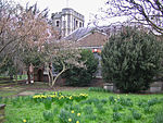
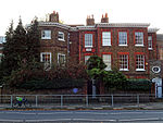
Petersham is a village in the London Borough of Richmond upon Thames on the east of the bend in the River Thames south of Richmond, which it shares with neighbouring Ham. It provides the foreground of the scenic view from Richmond Hill across Petersham Meadows, with Ham House further along the river. Other nearby places include Twickenham, Isleworth, Teddington, Mortlake, and Roehampton.
Richmond is a town in south-west London, 8.2 miles (13.2 km) west-southwest of Charing Cross. It stands on the River Thames, and features many parks and open spaces, including Richmond Park, and many protected conservation areas, which include much of Richmond Hill. A specific Act of Parliament protects the scenic view of the River Thames from Richmond.
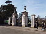
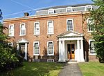
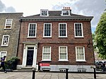
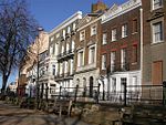
Richmond Green is a recreation area near the centre of Richmond, a town of about 20,000 inhabitants situated in south-west London. Owned by the Crown Estate, it is leased to the London Borough of Richmond upon Thames. The Green, which has been described as "one of the most beautiful urban greens surviving anywhere in England", is roughly square in shape and its open grassland, framed with broadleaf trees, extends to roughly twelve acres. On the north-east side there is also a smaller open space called Little Green. Richmond Green and Little Green are overlooked by a mixture of period townhouses, historic buildings and municipal and commercial establishments including the Richmond Lending Library and Richmond Theatre.
The National Heritage List for England (NHLE) is England's official database of protected heritage assets. It includes details of all English listed buildings, scheduled monuments, register of historic parks and gardens, protected shipwrecks, and registered battlefields. It is maintained by Historic England, a government body, and brings together these different designations as a single resource even though they vary in the type of legal protection afforded to them. Although not designated by Historic England, World Heritage Sites also appear on the NHLE; conservation areas do not appear since they are designated by the relevant local planning authority.
There are over 9,000 Grade I listed buildings and 20,000 Grade II* listed buildings in England. This page is a list of these buildings in the London Borough of Barnet.
There are over 9,000 Grade I listed buildings and 20,000 Grade II* listed buildings in England. This page is a list of these buildings in the London Borough of Bexley.
There are over 9,000 Grade I listed buildings and 20,000 Grade II* listed buildings in England. This page is a list of these buildings in the London Borough of Brent.
There are over 9,000 Grade I listed buildings and 20,000 Grade II* listed buildings in England. This page is a list of these buildings in the London Borough of Croydon.
There are over 9,000 Grade I listed buildings and 20,000 Grade II* listed buildings in England. This page is a list of these buildings in the London Borough of Harrow.
There are over 9,000 Grade I listed buildings and 20,000 Grade II* listed buildings in England. This page is a list of these buildings in the London Borough of Hillingdon.
There are over 9,000 Grade I listed buildings and 20,000 Grade II* listed buildings in England. This page is a list of these buildings in the London Borough of Havering.
There are over 9,000 Grade I listed buildings and 20,000 Grade II* listed buildings in England. This page is a list of these buildings in the London Borough of Hounslow.
There are over 9,000 Grade I listed buildings and 20,000 Grade II* listed buildings in England. This page is a list of these buildings in the Royal Borough of Kingston upon Thames.
There are over 9,000 Grade I listed buildings in England. This page is a list of these buildings in the London Borough of Richmond upon Thames.
There are over 9,000 Grade I listed buildings and 20,000 Grade II* listed buildings in England. This page is a list of these buildings in the London Borough of Southwark.
There are over 20,000 Grade II* listed buildings in England. This page is a list of these buildings in the London Borough of Camden.
St Leonard's Court is a four-storey block of flats on Palmers Road, off St Leonard's Road in East Sheen, London SW14 in the London Borough of Richmond upon Thames, 0.2 miles from Mortlake railway station. It was constructed between 1934 and 1938 and is remarkable for its surviving underground air raid shelter, built in anticipation of the Second World War and now Grade II listed.
This page is a list of the 101 Grade II listed buildings in the London Borough of Bexley. There are also four Grade II-listed entries on the Register of Historic Parks and Gardens of Special Historic Interest in England.
The Register of Historic Parks and Gardens of Special Historic Interest in England, created in 1983, is administered by Historic England. It includes more than 1,600 sites, ranging from gardens of private houses, to cemeteries and public parks.