North East England is one of nine official regions of England at the first level of ITL for statistical purposes. The region has three current administrative levels below the region level in the region: combined authority, unitary authority or metropolitan borough, and civil parishes. They are also multiple divisions without administrative functions; ceremonial county, emergency services, built-up areas and historic county. The largest settlements in the region are Newcastle upon Tyne, Middlesbrough, Sunderland, Gateshead, Darlington, Hartlepool and Durham.

Newcastle upon Tyne, or simply Newcastle, is a cathedral city and metropolitan borough in Tyne and Wear, England. It is located on the River Tyne's northern bank, opposite Gateshead to the south. It is the most populous settlement in the Tyneside conurbation and North East England.
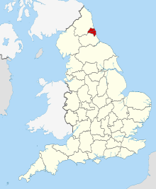
Tyne and Wear is a ceremonial county in North East England. It borders Northumberland to the north and County Durham to the south, and the largest settlement is the city of Newcastle upon Tyne.

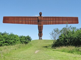
Gateshead is a town in the Gateshead Metropolitan Borough of Tyne and Wear, England. It is on the River Tyne's southern bank. The town's attractions include the twenty metre tall Angel of the North sculpture on the town's southern outskirts, The Glasshouse International Centre for Music and the Baltic Centre for Contemporary Art. The town shares the Millennium Bridge, Tyne Bridge and multiple other bridges with Newcastle upon Tyne.
South Tyneside is a metropolitan borough in the metropolitan county of Tyne and Wear, England.

South Shields is a coastal town in South Tyneside, Tyne and Wear, England; it is on the south bank of the mouth of the River Tyne. The town was once known in Roman times as Arbeia and as Caer Urfa by the Early Middle Ages. It is the fourth largest settlement in Tyne and Wear, after Newcastle upon Tyne, Sunderland and Gateshead.

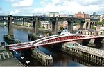
The Tyne Bridge is a through arch bridge over the River Tyne in North East England, linking Newcastle upon Tyne and Gateshead. The bridge was designed by the engineering firm Mott, Hay and Anderson, who later designed the Forth Road Bridge, and was built by Dorman Long and Co. of Middlesbrough. The bridge was officially opened on 10 October 1928 by King George V and has since become a defining symbol of Tyneside. It is ranked as the tenth tallest structure in Newcastle.
The Metropolitan Borough of Gateshead is a metropolitan borough in the metropolitan county of Tyne and Wear, England. It includes Gateshead, Rowlands Gill, Whickham, Blaydon, Ryton, Felling, Birtley, Pelaw, Dunston and Low Fell. The borough forms part of the Tyneside conurbation, centred on Newcastle upon Tyne.

Newcastle station is a railway station in Newcastle, Tyne and Wear, England, United Kingdom. It is located on the East Coast Main Line, around 268 miles (432 km) north of London King's Cross. It is the primary national rail station serving Newcastle upon Tyne and is an interchange for local services provided by the Tyne and Wear Metro network whose Central Station is situated beneath the national rail station.
Felling is a town in the Metropolitan Borough of Gateshead in Tyne and Wear, England. Historically part of County Durham, the town became part of the metropolitan borough of Gateshead in 1974. It lies on the B1426 Sunderland Road and the A184 Felling bypass, than 1 mile (1.6 km) east of Gateshead, 1 mile (1.6 km) south east of Newcastle-upon-Tyne and 10 miles north west of the City of Sunderland. In 2011, Felling had a population of 8,908.

The Boldons is an area made up of the three villages of East Boldon, West Boldon and Boldon Colliery in South Tyneside in the county of Tyne and Wear, England. In 2001 they had a population of 13,271.
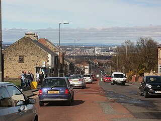
Sheriff Hill is a suburb in the Metropolitan Borough of Gateshead in Tyne and Wear, England. It lies on the B1296 road 2 miles (3.2 km) south of Gateshead, 2.5 miles (4.0 km) south of Newcastle upon Tyne and 12 miles (19 km) north of the historic city of Durham. According to the 2001 UK census it had a population of 5,051.

Low Fell is a suburb of Gateshead situated in the Metropolitan Borough of Gateshead in Tyne and Wear, England. Built predominantly on sandstone, grindstone and clay, it is bordered by Sheriff Hill/Deckham to the east, Saltwell/Bensham to the west, Harlow Green to the south and Shipcote to the north. Low Fell is 3 miles south of Gateshead, 3 miles south of Newcastle upon Tyne and 12 miles north of Durham.
There are 11 Grade I listed buildings in Ipswich, a non-metropolitan district and the county town of Suffolk, England.

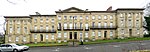
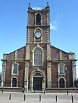
There are 208 Grade II* listed buildings in Tyne and Wear, England. Over a third of these are constituent parts of the Byker Wall housing estate, which is given its own sub-heading below.

The North East Combined Authority, abbreviated to NECA, is one of three combined authorities in North East England. It was created in 2014, and currently consists of the City of Sunderland; Metropolitan Borough of Gateshead, South Tyneside; and Durham County local authorities.
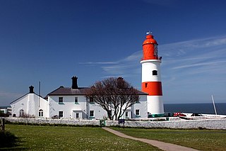
The High and Low Lights of North Shields are decommissioned leading lights in North Shields, Tyne and Wear in the United Kingdom. Two pairs of lights survive: the older pair date from 1727 and were operational until 1810; the newer pair then took over, remaining in use until 1999. All four are listed buildings. They were sometimes known as the Fish Quay High and Low Lights, or as 'Fish Quay ' and 'Dockwray Square '.
The ceremonial county of Tyne and Wear has returned 12 MPs to the UK Parliament since 2010. It was created under the Local Government Act 1972, which came into effect on 1 April 1974, comprising the urban areas around the mouths of the Rivers Tyne and Wear, previously parts of the historic counties of Northumberland and Durham.