The Cayman Islands are a British overseas territory located in the Caribbean that have been under various governments since their discovery by Europeans. Christopher Columbus sighted the Cayman Islands on May 10, 1503 and named them Las Tortugas after the numerous sea turtles seen swimming in the surrounding waters. Columbus had found the two smaller sister islands and it was these two islands that he named "Las Tortugas".

The Virgin Islands are geologically and biogeographically the easternmost part of the Greater Antilles, the northern islands belonging to the Puerto Rican Bank and St. Croix being a displaced part of the same geologic structure. Politically, the British Virgin Islands have been governed as the western island group of the Leeward Islands, which are the northern part of the Lesser Antilles, and form the border between the Caribbean Sea and the Atlantic Ocean. The archipelago is separated from the true Lesser Antilles by the Anegada Passage and from the main island of Puerto Rico by the Virgin Passage.

Saint Croix is an island in the Caribbean Sea, and a county and constituent district of the United States Virgin Islands (USVI), an unincorporated territory of the United States.
The Antilles is an archipelago bordered by the Caribbean Sea to the south and west, the Gulf of Mexico to the northwest, and the Atlantic Ocean to the north and east.
Caribbean English dialects of the English language are spoken in the Caribbean and Liberia, most countries on the Caribbean coast of Central America, and Guyana and Suriname on the coast of South America. Caribbean English is influenced by the English-based Creole varieties spoken in the region, but they are not the same. In the Caribbean, there is a great deal of variation in the way English is spoken. Scholars generally agree that although the dialects themselves vary significantly in each of these countries, they primarily have roots in British English and West African languages. Caribbean English in countries with a majority Indian population like Trinidad and Tobago and Guyana has been influenced by Hindustani and other South Asian languages in addition to British English and West African languages.

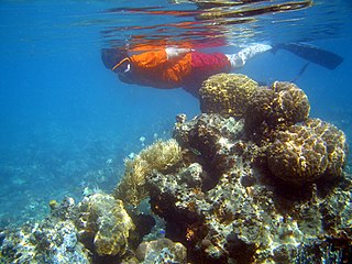
Little Cayman is one of three islands comprising the Cayman Islands. It is located in the Caribbean Sea, approximately 60 miles northeast of Grand Cayman and five miles (8 km) west of Cayman Brac. Little Cayman is by far the least populous, with a permanent population of about 170. It is about 10 miles (16 km) long with an average width of 1 mile (2 km) and most of the island is undeveloped. Almost the entire island is at sea level. The highest elevation is about 40 feet.

The Virgin Islands National Park is an American national park preserving about 60% of the land area of Saint John in the United States Virgin Islands, as well as more than 5,500 acres of adjacent ocean, and nearly all of Hassel Island, just off the Charlotte Amalie, Saint Thomas harbor.

Roatán is an island in the Caribbean, about 65 kilometres (40 mi) off the northern coast of Honduras. It is located between the islands of Útila and Guanaja, and is the largest of the Bay Islands of Honduras.

The Abaco Islands lie in the northern Bahamas 180 miles (290 km) east of South Florida. They comprise the main islands of Great Abaco and Little Abaco, along with smaller barrier cays. The northernmost are Walker's Cay, and its sister island Grand Cay. To the south, the next inhabited islands are Spanish Cay and Green Turtle Cay, with its settlement of New Plymouth, Great Guana Cay, private Scotland Cay, Man-O-War Cay, and Elbow Cay, with its settlement of Hope Town. Southernmost are Tilloo Cay and Lubbers Quarters. Another of note off Abaco's western shore is onetime Gorda Cay, now a Disney Island and cruise ship stop and renamed Castaway Cay. Also in the vicinity is Moore's Island. On the Big Island of Abaco is Marsh Harbour, the Abacos' commercial hub and the Bahamas' third largest city, plus the resort area of Treasure Cay. Both have airports. A few mainland settlements of significance are Coopers Town and Fox Town in the north and Cherokee and Sandy Point in the south. Administratively, the Abaco Islands constitute seven of the 31 Local Government Districts of the Bahamas: Grand Cay, North Abaco, Green Turtle Cay, Central Abaco, South Abaco, Moore's Island, and Hope Town.
Guanaja is one of the Bay Islands of Honduras and is in the Caribbean. It is about 70 kilometres (43 mi) off the north coast of Honduras, and 12 kilometres (7.5 mi) from the island of Roatan. One of the cays off Guanaja, also called Guanaja or Bonacca or Low Cay, is near the main island, and contains most of the approximately 10,000 people who live in Guanaja. The densely populated cay has been described as the Venice of Honduras because of the waterways that run through it. The other two main settlements on Guanaja are Mangrove Bight and Savannah Bight. Smaller settlements include East End and North East Bight.

Salt River Bay National Historic Park and Ecological Preserve is a unit of the National Park Service on the island of St. Croix in the U.S. Virgin Islands. It preserves upland watersheds, mangrove forests, and estuarine and marine environments that support threatened and endangered species. It also contains the Columbus Landing Site, a National Historic Landmark that is the only known site where members of a Columbus expedition set foot on what is now United States territory. The site is marked by Fort Salé, a remaining earthworks fortification from the French period of occupation, about 1617. The park also preserves prehistoric and colonial-era archeological sites including the only existing example of a ball court in the US Virgin Islands.
Tortuga is the Spanish word for a turtle or tortoise. It may also refer to:

British America included the British Empire's colonial territories in America, Bermuda, Central America, the Caribbean, and Guyana from 1607 to 1783. The American colonies were formally known as British America and the British West Indies before the Thirteen Colonies declared their independence in the American Revolutionary War (1775–1783) and formed the United States of America. After that, the term British North America was used to describe the remainder of Britain's continental American possessions. That term was used informally in 1783 by the end of the American Revolution, but it was uncommon before the Report on the Affairs of British North America (1839), called the Durham Report.

The West Indies is a region of the North Atlantic Ocean and the Caribbean that includes the island countries and surrounding waters of three major archipelagos: the Greater Antilles, the Lesser Antilles and the Lucayan Archipelago.

The Spanish West Indies or the Spanish Antilles was the former name of the Spanish colonies in the Caribbean. In terms of governance of the Spanish Empire, The Indies was the designation for all its overseas territories and was overseen by the Council of the Indies, founded in 1524 and based in Spain. When the crown established the Viceroyalty of New Spain in 1535, the islands of the Caribbean came under its jurisdiction.

The 22nd Central American and Caribbean Games were held November 14–30, 2014 in Veracruz, Mexico. The Games featured 36 sports, with most occurred in Veracruz, but some occurred in Boca del Río, Xalapa, Córdoba, Tuxpan, and Coatzacoalcos

Dog Islands are a small group of islets among the British Virgin Islands in the Caribbean.

Scrub Island of the British Virgin Islands in the Caribbean is a part of the Lesser Antilles, a group of islands that are young volcanic or coral islands. It is home to the Scrub Island Resort Marina and Spa.
Xerolinus is a genus of darkling beetle. It consists of approximately thirty species found in the West Indies. Michael A. Ivie and Charles J. Hart named and circumscribed the genus in 2016.