Equatoria is a region of southern South Sudan, along the upper reaches of the White Nile. Originally a province of Anglo-Egyptian Sudan, it also contained most of northern parts of present-day Uganda, including Lake Albert and West Nile. It was an idealistic effort to create a model state in the interior of Africa that never consisted of more than a handful of adventurers and soldiers in isolated outposts.

Below is a list of the 18 states of the Sudan. Prior to 9 July 2011, the Republic of the Sudan was composed of 25 states. The ten southern states now form part of the independent country of South Sudan. Two additional states were created in 2012 within the Darfur region, and one in 2013 in Kordofan, bringing the total to 18.
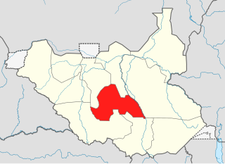
Lakes State is a state in South Sudan. It has an area of 43,595.08 km2. Rumbek is the capital of the state. Lakes is in the Bahr el Ghazal region of South Sudan, in addition to Northern Bahr el Ghazal, Western Bahr el Ghazal, and Warrap states. Bahr el Ghazal itself was a former province which was split from the Anglo-Egyptian mudiriyat, or province of Equatoria in 1948. The eastern border was the White Nile with Jonglei State on the opposite bank. To the northeast lied the Unity State. Other borders included Warrap State towards the northwest, Western Equatoria to the south and west, and Central Equatoria to the south.

The Bahr el Ghazal is a region of northwestern South Sudan. Its name came from the river Bahr el Ghazal. The name translates as "sea of gazelles" from Arabic.
The Dinka tribe are a Nilotic ethnic group native to South Sudan with a sizable diaspora population abroad. The Dinka mostly live along the Nile, from Bor to Renk, in the region of Bahr el Ghazal, Upper Nile, and the Abyei Area of the Ngok Dinka in South Sudan.

Bentiu, also spelled Bantiu, is a city in South Sudan and capital of the state of Unity State.

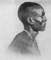
The SPLA-Nasir was a splinter faction of the Sudan People's Liberation Army (SPLA), a rebel group that fought in the Second Sudanese Civil War. Originally created as an attempt by the Nuer tribe to replace SPLA leader John Garang in August 1991, it gradually became coopted by the government. The break away of Riek Machar from SPLM/A resulted in Nuer ethnic group massacring Garang's ethnic Dinka from Bor in the Bor massacre in 1991. This split resulted in the 1994 National Convention of New Sudan in Chukudum.

The coat of arms of the Republic of South Sudan was adopted in July 2011 following independence from the Republic of Sudan. Prior to independence, South Sudan was an autonomous region of Sudan.

The flag of South Sudan was adopted following the signing of the Comprehensive Peace Agreement that ended the Second Sudanese Civil War. A similar version of the flag was previously used as the flag of the Sudan People's Liberation Movement. The flag of South Sudan is older than the country itself, as the flag was adopted in 2005, while the country became independent in 2011.

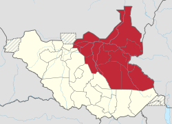
The States of South Sudan were created out of the three historic former provinces of Bahr el Ghazal (northwest), Equatoria (southern), and Greater Upper Nile (northeast). The states are further divided into 79 counties.
Southern Sudan was an autonomous region consisting of the ten southern states of Sudan between its formation in July 2005 and independence as the Republic of South Sudan in July 2011. The autonomous government was initially established in Rumbek and later moved to Juba. It was bordered by Ethiopia to the east; Kenya, Uganda, and the Democratic Republic of the Congo to the south; and the Central African Republic to the west. To the north lies the predominantly Arab and Muslim region directly under the control of the central government. The region's autonomous status was a condition of a peace agreement between the Sudan People's Liberation Army/Movement (SPLA/M) and the Government of Sudan represented by the National Congress Party ending the Second Sudanese Civil War. The conflict was Africa's longest running civil war.
South Sudan, officially the Republic of South Sudan, is a landlocked country in East Africa. It is bordered by Ethiopia, Sudan, the Central African Republic, the Democratic Republic of the Congo, Uganda, and Kenya. Its population was estimated at 10,913,164 in 2022. Juba is the capital and largest city.

South Sudan is home to around 60 indigenous ethnic groups and 80 linguistic partitions among a 2021 population of around 11 million. Historically, most ethnic groups were lacking in formal Western political institutions, with land held by the community and elders acting as problem solvers and adjudicators. Today, most ethnic groups still embrace a cattle culture in which livestock is the main measure of wealth and used for bride wealth.

The geography of South Sudan describes the physical features of South Sudan, a country in East Africa. South Sudan is a landlocked country and borders – clockwise – Sudan from the north, Ethiopia from the east, Kenya, Uganda and the Democratic Republic of the Congo from the south and the Central African Republic from the west.

Fangak County is an administrative area in Jonglei State, South Sudan, with headquarters in the town of Phom el Zaraf.

The following outline is provided as an overview of and topical guide to South Sudan:

The Ruweng Administrative Area is an administrative area in South Sudan. The area was known as Ruweng State between 2 October 2015 and 22 February 2020 when it was a state of South Sudan.

Fangak State was a state in South Sudan that existed between 2 October 2015 and 22 February 2020. It was located in the Greater Upper Nile region and it bordered Ruweng to the northwest, Western Nile to the northeast, Eastern Nile to the east, Eastern Bieh to the southeast, Jonglei to the south, Southern Liech to the southwest, and Northern Liech to the west.
This article lists events from the year 2019 in South Sudan