Greenough River

Last updated

Greenough River
Country Australia
Physical characteristics
Main source Jingemarra Station
391 metres (1,283 ft) [1]
River mouth Cape Burney
Length 340 kilometres (211 mi) [2]
Basin features
Basin size 13,200 square kilometres (5,097 sq mi) [3]

The Greenough River /ˈɡrɛnəf/ is a river in the Mid West region of Western Australia.

Mid West (Western Australia) Region in Western Australia

The Mid West region is one of the nine regions of Western Australia. It is a sparsely populated region extending from the west coast of Western Australia, about 200 kilometres (120 mi) north and south of its administrative centre of Geraldton and inland to 450 kilometres (280 mi) east of Wiluna in the Gibson Desert.

Western Australia state in Australia

Western Australia is a state occupying the entire western third of Australia. It is bounded by the Indian Ocean to the north and west, and the Southern Ocean to the south, the Northern Territory to the north-east, and South Australia to the south-east. Western Australia is Australia's largest state, with a total land area of 2,529,875 square kilometres, and the second-largest country subdivision in the world, surpassed only by Russia's Sakha Republic. The state has about 2.6 million inhabitants – around 11 percent of the national total – of whom the vast majority live in the south-west corner, 79 per cent of the population living in the Perth area, leaving the remainder of the state sparsely populated.

Contents

Course

Greenough River has its headwaters near Woojalong Hills on the Yilgarn Plateau. It runs in a south-westerly direction through deep valleys for approximately 340 kilometres (211 mi), passing through the Waterloo Ranges before descending to the coastal plain. A few kilometres from the sea it is obstructed by dunes, and turns to the north-west, running along a dune swale parallel with the coast for about 35 km before finally discharging into the Indian Ocean at Cape Burney, about 9 kilometres (6 mi) south of Geraldton, Western Australia. [4]

Swale (landform) low tract of land

A swale is a shallow channel with gently sloping sides. A swale may be either natural or man-made. Artificial swales are often infiltration basins, designed to manage water runoff, filter pollutants, and increase rainwater infiltration.

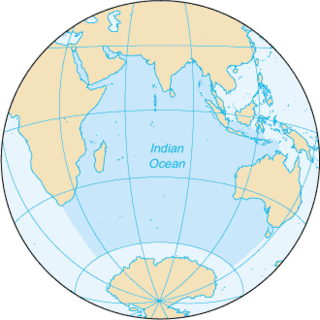
Indian Ocean The ocean between Africa, Asia, Australia and Antarctica (or the Southern Ocean)

The Indian Ocean is the third largest of the world's oceanic divisions, covering 70,560,000 km2 (27,240,000 sq mi). It is bounded by Asia on the north, on the west by Africa, on the east by Australia, and on the south by the Southern Ocean or, depending on definition, by Antarctica.

The ten tributaries that contribute to the Greenough are Woojalong Brook, Woolbarka Brook, Bangemall Creek, Urawa River, Kolanadgy Gully, Nangerwalla Creek, Wooderarrung River, Wandin Creek, Kockatea Creek and Wicherina Brook.

Tributary stream or river that flows into a main stem river or lake

A tributary or affluent is a stream or river that flows into a larger stream or main stem river or a lake. A tributary does not flow directly into a sea or ocean. Tributaries and the main stem river drain the surrounding drainage basin of its surface water and groundwater, leading the water out into an ocean.

The lower reaches of the Greenough are estuarine; how far upriver the estuary extends is not certain, but probably about 7 km to near Bootenal Springs. The river mouth is barred from the ocean by a sandbar that breaks only in periods of strong flow. Once open, it usually remains open for several months. The bar has now been reinforced with brushwood on the northern side, to force the bar to open only on the southern side, where the adjacent dune is more stable. [4]

Evidence from wind gaps suggests that, thousands of years ago, the Greenough River turned to the north-west a few kilometres further from the coast than it does at present, at the present-day site of Walkaway. It then ran along the inside of a limestone ridge, following what is now the path of the Geraldton–Dongara railway line, to the vicinity of Rudds Gully. Both watercourses then flowed north to discharge into the Chapman River. Later, Rudds Gully cut its own path to the ocean, and the Greenough River discharged into it; and later still, the Greenough cut its own path through the limestone ridge at Walkaway, thus forming its own course. [4]

Walkaway is a small town in the City of Greater Geraldton local government area of Western Australia. At the 2016 census, Walkaway had a population of 270.

The well-documented strong winds at Greenough have resulted in large mobile dune systems both to the south and north of the Greenough River mouth. Both are gradually moving northwards, and it is estimated that the southern dune will reach the mouth of the Greenough around 2045, at which point the Greenough may well become even more prone to flooding, or be forced to change its course. [4]

Greenough, Western Australia Town in Western Australia

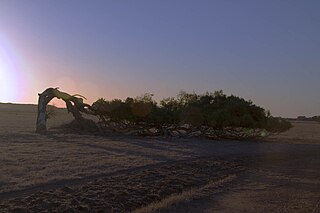
Greenough is a historical settlement situated in a floodplain 400 kilometres north of Perth, Western Australia and 24 kilometres south of Geraldton on the Brand Highway. The settlement's historical buildings are mostly built of local limestone and date to the second half of the 19th century. A sizeable collection of these are owned and managed by the National Trust of Australia. A remarkable feature of the Greenough Flats is its windswept trees, some of which are bent a full 90 degrees due to the prevailing coastal winds.

Hydrology

The river is dry most of the time, but has a number of permanent pools such as Bootenal Spring. However, the entire basin is prone to severe flooding which has periodically devastated local farming communities. The worst on record occurred in 1888: over 50 square kilometres (19 sq mi) was flooded; the water was over 5 metres (16 ft) deep south of Greenough; four people were drowned and many financially ruined; and ultimately the town of Greenough was abandoned. [4]

Another flood occurred in 1953 with the river being reported as 100 yards (91 m) past the width of the floods in 1883. An 8 feet (2 m) wall of water washed down the river then steadily rose until it was 20 feet (6 m) high, completely covering the bridge near Walkaway, Western Australia. The 1953 flood was the biggest in 30 years. [5]

The river water is eutrophic and sediment-laden, and there is evidence that this has affected the ecology of the area, with migratory wading birds no longer visiting the floodplain in numbers as large as previously. [4]

History

The Greenough River was named on 8 April 1839 by the explorer George Grey, while on his second disastrous expedition along the Western Australian coast, after George Bellas Greenough, President of the Royal Geographical Society in 1837 at the time Grey's expedition was equipped. [6] [2]

Related Research Articles

North West Coastal Highway highway in Western Australia

North West Coastal Highway is a generally north-south Western Australian highway which links the coastal city of Geraldton with the town of Port Hedland. The 1,300-kilometre-long (808 mi) road, constructed as a sealed two-lane single carriageway, travels through remote and largely arid landscapes. Carnarvon is the only large settlement on the highway, and is an oasis within the harsh surrounding environment. The entire highway is allocated National Route 1, part of Australia's Highway 1, and parts of the highway are included in tourist routes Batavia Coast Tourist Way and Cossack Tourist Way. Economically, North West Coastal Highway is an important link to the Mid West, Gascoyne and Pilbara regions, supporting the agricultural, pastoral, fishing, and tourism industries, as well as mining and offshore oil and gas production.

Murchison River (Western Australia) river in Western Australia

The Murchison River is the second longest river in Western Australia. It flows for about 820 km (510 mi) from the southern edge of the Robinson Ranges to the Indian Ocean at Kalbarri. The Murchison-Yalgar-Hope river system is the longest river system in Western Australia. It has a mean annual flow of 208 gigalitres, although in 2006, the peak year on record since 1967, flow was 1,806 gigalitres.
City of Geraldton Local government area in Western Australia

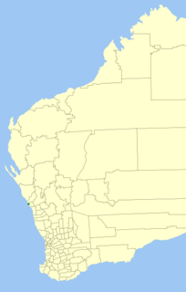
The City of Geraldton was a local government area in the Mid West region of Western Australia, 424 kilometres (263 mi) north of the state capital, Perth on the Indian Ocean. The City covered an area of 46.3 square kilometres (17.9 sq mi), and its seat of government was the town of Geraldton.

City of Geraldton-Greenough Local government area in Western Australia

The City of Geraldton-Greenough was a local government area in the Mid West region of Western Australia, 424 kilometres (263 mi) north of the state capital, Perth on the Indian Ocean. It covered an area of 1,798.3 square kilometres (694.3 sq mi), and its seat of government was the town of Geraldton.

Hill River (Western Australia) river in Western Australia, Australia

Hill River is a river in the Wheatbelt region of Western Australia.

Cape Burney, Western Australia Suburb of Geraldton, Western Australia

Cape Burney is a coastal town and locality 12 kilometres (7 mi) south of Geraldton, Western Australia at the mouth of the Greenough River. Its local government area is the City of Greater Geraldton. At the 2006 census, Cape Burney had a population of 399.

Glenfield is a locality north of Geraldton, Western Australia. Its local government area is the City of Greater Geraldton.

Chapman River river in the Mid West region of Western Australia

Chapman River is a river in the Mid West region of Western Australia.

Irwin River river in Western Australia, Australia

The Irwin River is a river in the Mid West of Western Australia. It was named on 9 April 1839 by the explorer George Grey, while on his second disastrous exploration expedition along the Western Australian coast, after his friend Major Frederick Irwin, the Commandant of the Swan River settlement, and later acting Governor of Western Australia from 1847 to 1848.

Hutt River is a river in the Mid West region of Western Australia.

The Preston River is a river in the South West region of Western Australia.

Hutt Lagoon lake in Western Australia

Hutt Lagoon is a salt lake located near the coast just north of the mouth of the Hutt River, in the Mid West region of Western Australia.

The Bowes River is a river in the Mid West of Western Australia. It was named on 6 April 1839 by the explorer George Grey while on his second exploration expedition along the Western Australian coast. It was named for Mary Bowes, Dowager Countess of Strathmore, the wife of Sir William Hutt. Hutt was a British Liberal politician who was heavily involved in the colonization of New Zealand and South Australia, and the brother of John Hutt, the second governor of Western Australia. Sir William Hutt was a member of the 1836 select committee on Disposal of Lands in the British Colonies. Grey named the nearby Hutt River after Hutt.

The Yule River is an ephemeral river in the Pilbara region of Western Australia. It was named on 10 August 1861 by the surveyor and explorer Frank Gregory while on expedition in the area, after Thomas Newte Yule, at times farmer of Toodyay, winemaker, Acting Colonial Secretary and Magistrate.

The Nambung River is a river in the Wheatbelt region of Western Australia, 170 kilometres (106 mi) north of Perth. The river drains an area between the towns of Cervantes and Badgingarra. In its lower reaches the Nambung River forms a chain of waterholes in the Nambung Wetlands where it disappears underground into a limestone karst system 5.5 kilometres (3 mi) from the Indian Ocean.

City of Greater Geraldton Local government area in Western Australia

The City of Greater Geraldton is a local government area in the Mid West region of Western Australia, 424 kilometres (263 mi) north of the state capital, Perth on the Indian Ocean. It covers an area of 12,625.5 square kilometres (4,874.7 sq mi), and its seat of government is the town of Geraldton.

The Buller River is a river in the Mid West of Western Australia, near Geraldton.

The Greenough River Solar Farm is a 10 megawatt (MW) photovoltaic power station located in Walkaway, Western Australia. When it opened in October, 2012, it was the country's first utility-scale solar farm. It remained Australia's largest solar PV system until 2014, when it was superseded by the 20 MW Royalla solar farm in Canberra. The Greenough River Solar Farm was built by Verve Energy and joint venture partners GE Financial Services. It uses over 150,000 thin film modules based on CdTe-PV technology provided by U.S. company First Solar. Its exact location is at Nangetty Walkaway Road, Walkaway, 50 kilometres southeast of Geraldton and covers an area of 80 hectares.

References

  1. "Bonzle Digital Atlas – Map of Greenough River, WA". 2008. Retrieved 24 November 2008.
  2. 1 2 Western Australian Land Information Authority. "History of river names". Archived from the original on 16 February 2015. Retrieved 24 November 2008.
  3. "Gindalbie Metals Ltd – Report on European and use and heritage significance of landalong a propose slurry pipeline" (PDF). 2008. Retrieved 25 November 2008.
  4. 1 2 3 4 5 6 Brearley, Anne (2005). Ernest Hodgkin's Swanland: Estuaries and coastal lagoons of Southwestern Australia. University of Western Australia Press. pp. 278–279. ISBN   1-920694-38-2.
  5. "Driver rescues flood victim". The West Australian . Perth: National Library of Australia. 27 March 1953. p. 8. Retrieved 16 September 2013.
  6. Grey, George (1841). Journals of two expeditions of discovery in North-West and Western Australia, during the years 1837, 38, and 39, describing many newly discovered, important, and fertile districts, with observations on the moral and physical condition of the aboriginal inhabitants, etc. etc. 2. London: T. and W. Boone. p. 26. Retrieved 17 March 2012. (entry for 8 April 1839)

Coordinates: 28°51′00″S114°38′00″E / 28.85000°S 114.63333°E / -28.85000; 114.63333