Gallatin County is a county in the U.S. state of Montana. With its county seat in Bozeman, it is the third-most populous county in Montana, with a population of 89,513 in 2010.

Bozeman is a city in and the seat of Gallatin County, Montana, United States. Located in southwest Montana, the 2010 census put Bozeman's population at 37,280 and by 2016 the population rose to 45,250, making it the fourth largest city in Montana. It is the principal city of the Bozeman, MT Micropolitan Statistical Area, consisting of all of Gallatin County with a population of 97,304. It is the largest Micropolitan Statistical Area in Montana and is the third largest of all of Montana's statistical areas.

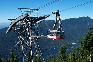
Big Sky is a census-designated place (CDP) in Gallatin and Madison counties in southwestern Montana. As of the 2010 census it had a population of 2,308. It is 45 miles (72 km) southwest of Bozeman. This unincorporated community straddles both counties, is not considered a town, and does not have a town government. The primary industry of the area is tourism.
Gallatin may refer to the following:

The Madison River is a headwater tributary of the Missouri River, approximately 183 miles (295 km) long, in Wyoming and Montana. Its confluence with the Jefferson and Gallatin rivers near Three Forks, Montana forms the Missouri River.

The Gallatin River is a tributary of the Missouri River, approximately 120 mi, in the U.S. states of Wyoming and Montana. It is one of three rivers, along with the Jefferson and Madison, that converge near Three Forks, Montana, to form the Missouri.

The East Gallatin River flows 42 miles (68 km) in a northwesterly direction through the Gallatin valley, Gallatin County, Montana. Rising from the confluence of Rocky Creek and several other small streams, the East Gallatin begins about one mile (1.6 km) east of downtown Bozeman, Montana. The river joins the main stem of the Gallatin River 2.3 miles (3.7 km) north of Manhattan, Montana. Throughout its course, the river traverses mostly valley floor ranch and farm land with typical summer flows of approximately 50 cu ft/s (1.4 m3/s).

Western Montana is the western region of the U.S. state of Montana. The most restrictive definition limits western Montana only to the parts of the state west of the Continental Divide. Other common definitions add in the mountainous areas east of the divide including Beaverhead, Gallatin, Jefferson, Lewis and Clark, Madison, and Park Counties. The region is sometimes considered to be part of the Inland Northwest.

Founded in 1899, Gallatin National Forest is located in south central Montana, United States. The forest comprises 1,819,515 acres (7,363.32 km2) and has portions of both the Absaroka-Beartooth and Lee Metcalf Wilderness areas within its boundaries. Gallatin National Forest borders Yellowstone National Park on the north and northwest and is part of the Greater Yellowstone Ecosystem, a region which encompasses almost 20,000,000 acres (81,000 km2). The forest is named after Albert Gallatin (1761–1849), U.S. Secretary of the Treasury and scholar of Native American languages and cultures.

Custer National Forest is located primarily in the south central part of the U.S. state of Montana but also has separate sections in northwestern South Dakota. With a total area of 1,188,130 acres (4,808 km2), the forest comprises over 10 separate sections. While in the westernmost sections, Custer National Forest is a part of the Greater Yellowstone Ecosystem, the easternmost sections are a combination of forest "islands" and grasslands. A portion of the forest is also part of the Absaroka-Beartooth Wilderness and constitutes over a third of the wilderness land. South of Red Lodge, Montana, the Beartooth Highway passes through the forest en route to Yellowstone National Park.

The Gallatin Range is a mountain range of the Rocky Mountains, located in the U.S. states of Montana and Wyoming. It includes more than 10 mountains over 10,000 feet (3,000 m). The highest peak in the range is Electric Peak at 10,969 feet (3,343 m).
Grassy Mountain may refer to

Fairy Lake is a lake in Gallatin County, Montana at the base of the Sacagawea Peak, a part of the Bridger mountains in south central Montana. It is located within the northwestern section of the Gallatin National Forest and sits at an elevation of 7,557 ft (2,303 m).

The Spanish Peaks, avg el. 8,441 feet (2,573 m), is a mountain range between Bozeman, Montana and Ennis, Montana in Gallatin and Madison County, Montana. It is a sub-range of the much larger Madison Range, itself a sub-range of the Rocky Mountains. The hydrological divide of the range serves as the border between Gallatin and Madison County, Montana. The Spanish Peaks are made up of 1.6 billion year-old gneiss, making them the oldest peaks in the Madison Range, predating the rest of the range by 50-60 million years. Gallatin Peak, el. 11,015 ft., is the highest peak in the group.
Grouse are a group of birds from the order Galliformes.

GALLATIN RIVER RANCH (GRR) is a 5,900(+/-) acre residential ranch community outside Bozeman in the Horseshoe Hills of southwest Montana, bordered on the south by the Gallatin River, with exposure to eight mountain ranges, rivers, and rolling farmlands.

Storm Castle, el. 7,165 feet (2,184 m) is a mountain peak in the Gallatin Range in Gallatin County, Montana. The peak is located in the Gallatin National Forest. Storm Castle is also known as Castle Peak or Castle Mountain. The peak is a popular 5-mile (8.0 km) round trip hike from the Storm Castle trailhead in the Gallatin Canyon.