Guayamouc River

Last updated
Guayamouc River
Bassin zim.jpeg
Country Haiti
Physical characteristics
Length 113 km (70 mi)

The Guayamouc River, (French: Rivière Guayamouc), is a river in central and eastern Haiti. It rises on the Massif du Nord and flows generally southeast for 113 km into the Artibonite River at the border with the Dominican Republic. It is notable for producing the fertile plain of central Haiti. Notable cities on the Guayamouc include Hinche. [1]

French language Romance language

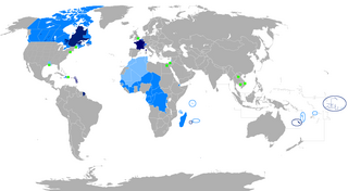
French is a Romance language of the Indo-European family. It descended from the Vulgar Latin of the Roman Empire, as did all Romance languages. French evolved from Gallo-Romance, the spoken Latin in Gaul, and more specifically in Northern Gaul. Its closest relatives are the other langues d'oïl—languages historically spoken in northern France and in southern Belgium, which French (Francien) has largely supplanted. French was also influenced by native Celtic languages of Northern Roman Gaul like Gallia Belgica and by the (Germanic) Frankish language of the post-Roman Frankish invaders. Today, owing to France's past overseas expansion, there are numerous French-based creole languages, most notably Haitian Creole. A French-speaking person or nation may be referred to as Francophone in both English and French.

Haiti country in the Caribbean

Haiti, officially the Republic of Haiti and formerly called Hayti, is a country located on the island of Hispaniola, east of Cuba in the Greater Antilles archipelago of the Caribbean Sea. It occupies the western three-eighths of the island, which it shares with the Dominican Republic. Haiti is 27,750 square kilometres (10,714 sq mi) in size and has an estimated 10.8 million people, making it the most populous country in the Caribbean Community (CARICOM) and the second-most populous country in the Caribbean as a whole.

Artibonite River river

The Artibonite River is a 320 km long river in Haiti. It is the longest as well as the most important river in Haiti and the longest on the island of Hispaniola. Forming part of the international border between Haiti and the Dominican Republic, the river's sources are in the Cordillera Central in the Dominican Republic, however most of its length lies in Haiti. The river empties into the Gulf of Gonâve.

Related Research Articles

Centre (department) department in Hinche, Haiti

Centre is one of the ten departments of Haiti, located in the center of the country along the border with the Dominican Republic. As of 2015, its estimated population was 746,236. Its capital is Hinche. It borders the Dominican Republic to the east and is the only landlocked department in Haiti.


Chaîne de la Selle is a mountain range in Haiti, on the island of Hispaniola.

Loma de Cabrera Place in Dajabón, Dominican Republic

Loma de Cabrera is the second largest city in the province of Dajabón, Dominican Republic. It is located in the northwest portion of the country, in the Cibao region.

The Melvin River is an 8.1-mile-long (13.0 km) river located in the Lakes Region of central New Hampshire in the United States. It is a tributary of Lake Winnipesaukee, part of the Merrimack River watershed.

Anse d'Hainault is an arrondissement of the Grand'Anse Department located in southwestern Haiti. As of 2015, the population was 98,522 inhabitants. Postal codes in the Anse d'Hainault Arrondissement start with the number 72.

Pedro Santana, Dominican Republic Place in Elías Piña, Dominican Republic

Pedro Santana is a city in the province of Elías Piña in the Dominican Republic. It is located on the border of Haiti.

Thomonde Commune in Centre, Haiti

Thomonde is a commune in the Hinche Arrondissement, in the Centre department of Haiti. It is located in the Centre or "Plateau Central", arrondissement Hinche. The geo-coordinates are 19.02N and 71.97W. The population was about 2,381 in 1982 and about 3,784 in 2007 - as reported by the government of Haiti.

Jérémie is an arrondissement in the Grand'Anse Department of Haiti. As of 2015, the population was 238,218 inhabitants. Postal codes in the Anse d'Hainault Arrondissement start with the number 71.

Jean-Rabel Commune in Nord-Ouest, Haiti

Jean-Rabel is a commune located west of the city of Port-de-Paix and east of the city of the Môle-Saint-Nicolas Arrondissement, in the Nord-Ouest department of Haiti. As of 2015, the estimated adult population was 148,416.

Cerca-la-Source is an arrondissement (district) in the Centre department of Haiti. As of 2015, the population was 119,756 inhabitants. Postal codes in the Cerca-la-Source Arrondissement start with the number 54.

Fort-Liberté is an arrondissement in the Nord-Est department of Haiti. As of 2015, the population was 60,632 inhabitants. Postal codes in the Fort-Liberté Arrondissement start with the number 21.

Lascahobas is an arrondissement in the Centre department of Haiti. As of 2015, the population was 168,685 inhabitants. Postal codes in the Lascahobas Arrondissement start with the number 53.

Ouanaminthe is an arrondissement in the Nord-Est department of Haiti. As of 2015, the population was 146,484 inhabitants. Postal codes in the Ouanaminthe Arrondissement start with the number 22.

Vallières is an arrondissement in the Nord-Est department of Haiti. As of 2015, the population was 71,851 inhabitants. Postal codes in the Vallières Arrondissement start with the number 24.

Pedernales, Dominican Republic Place in Pedernales, Dominican Republic

The Dominican city of Pedernales is the capital of the Pedernales Province, in the Dominican Republic. It is located in the southwest of the country, on the border, and has a crossing to the Haitian town of Anse-à-Pitres.

The Pedernales River (Hispaniola) is a river that forms the southernmost part of the international boundary between the Dominican Republic and Haiti.

The Rivière Bouyaha is a river of Haiti.

Fairview Township, Russell County, Kansas Township in Kansas, United States

Fairview Township is a township in Russell County, Kansas, United States. As of the 2010 United States Census, it had a population of 466.

Massif du Nord Mountain range of Haiti

The Massif du Nord is the longest mountain range of Haiti.

References

Coordinates: 18°59′N71°52′W / 18.98°N 71.86°W / 18.98; -71.86

Geographic coordinate system Coordinate system

A geographic coordinate system is a coordinate system that enables every location on Earth to be specified by a set of numbers, letters or symbols. The coordinates are often chosen such that one of the numbers represents a vertical position and two or three of the numbers represent a horizontal position; alternatively, a geographic position may be expressed in a combined three-dimensional Cartesian vector. A common choice of coordinates is latitude, longitude and elevation. To specify a location on a plane requires a map projection.