This page is based on this
Wikipedia article Text is available under the
CC BY-SA 4.0 license; additional terms may apply.
Images, videos and audio are available under their respective licenses.

The Mersey Railway was the first part of the passenger railway connecting the communities of Liverpool, Birkenhead, and now the rest of the Wirral Peninsula in England, which lie on opposite banks of the River Mersey, via the Mersey Railway Tunnel. The railway opened in 1886 with four stations using steam locomotives hauling unheated wooden carriages; in the next six years the line was extended and three more stations opened. Using the first tunnel under the Mersey the line is the world's oldest underground railway outside London.

Liverpool James Street railway station is a railway station located in the centre of Liverpool, England, situated on the Wirral Line of the Merseyrail network. James Street is an underground station with access to the platforms via lifts from the James Street booking hall. At certain times the booking hall is accessed via a pedestrian tunnel from the India Buildings on Water Street. As of 2013/14, James Street was the fifth-busiest station on the Merseyrail network.

Conway Park railway station is situated in the town centre of Birkenhead, Wirral, England. It lies on the Wirral Line of the Merseyrail network.
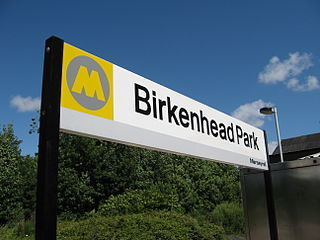
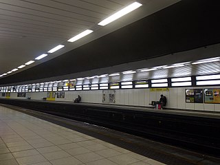
Birkenhead Park railway station is a two-platform through station situated in Birkenhead, Wirral, England. It lies on the Wirral Line 3 1⁄2 miles (5.6 km) west of Liverpool Lime Street on the Merseyrail network.

Spital railway station, on the former main line from Birkenhead Woodside to London Paddington, is situated near Bebington on the Wirral Peninsula, England in the small suburb of Spital. The station is located on the Wirral Line operated by Merseyrail and there are frequent third rail electric train services to Liverpool, Chester and Ellesmere Port.

Birkenhead Central is a railway station serving the town of Birkenhead, Wirral, England. Situated on the south side of Birkenhead town centre, it lies on the Chester and Ellesmere Port branches of the Wirral Line, part of the Merseyrail network. The station is in a deep cutting and reached by stairs down from the street level entrance.
Ledsham is a village and civil parish in the unitary authority of Cheshire West and Chester and the ceremonial county of Cheshire, England. It is located on the Wirral Peninsula, to the north of Capenhurst and to the west of Ellesmere Port. The village includes parts of the hamlets of Badger's Rake and Two Mills, and has a population of 88, increasing to 181 at the 2011 census.

New Lisbon is an unincorporated community located within Pemberton Township in Burlington County, New Jersey, United States. It is a settlement along Four Mile Road where it intersects Mount Misery Road. The community is located along the Philadelphia and Long Branch Railway, later a part of the Pennsylvania Railroad, and featured a train station.

Nottingham is an unincorporated community located within Hamilton Township in Mercer County, New Jersey, United States. It was named after the English town of Nottingham when the area was settled by English emigrants entering an area of Dutch culture just two decades removed from the land being part of New Netherland, Dutch Empire.

Alexauken is an unincorporated community located within West Amwell Township in Hunterdon County, New Jersey, United States. The community is located along Alexauken Creek Road between an interchange with U.S. Route 202 and Queen Road and is mostly made up of residential homes.

Ewansville or Ewanville is an unincorporated community located in Burlington County, New Jersey, United States. The community is centered on the crossing of U.S. Route 206 (US 206) and the North Branch Rancocas Creek just north of the former Philadelphia and Long Branch Railway. Ewansville was the site of a station on the aforementioned railroad and was the terminus for a short spur track to Vincentown.

Browns Mills Junction is an unincorporated community located within Pemberton Township in Burlington County, New Jersey, United States. The site, located about 1.6 miles (2.6 km) southwest of downtown Browns Mills, is located at the crossing of Junction Road and the Philadelphia and Long Branch Railway, later a part of the Pennsylvania Railroad. It was the site of a train station named Browns Mills in-the-Pines where a short branch connected the main line to Browns Mills. The settlement features a few houses along Junction Road and Mount Misery Road but is otherwise very forested as a part of the New Jersey Pine Barrens.