
Bhojpur is one of the two urban municipalities of Bhojpur District of Province No. 1 of Nepal.
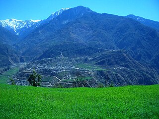
Bajura District, a part of Sudurpashchim Province, is one of the seventy-seven districts of Nepal. The district, with Martadi as its district headquarters, covers an area of 2,188 km2 (845 sq mi) and had a population of 108,781 in 2001 and 134,912 in 2011.
Sarlahi, a part of Madhesh Province, is one of the seventy-seven districts of Nepal. According to new laws, a combination of more than two or four villages makes a municipality, which covers an area of 1,259 km2 (486 sq mi) and had a population of 635,701 in 2001,769,729 in 2011 and 862,470 in 2021.
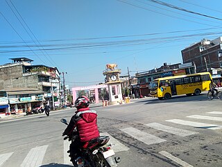
Kohalpur is a municipality in Banke District of Lumbini province of Nepal. The municipality was established on 18 May 2014 merging the existing two Village Development Committees i.e. Rajhena and Kohalpur. The town is in East-West highway and one of the fastest developing places in Nepal. A neighboring city Nepalgunj is on South (16 km [9.9 mi]), with Ghorahi city (135 km [84 mi]) to west in Dang District and further 6 km (3.7 mi) is the Indian border. In fact it is a growing city in the western region of Nepal. It has a junction to diverse the roadway transport to east, west, north and south from the city.
Triyuga is one of eight municipalities of Udayapur district of the Koshi Pradesh of Nepal. Gaighat is the headquarter of the municipality. At the 1991 Nepal census, it had a population of 55,291. The 2011 Nepal census counted 87,557 inhabitants. According to the 2021 Nepal census the initial population of the municipality is 104,375. It is divided into 16 wards. Triyuga Municipality was established on B.S. Chaitra 13, 2053. It was named after Triyuga River. A river which flows through the town. Triyuga is the 3rd largest municipality in Nepal and 1st largest in Koshi Pradesh in term of size (area). The total area of the municipality is 547.43 square kilometres (211.36 sq mi)
Sisautiya सिसौटिया is a small and most populated village in the southernmost part of Nepal commonly known as Madhesh or Terai. Sisautiya is 9 km north of the Indian border, 18 km south from Brahathawa municipality 9 km west from district headquarters Malangawa. It is located at 26°52'0N 85°34'0E with an altitude of 79 metres(262 feet) There is a customs checkpoint at the border crossing. It is part of the Sarlahi district and Province No. 2. It forms the main part of the Sisautiya village development committee. At the time of the 2011 Nepal census it had a population of 13,729 people living in 2259 individual households.
Aslewa is a village development committee (VDC) in Gulmi District in the Lumbini Zone of central Nepal. At the time of the 1991 Nepal census it had a population of 8088 persons living in 992 individual households. The village has a temple called Rudra Beni Dhaam and a school for higher level study, the Shree Janata Higher Secondary School.
Rupakot is a Village Development Committee (VDC) in Gulmi District in the Lumbini Zone of central Nepal. Its headquarters is in Myal pokhara. It is located in about the center of Gulmi District. It is surrounded by hills. Its main religion is Hinduism. There are many temples like Chhatra Thaan, Shiddababa temple, Shiva Temple, Ram Temple, Debi deurali temple etc. The main sources of revenue for the village are agriculture and foreign employment. At the time of the 2001 Nepal census, it had a population of 3521 persons residing in 704 individual households. 76.48% of students attend school. The most populated parts of this VDC is Damuka, Sota & Ekle Pipal.

Bardibas is a municipal area (municipality) and a town located in Mahottari District of Madhesh Province of Nepal. It is located at latitude: 26°54'6.84" to 27°08'46.90" and longitude: 85°47'42.67" to 85°56'42.97". The municipality is surrounded by Dhalkebar of Mithila municipality, Dhanusha District in the East and Ishworpur municipality of Sarlahi District in the West, Kamalamai municipality of Sindhuli District, Bagmati Province falls in the North and Bhangaha, Aurahi and Gaushala municipalities are located in the South.
Gamhariya is a Village Development Committee in Sarlahi District in the Janakpur Zone of south-eastern Nepal. At the time of the 2011 Nepal census it had a population of 8,000 people residing in 674 individual households. It has two sub villages small Palsi which is hardly 1 km east of the village and other is called Ganesiya which is located at south of the village which is also 1 km. North Ganesiya is associate with Gamhariya identified by ward no 6 and south part is located in Musaili VDC.
Hajariya is a village development committee (VDC) in Sarlahi District in the Janakpur Zone of south-eastern Nepal. Now it is included to barahathwa municipality. At the time of the 2011 Nepal census it had a population of 16,336 people living in 2814 individual households.

Lalbandi is a municipality in Sarlahi district in Madhesh Province of Nepal. The municipality was established on 18 May 2014 by merging the existing Parwanipur VDC, Netragunj VDC, Jabdi, Lalbandi and Pattharkot VDCs. At the time of the 2021 Nepal Census, it had a population of 66,419 living in 14,873 individual households. There are 17 wards in this municipality. It is the largest municipality in Sarlahi district. The office of this municipality is in ward no.6 Located in Lalbandi. Lalbandi Bazar, located on the East West or Mahendra highway, is one of the main trading areas within the municipality. Bordering Ishwarpur Municipality to the east and south, Haripur Municipality to the west and south, Sindhuli district to the north and Hariwan to the west, Lalbandi is the main trading site of the district.
Parsa is a rural municipality in Sarlahi District, a part of Madhesh Province in Nepal. It is situated 10 km East from Malangwa which is headquarter of Sarlahi district. It was formed in 2016 occupying current 6 sections (wards) from previous 6 former VDCs. It occupies an area of 23.12 km2 with a total population of 21,650. The major language spoken in the rural municipality are Maithili and Bajjika.
Pipariya is a village development committee in Sarlahi District in the Janakpur Zone of south-eastern Nepal. At present it's part of Kabilasi Municipality. It includes 2 wards of Kabilasi i.e. 1&2. According to the CBS 2011 it is carrying 1,218 households and total population 6,991 including 3,581 males and 3,410 females.
Beldandi is a rural municipality in Kanchanpur District in Sudurpashchim Province of southwestern Nepal named after the former Village Development Committee. At the time of the 1991 Nepal census the VDC had a population of 9301 people living in 1483 individual households. According to the Nepal census 2011 the municipality had 3022 individual households and a population of 21,959. In the north and west, Beldandi is surrounded by Suklaphatha national park. To the east lies Belauri Municipality. On the south, it borders India.

Letang, "लेटाङ " is a municipality in Morang District in the Koshi Province of Nepal. It was formed by merging the existing Village Development Committees of Letang, Jante, Warrangi and Bhogateni. This municipality is situated in Hilly Region as well as Terai Region. Previously it was called Letang Bhogateni but now it's known as Letang.
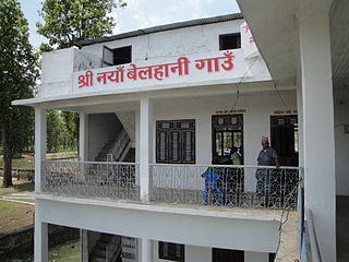
Naya Belhani is a village development committee in Nawalparasi District in the Lumbini Zone of western Nepal. At the time of the 1991 Nepal census it had a population of 9786 people living in 1795 individual households. Naya Belhani is divided into 9 wards, among which ward number 9, Arunkhola is the center of the VDC, which is considered one of an emerging business market of the Nawalparasi district. The VDC's main interesting factor is divided into two parts by Aarungkhola river and East West highway. The river is partition 6, 7 & 9 ward east region and 1,2,3,4,5,8 west region.

Kawasoti (Nepali: कावासोती) is a municipality in Nawalpur District, Gandaki Province, Nepal. It is 31 km (19 mi) west of Bharatpur and 85 km (53 mi) east of Butwal, approximately on the middle of Mahendra Highway. The Naryani River flows south of it, and the Mahabharat Range is north of it.
Simara was a village development committee in Sarlahi District in the Janakpur Zone of south-eastern Nepal. It constitutes 4 villages including Simara, Simara tola, Phenhara and Pakadi.

Dakneshwori Municipality is located in Saptari District in Madhesh Province of Nepal. It was formed in 2016 occupying current 10 sections (wards) merging previous Kabilasha, Hariraha, Tarhi, Bhuthi, Pato, Aurahi, Brahampur, Gamahariya Parwaha, Patthargada and Banaula VDCs. It occupies an area of 69.11 km2 with a total population of 44,782. Dakneshwori Municipality is named after the famous temple Dakneshwori Bhagwati located at ward no. 5, Pato.

