Harrismith, Western Australia

Last updated
Harrismith
Western Australia
Australia Western Australia location map.svg
Red pog.svg
Harrismith
Coordinates 32°56′02″S117°53′02″E / 32.934°S 117.884°E / -32.934; 117.884 Coordinates: 32°56′02″S117°53′02″E / 32.934°S 117.884°E / -32.934; 117.884
Established 1914
Postcode(s) 6361
Location
LGA(s) Shire of Wickepin
State electorate(s) Roe
Federal Division(s) O'Connor

Harrismith is a small town in the Wheatbelt region of Western Australia, approximately 260 kilometres (162 mi) south-east of Perth between the towns of Wickepin and Kulin.

Wheatbelt (Western Australia) region in Western Australia

The Wheatbelt is one of nine regions of Western Australia defined as administrative areas for the state's regional development, and a vernacular term for the area converted to agriculture during colonisation. It partially surrounds the Perth metropolitan area, extending north from Perth to the Mid West region, and east to the Goldfields-Esperance region. It is bordered to the south by the South West and Great Southern regions, and to the west by the Indian Ocean, the Perth metropolitan area, and the Peel region. Altogether, it has an area of 154,862 square kilometres (59,793 sq mi).

Western Australia state in Australia

Western Australia is a state occupying the entire western third of Australia. It is bounded by the Indian Ocean to the north and west, and the Southern Ocean to the south, the Northern Territory to the north-east, and South Australia to the south-east. Western Australia is Australia's largest state, with a total land area of 2,529,875 square kilometres, and the second-largest country subdivision in the world, surpassed only by Russia's Sakha Republic. The state has about 2.6 million inhabitants – around 11 percent of the national total – of whom the vast majority live in the south-west corner, 79 per cent of the population living in the Perth area, leaving the remainder of the state sparsely populated.

Wickepin, Western Australia Town in Western Australia

Wickepin is a town in the Wheatbelt region of Western Australia, 214 kilometres (133 mi) south-east of Perth and 38 kilometres (24 mi) east of Narrogin. Wickepin had a population of 381 at the 2016 census..

Contents

History

When a railway was being constructed from Narrogin to Kondinin in 1914, the government placed a siding at this location, naming it "South Dorakin". However, local settlers opposed the name, and suggested Harrismith, after Harry Smith, the first settler in the vicinity. The name change was approved and the town was gazetted in 1915. [1]

Narrogin, Western Australia Town in Western Australia

Narrogin is a large town in the Wheatbelt region of Western Australia, 192 kilometres (119 mi) southeast of Perth on the Great Southern Highway between Pingelly and Wagin. In the age of steam engines, Narrogin was one of the largest railway operation hubs in the southern part of Western Australia.

Kondinin, Western Australia Town in Western Australia

Kondinin is a town located in the eastern Wheatbelt region of Western Australia, 279 kilometres (173 mi) east of the state capital, Perth via the Brookton Highway and State Route 40 between Corrigin and Hyden. It is the main town in the Shire of Kondinin. At the 2006 census, Kondinin had a population of 311.

Present day

The town has a small hotel and caravan park as well as sports facilities. Other services are offered from nearby Tincurrin. The area around Harrismith is home to wildflowers in spring, especially verticordia.

Tincurrin is a small town in the Wheatbelt region of Western Australia, 250 kilometres (155 mi) south-east of Perth and within the Shire of Wickepin.

Wildflower flower that grows in the wild, meaning it was not intentionally seeded or planted

A wildflower is a flower that grows in the wild, meaning it was not intentionally seeded or planted. Yet "wildflower" meadows of a few mixed species are sold in seed packets. The term implies that the plant probably is neither a hybrid nor a selected cultivar that is in any way different from the way it appears in the wild as a native plant, even if it is growing where it would not naturally. The term can refer to the flowering plant as a whole, even when not in bloom, and not just the flower.

<i>Verticordia</i> genus of plants

Verticordia is a genus of more than 100 species of plants commonly known as featherflowers, in the myrtle family, Myrtaceae. They range in form from very small shrubs such as V. verticordina to trees like V. cunninghamii, some spindly, others dense and bushy, but the majority are woody shrubs up to 2.0 m (7 ft) tall. The flowers are variously described as "feathery", "woolly" or "hairy" and are found in most colours except blue. They often appear to be in rounded groups or spikes but in fact are always single, each flower borne on a separate stalk in a leaf axil. Each flower has five sepals and five petals all of a similar size with the sepals often having feathery or hairy lobes. There are usually ten stamens alternating with variously shaped staminodes. The style is simple, usually not extending beyond the petals and often has hairs near the tip. All but two species are found in Southwest Australia, the other two occurring in the Northern Territory.

Related Research Articles

Swan River Colony British colony which later became Western Australia

The Swan River Colony was a British colony established in 1829 on the Swan River, in Western Australia.

Harrismith Place in Free State, South Africa

Harrismith is a large town in the Free State province of South Africa. It was named for Sir Harry Smith, a 19th century British governor of the Cape Colony. It is situated by the Wilge River, alongside the N3 highway, about midway between Johannesburg, about 300 km to the north-west, and Durban to the southeast. The town is located at the junction of the N5 highway, which continues westward towards the provincial capital Bloemfontein, some 340 km to the south-west. This important crossroads in South Africa's land trade routes is surrounded by mesas and buttes. It is located at the base of one of these called Platberg.

York, Western Australia Town in Western Australia

York is the oldest inland town in Western Australia, situated on the Avon River, 97 kilometres (60 mi) east of Perth in the Wheatbelt, on Ballardong Nyoongar land, and is the seat of the Shire of York.

Kellerberrin, Western Australia Town in Western Australia

Kellerberrin is a town in the Wheatbelt region of Western Australia, 205 kilometres (127 mi) east of Perth on the Great Eastern Highway. The town serves as a stop on the Prospector and MerredinLink rural train services. It is also located on the Golden Pipeline Heritage Trail.

Cookernup, Western Australia Town in Western Australia

Cookernup is a town in the South West of Western Australia near the South Western Highway, between Waroona and Harvey.

The Macdonald River is a perennial river located in the Hunter and Outer Metropolitan Sydney regions of New South Wales, Australia. It is a part of the Hawkesbury-Nepean catchment.

Port Neill, South Australia Town in South Australia

Port Neill is a small coastal town on the eastern side of the Eyre Peninsula, in South Australia about 3 km off the Lincoln Highway between the major towns of Whyalla and Port Lincoln. It is 576 km by road from Adelaide.

Duranillin, Western Australia Town in Western Australia

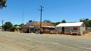
Duranillin is a small town located in the Wheatbelt region of Western Australia, 24 kilometres (15 mi) south of Darkan near the junction of the Arthur and Beaufort rivers.

Popanyinning, Western Australia Town in Western Australia

Popanyinning is a small town in the Wheatbelt region of Western Australia, along Great Southern Highway between Pingelly and Narrogin. At the date of the 2016 census, Popanyinning had a population of 180.

Shire of Wickepin Local government area in Western Australia

The Shire of Wickepin is a local government area in the Wheatbelt region of Western Australia, east of Narrogin and about 220 kilometres (137 mi) southeast of the state capital, Perth. The Shire covers an area of 2,042 square kilometres (788 sq mi), and its seat of government is the town of Wickepin.

Piesseville, Western Australia Town in Western Australia

Piesseville is a small town in the Wheatbelt region of Western Australia, 211 kilometres (131 mi) south-east of Perth on the Great Southern Highway between Narrogin and Wagin. It is also on the Great Southern Railway. At the 2016 census, Piesseville had a population of 59., being a significant decrease from 246 at the 2006 census

Hester, Western Australia Town in Western Australia

Hester is a small town in the South West region of Western Australia, 7 km north of Bridgetown on the railway.

Murray River (Western Australia) river

The Murray River is a river in the southwest of Western Australia. It played a significant part in the expansion of settlement in the area south of Perth after the arrival of British settlers at the Swan River Colony in 1829.

Baandee, Western Australia Town in Western Australia

Baandee is a small town located in the Wheatbelt region of Western Australia, about halfway between the towns of Kellerberrin and Merredin on the Great Eastern Highway approximately 230 kilometres (143 mi) from Perth, the state capital.

Manmanning, Western Australia Town in Western Australia

Manmanning is a small Wheatbelt town in Western Australia.

Dangin, Western Australia Town in Western Australia

Dangin is a small town in the wheatbelt region of Western Australia. It is located about 7 kilometres south-west of Quairading, in the Shire of Quairading. At the 2006 census, Dangin had a population of 283.

Dinninup, Western Australia Town in Western Australia

Dinninup is a small town in the South West region of Western Australia. It is between Boyup Brook and Kojonup.

Erikin, Western Australia Town in Western Australia

Erikin is a small town located in the Eastern Wheatbelt region of Western Australia. It is located close to the Salt River and between the towns of Quairading and Bruce Rock.

Yalup Brook, Western Australia Town in Western Australia

Yalup Brook is a small town located in the South West of Western Australia along the South Western Highway, between Waroona and Harvey. It is also situated on the Perth-Bunbury railway line.

Harrismith Commando

Harrismith Commando was a light infantry regiment of the South African Army. It formed part of the South African Army Infantry Formation as well as the South African Territorial Reserve.

References

  1. Western Australian Land Information Authority. "History of country town names – H" . Retrieved 2007-01-17.