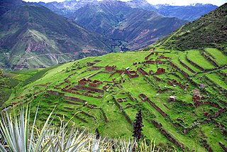
Chumbivilcas(3D-map) is a province in the Andes in South Peru. The Inca called it "Chumpiwillka". The seat of the province is Santo Tomás. Officially Chumbivilcas was founded on June 21, 1825.

The Abancay Province is one of seven provinces of the Apurímac Region in Peru. The capital of the province is the city of Abancay.

Antabamba Province is one of the seven provinces of the Apurímac Region in Peru. The capital of the province is the city of Antabamba.

Calca Province is one of thirteen provinces in the Cusco Region in the southern highlands of Peru. Its seat is Calca.

Vilcabamba District is one of eleven districts of the La Convención Province in the Cusco Region in Peru.
Jatun Q'asa or Hatun Q'asa may refer to:

Hatunqullpa is a mountain in the Wansu mountain range in the Andes of Peru, about 5,200 metres (17,060 ft) high. It is located in the Apurímac Region, Antabamba Province, Oropesa District, and in the Cusco Region, Chumbivilcas Province, Santo Tomás District. Hatunqullpa is situated north of the mountains Chankuwaña, Wayunka and Pinta Pata and south-west of the mountain Pilluni.

Hatun Urqu is a mountain in the Cusco Region in Peru, about 4,200 metres (13,780 ft) high. It is situated in the Acomayo Province, on the border of the districts Acomayo, Acos and Rondocan. Hatun Urqu lies south-west of the mountain Pisqu Urqu.

Hatun Qillqa is a mountain in the Wansu mountain range in the Andes of Peru, about 5,000 metres (16,404 ft) high. It is situated in the Apurímac Region, Antabamba Province, Antabamba District. Hatun Qillqa lies southeast of Qillqa, southwest of Sisiwa and Yuraq Urqu and northwest of Wank'ayuq Saywa.

Hatun Ch'aqu is a mountain in the Andes of Peru, about 5,000 metres (16,404 ft) high. It is located in the Cusco Region, Canchis Province, Pitumarca District, and in the Quispicanchi Province, Cusipata District. It lies south-west of the mountain Ch'aqu, west of the mountain Yanaqaqa, north-west of the mountain Tiklla Q'asa and north of the mountain Tuqtu. Its ridge stretches to the north-west.

Tiklla Q'asa is a mountain in the Andes of Peru, about 4,800 metres (15,748 ft) high. It is situated in the Cusco Region, Canchis Province, Pitumarca District, and in the Quispicanchi Province, Cusipata District. Tiklla Q'asa lies southwest of Ch'aqu and Yuraq Q'asa and southeast of Tuqtu and Hatun Ch'aqu.

Aqu Q'asa is a 5,091-metre-high (16,703 ft) mountain in the Wansu mountain range in the Andes of Peru. It is situated in the Apurímac Region, Antabamba Province, Oropesa District. Aqu Q'asa lies northeast of Hatun Qillqa.

Q'illu Pachaka is a mountain in the Wansu mountain range in the Andes of Peru, about 5,000 metres (16,404 ft) high. It is situated in the Apurímac Region, Antabamba Province, Oropesa District. Q'illu Pachaka lies east of Wank'ayuq Saywa and southeast of Hatun Qillqa.

Sura Kallanka is a mountain in the Andes of Peru, about 5,000 metres (16,404 ft) high. It is situated in the Apurímac Region, Antabamba Province, Oropesa District. It lies southeast of Kimsaqucha, Mallmanya and Hatun Q'asa. North of Sura Kallanka there is a lake named Suraqucha (Soracocha).

Qillqa is a mountain in the Wansu mountain range in the Andes of Peru, about 5,000 metres (16,404 ft) high. It is situated in the Apurímac Region, Antabamba Province, Antabamba District. Qillqa lies northwest of Hatun Qillqa.

Hatun Q'asa is a mountain in the Wansu mountain range in the Andes of Peru, about 4,800 metres (15,748 ft) high. It is situated in the Arequipa Region, Condesuyos Province, Cayarani District. Hatun Q'asa lies at the Q'illumayu valley.

Chuchaujasa is a mountain in the northwest of the Vilcabamba mountain range in the Andes of Peru, about 4,800 metres (15,748 ft) high. It is situated in the Cusco Region, La Convención Province, Vilcabamba District. Chuchaujasa lies west of Quenuaorco and northeast of Azulcocha and Panta at a brook or valley named Hatun Wayq'u.

Hatun Suyu Q'asa is a mountain in the Andes of Peru, about 4,400 m (14,436 ft) high. It is located in the Cusco Region, Calca Province, on the border of the districts of Coya and Lamay. It lies southeast of Lamay between the Willkapampa valley and the Yanamayu.
Hatun Wayq'u which downstream successively is named T'uruyunka(Toroyunca) and Chuqisayra(Choquesayra) is a river in Peru. It is located in the Cusco Region, La Convención Province, Vilcabamba District. It belongs to the watershed of the Apurímac River, the source of the Amazon River.

Hatun Wasi is a mountain in Peru which reaches a height of approximately 3,800 m (12,500 ft). It is located in the Apurímac Region, Andahuaylas Province, on the border of the districts of Chicmo District and Huancaray.


