The Hume Highway, inclusive of the sections now known as the Hume Freeway and Hume Motorway, is one of Australia's major inter-city national highways, running for 840 kilometres (520 mi) between Melbourne in the southwest and Sydney in the northeast. Upgrading of the route from Sydney's outskirts to Melbourne's outskirts to dual carriageway was completed on 7 August 2013.

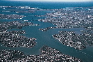
The Georges River, formerly known as Tucoerah River, is an intermediate tide dominated drowned valley estuary, located to the south and west of Sydney, New South Wales, Australia.

The Princes Highway is a major road in Australia, extending from Sydney to Adelaide via the coast through the states of New South Wales, Victoria and South Australia. It has a length of 1,941 kilometres (1,206 mi) or 1,898 kilometres (1,179 mi) via the former alignments of the highway, although these routes are slower and connections to the bypassed sections of the original route are poor in many cases.

The Pacific Highway is a 790-kilometre-long (490 mi) national highway and major transport route along the central east coast of Australia, with the majority of it being part of Australia's national route 1.
The A6 is a major arterial road linking Cumberland Highway at Carlingford and Princes Highway at Heathcote, via Lidcombe and Bankstown. It was formerly designated as Metroad 6, which was one of the Sydney Metroads.

The Sutherland Shire is a local government area in the southern region of Sydney, in the state of New South Wales, Australia. The Sutherland Shire is colloquially known as "The Shire" and it has been featured in several reality television series.

The Cumberland Highway is a 34-kilometre (21 mi) long urban highway located in Sydney, New South Wales, Australia. The highway links the Pacific Highway (A1/B83) and Pacific Motorway (M1) at Pearces Corner, Wahroonga in the northeast with the Hume Highway (A22/A28) at Liverpool in the southwest.

The Princes Motorway is a 55-kilometre (34 mi) predominately dual carriage untolled motorway that links Sydney to Wollongong and further south through the Illawarra region to Albion Park Rail. Part of the Australian Highway 1 network, the motorway is designated with the route number M1.

The Roads & Traffic Authority (RTA) is a former Australian government agency in New South Wales that was responsible for major road infrastructure, licensing of drivers, and registration of motor vehicles. The RTA directly managed State roads and provided funding to local councils for regional and local roads. In addition, with assistance from the Federal Government, the RTA also previously managed the NSW national highway system. The agency was abolished in 2011 and replaced by NSW Roads and Maritime Services.

The South Coast railway line is a commuter and goods railway line in New South Wales, Australia. Beginning at the Illawarra Junction, the line primarily services the Illawarra and South Coast regions of New South Wales, and connects Sydney and Nowra through Wollongong and Kiama.

The Tarban Creek Bridge, a prestressed concrete arch bridge that spans the Tarban Creek, is located west of the Sydney central business district in New South Wales, Australia. The bridge is situated between the Gladesville Bridge and the Fig Tree Bridge, being immediately to the north of Gladesville Bridge. The bridge carries the Burns Bay Road and a footpath and connects the suburbs of Hunters Hill and Huntleys Point.

Fig Tree Bridge is a concrete girder bridge that spans the Lane Cove River, 7 km northwest of the central business district of Sydney in New South Wales, Australia. It is immediately to the north of Tarban Creek Bridge. The bridge carries Burns Bay Road and a footpath and connects the suburbs of Hunters Hill and Linley Point.

Public transport in Sydney is provided by an extensive network of operating modes including suburban rail, light rail, buses and ferries. The network will also include a mode of rapid transit, with the new Sydney Metro opening in early 2019. According to the 2006 census, in terms of travel to work or study Sydney has the highest rate of public transport usage among the Australian capital cities of 26.3% with more than 80% of weekday trips to/from Central Sydney being made by public transport. According to the New South Wales State Plan, the state has Australia's largest public transport system. The network is regulated by Transport for NSW.
Cabramatta Creek, an urban watercourse of the Georges River catchment, is located in the south-western region of Sydney, in New South Wales, Australia.
Duncan John Gay, an Australian politician, was the Vice-President of the Executive Council of New South Wales and the Leader of the Government in the Legislative Council from May 2014 to January 2017; and the Minister for Roads, Maritime and Freight from April 2015 to January 2017. Gay was the Leader of the Nationals in the Legislative Council until January 2017 and was a member of the Council from 1988 to 2017, representing The Nationals.

Silverwater Bridge is a concrete box girder bridge that spans the Parramatta River west of the central business district in Sydney, New South Wales, Australia. The bridge carries Silverwater Road (A6) over the river to link Silverwater in the south to Rydalmere and Ermington in the north.

The Lansdowne Bridge is an heritage-listed road bridge that carries the Hume Highway across the Prospect Creek at Lansvale in the City of Fairfield local government area of New South Wales, Australia. It was designed and built from 1834 to 1836 by David Lennox. It is also known as Lennox Bridge. The property is owned by Roads and Maritime Services, an agency of the Government of New South Wales. It was added to the New South Wales State Heritage Register on 20 June 2000.
The M4 cycleway is a 15-kilometre-long (9.3 mi) shared use path for cyclists and pedestrians that is generally aligned with the M4 Motorway in Sydney, New South Wales, Australia. The eastern terminus of the cycleway is in the Sydney Olympic Park, while the western terminus is in South Wentworthville.
The Holsworthy railway line was located in South-western Sydney. It was built during World War I with German concentration camp internees to serve the Holsworthy army facilities opening on 21 January 1918.


