
The United States presidential election of 1888 was the 26th quadrennial presidential election, held on Tuesday, November 6, 1888. Republican nominee Benjamin Harrison, a former Senator from Indiana, defeated incumbent Democratic President Grover Cleveland of New York. It was the third of five U.S. presidential elections in which the winner did not win a plurality of the national popular vote.
Sandusky County is a county in the U.S. state of Ohio located southeast of the Toledo Metropolitan Area. As of the 2010 census, the population was 60,944. Its county seat is Fremont. The county was formed on February 12, 1820, from portions of Huron County. The name is derived from the Wyandot word meaning "water". The Sandusky River runs diagonally northeast through the county to its mouth on Sandusky Bay. The bay opens into Lake Erie.
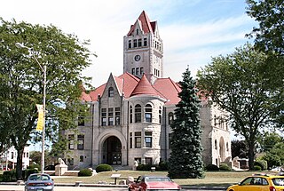
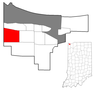
Fulton County is a county located in the U.S. state of Indiana. As of 2010, the population was 20,836. The county seat is Rochester.
Steve K. Munsey is the pastor of the Family Christian Center in Munster, Indiana.
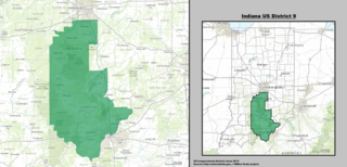
Indiana's 9th congressional district is a congressional district in the U.S. state of Indiana. Located in south-central and southeastern Indiana, the district stretches from the outer suburbs of Indianapolis to the Indiana side of the Louisville metropolitan area. The district's largest city is Bloomington, home to Indiana University.

Indiana's 8th congressional district is a congressional district in the U.S. state of Indiana. Based in southwest and west central Indiana, the district is anchored in Evansville and also includes Jasper, Princeton, Terre Haute, Vincennes and Washington.

Cyrus Livingston Dunham was an attorney, soldier, and prominent Indiana politician, serving most notably as a U.S. Representative from Indiana from 1849 to 1855.
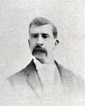
Jethro Ayers Hatch was a U.S. Representative from Indiana.

Indiana is a U.S. state located in the Midwestern and Great Lakes regions of North America. Indiana is the 38th largest by area and the 17th most populous of the 50 United States. Its capital and largest city is Indianapolis. Indiana was admitted to the United States as the 19th U.S. state on December 11, 1816. Indiana borders Lake Michigan to the northwest, Michigan to the north, Ohio to the east, Kentucky to the south and southeast, and Illinois to the west.
Westside is a neighborhood in west-central Gary, Indiana, USA, bounded by the Cline Avenue expressway on the west, the Norfolk Southern railroad on the north, Clark Road on the east and 25th Avenue on the south. It lies directly east of the Hessville neighborhood of Hammond. Within Gary, it adjoins the neighborhoods of Brunswick, Tolleston and Black Oak. In 2000, Westside had a population of 6,153, which was 63.3% African-American and 31.9% white, with 10.1% Hispanic ethnicity.
Oliver P. Morton High School is a public secondary school located in Hammond, Indiana. It is part of the School City of Hammond district.
Hessville is an unincorporated community and census-designated places in Washington Township, Sandusky County, Ohio, United States.

Woodmar is a neighborhood in southeast Hammond, Indiana, approximately between Columbia and Kennedy Avenues. It is bounded to the east by Hessville, to the west by South Hammond, to the north by industrial land along United States Route 20, and to the south by the town of Highland. The neighborhood's boundaries correspond to Hammond's Planning District V.
Calumet is the portion of East Chicago, Indiana located east of the Indiana Harbor and Ship Canal and south of Chicago Avenue. The neighborhood is bisected by the Indiana Harbor Belt Railroad. The area west of the tracks is referred to as Calumet proper, or as "West Calumet". The area east of the tracks is known as "East Calumet."
Ridge and swale, or in dunal areas dune and swale, is a landform consisting of regular, parallel ridges alternating with marshy depressions. Ridge-and-swale landscapes are most commonly formed by the gradual movement of a beach, for example as a result of gradually fluctuating water levels, or the shifting meanders of a river. In the river context, ridge-and-swale landscapes are commonly formed by scroll bars. They are also found along ocean coasts, for example on the Outer Banks of North Carolina.
Bowmans Creek is a river in Montgomery County, New York. It begins west of the hamlet of Hessville and just south of the hamlet of Ripple Corners. It then flows in a mostly southeast direction for a few miles passing through the hamlet of Sprout Brook before flowing into the Canajoharie Creek just east of the hamlet of Sprout Brook.

