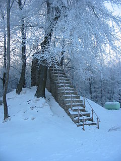
The Hill as a state border
During the Roman era the river was a boundary between the administrative regions of Tongeren (Civitas Tungrorum) and Cologne (Civitas Agrippinensium).
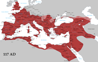
The Roman Empire was the post-Roman Republic period of the ancient Roman civilization. Ruled by emperors, it had large territorial holdings around the Mediterranean Sea in Europe, North Africa, the Middle East, and the Caucasus. From the constitutional reforms of Augustus to the military anarchy of the third century, the Empire was a principate ruled from Italy, homeland of the Romans and metropole of the empire, with the city of Rome as capital. The Roman Empire was then ruled by multiple emperors and divided in a Western Roman Empire, based in Milan and later Ravenna, and an Eastern Roman Empire, based in Nicomedia and later Constantinople. Rome remained the nominal capital of both parts until 476 AD, when Odoacer deposed Romulus Augustus after capturing Ravenna and the Senate of Rome sent the imperial regalia to Constantinople. The fall of the Western Roman Empire to barbarian kings, along with the hellenization of the Eastern Roman Empire into the Byzantine Empire, is conventionally used to mark the end of Ancient Rome and the beginning of the Middle Ages.

Tongeren is a city and municipality located in the Belgian province of Limburg, in the southeastern corner of the Flemish region of Belgium. Tongeren is the oldest town in Belgium, as the only Roman administrative capital within the country's borders. As a Roman city, it was inhabited by the Tungri, and known as Atuatuca Tungrorum, it was the administrative centre of the Civitas Tungrorum district. The city is a member of the Most Ancient European Towns Network.

Cologne is the largest city of Germany's most populous federal state of North Rhine-Westphalia, and its 1 million+ (2016) inhabitants make it the fourth most populous city in Germany after Berlin, Hamburg, and Munich. The largest city on the Rhine, it is also the most populous city both of the Rhine-Ruhr Metropolitan Region, which is Germany's largest and one of Europe's major metropolitan areas, and of the Rhineland. Centred on the left bank of the Rhine, Cologne is about 45 kilometres (28 mi) southeast of North Rhine-Westphalia's capital of Düsseldorf and 25 kilometres (16 mi) northwest of Bonn. It is the largest city in the Central Franconian and Ripuarian dialect areas.
From the High Middle Ages to 1795 it was the border between the territorial lordships that divided up the region of the High Fens. For example, the border between the Duchy of Limburg and the Duchy of Luxembourg ran here and, further north, in the area of the Herzogenhügel ("Duke(s) Knoll"), between Limburg and the Duchy of Jülich.
The High Middle Ages, or High Medieval Period, was the period of European history that commenced around 1000 and lasted until around 1250. The High Middle Ages were preceded by the Early Middle Ages and were followed by the Late Middle Ages, which ended around 1500.

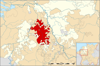
The Duchy of Limburg or Limbourg was a state of the Holy Roman Empire. Its main territory including the capital Limbourg is today located within the Belgian province of Liège, with a small part in the neighbouring province of Belgian Limburg, within the east of Voeren.
The Duchy of Jülich comprised a state within the Holy Roman Empire from the 11th to the 18th centuries. The duchy lay left of the Rhine river between the Electorate of Cologne in the east and the Duchy of Limburg in the west. It had territories on both sides of the river Rur, around its capital Jülich – the former Roman Iuliacum – in the lower Rhineland. The duchy amalgamated with the County of Berg beyond the Rhine in 1423, and from then on also became known as Jülich-Berg.
From 1815 to 1919 it divided Prussia from the United Kingdom of the Netherlands and its successor state, Belgium.
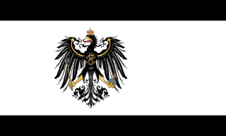
Prussia was a historically prominent German state that originated in 1525 with a duchy centred on the region of Prussia on the southeast coast of the Baltic Sea. It was de facto dissolved by an emergency decree transferring powers of the Prussian government to German Chancellor Franz von Papen in 1932 and de jure by an Allied decree in 1947. For centuries, the House of Hohenzollern ruled Prussia, successfully expanding its size by way of an unusually well-organised and effective army. Prussia, with its capital in Königsberg and from 1701 in Berlin, decisively shaped the history of Germany.

The United Kingdom of the Netherlands is the unofficial name given to the Kingdom of the Netherlands as it existed between 1815 and 1839. The United Netherlands was created in the aftermath of the Napoleonic Wars through the fusion of territories that had belonged to the former Dutch Republic, Austrian Netherlands, and Prince-Bishopric of Liège. The polity was a constitutional monarchy, ruled by William I of the House of Orange-Nassau.
In 1952 a 1.5-kilometre-long link tunnel was dug between the Hill and the Eupen Weser Reservoir, in order to better regulate the high water demand of the textile industry. For about half its length, the Hill flows through the High Fens-Eifel Nature Park.
Limburg is the southernmost of the 12 provinces of the Netherlands. It is in the southeastern part of the country, stretched out from the north, where it touches the province of Gelderland, to the south, where it internationally borders Belgium. Its northern part has the North Brabant province to its west. Its long eastern boundary is the international border with the German state of North Rhine-Westphalia. Much of the west border runs along the River Maas, bordering the Flemish province of Limburg, and a small part of the Walloon province of Liège. On the south end, it has borders with the Flemish exclave of Voeren and its surrounding part of Liège, Wallonia. The Vaalserberg is on the extreme south-eastern point, marking the tripoint of Netherlands, Germany and Belgium.

Limburg is a province in Belgium. It is the easternmost of the five Dutch-speaking provinces that together form the Region of Flanders, one of the three main political and cultural sub-divisions of modern Belgium.
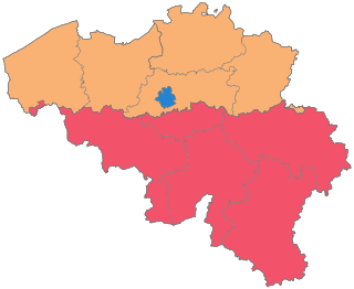
The country of Belgium is divided into three regions. Two of these regions, the Flemish Region or Flanders, and Walloon Region, or Wallonia, are each subdivided into five provinces. The third region, the Brussels-Capital Region, is not divided into provinces, as it was originally only a small part of a province itself.

The Lahn is a 245.6-kilometer (152.6 mi)-long, right tributary of the Rhine in Germany. Its course passes through the federal states of North Rhine-Westphalia (23.0 km), Hesse (165.6 km), and Rhineland-Palatinate (57.0 km).
Limburgish, also called Limburgan, Limburgian, or Limburgic, is a group of East Low Franconian varieties spoken in the Belgian and Dutch provinces both named Limburg and some neighbouring areas of Germany. The area in which it is spoken roughly fits within a wide circle from Venlo to Düsseldorf to Aachen to Maastricht to Tienen and back to Venlo. In some parts of this area it is generally used as the colloquial language in daily speech.

Eupen-Malmedy or Eupen-Malmédy is a small, predominantly German-speaking region in eastern Belgium. It consists of three administrative cantons around the small cities of Eupen, Malmedy, and Sankt Vith which encompass some 730 square kilometres (280 sq mi). In the area itself, the region is referred to as Ostbelgien. Elsewhere in Belgium, the region is commonly referred to as the East Cantons.
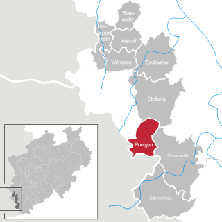
Roetgen is a municipality in the district of Aachen, in North Rhine-Westphalia, Germany.
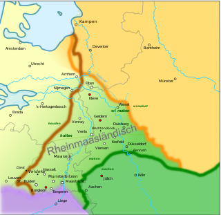
Meuse-Rhenish is a modern term that refers to the literature written in the Middle Ages in the greater Meuse-Rhine area. This area stretches in the northern triangle roughly between the rivers Meuse and Rhine. It also applies to the Low Franconian dialects that have been spoken in that area in continuation from mediaeval times up to now.
Southeast Limburgish, also referred to as Southern Meuse-Rhenish, is a subdivision of what recently has been named Meuse-Rhenish. Both terms denote a rather compact grouping of Low Franconian varieties, spoken in the Limburg and Lower Rhineland regions, near the common Dutch/Flemish (Belgium) and Dutch/German borders. These dialectal varieties differ notably from Dutch and Flemish at the one side, and no less from German at the other. In the Netherlands and Belgium this group is often included in the generic term Limburgish. Limburgish was recently recognised as a regional language (streektaal) in the Netherlands and as such it receives moderate protection under chapter 2 of the European Charter for Regional or Minority Languages. The linguistic border of the Limburgish varieties to the South is the Benrath line, to the North it is the Uerdingen line. This means Southeast Limburgish is different in nature from the other Limburgish varieties.

Lake Eupen is an artificial lake near Eupen in eastern Belgium, not far from High Fens. The lake is created by a dam which was built on the river Vesdre in 1938 but inaugurated only in 1950 by Prince Charles of Belgium. The area has a German-speaking population who refer to the river Vesdre as Weser, but which is distinct from the Weser river in North Germany.

Low Dietsch refers to a handful of transitional Limburgish–Ripuarian dialects spoken in a number of towns and villages.

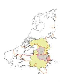
The Meuse–Rhine Euroregion is a Euroregion created in 1976, with judicial status achieved in 1991. It comprises 11.000 km² and has around 3.9 million inhabitants around the city-corridor of Aachen–Maastricht–Hasselt–Liège. The seat of the region has been in Eupen, Belgium since 1 January 2007. Within a wider context, the region is part of what is called the Blue Banana European urbanisation corridor.
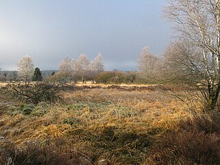
The German-Belgian High Fens – Eifel Nature Park, often called the North Eifel Nature Park, is a cross-border nature park with elements in the German federal states of North Rhine-Westphalia and Rhineland-Palatinate as well as the Belgian province of Liège. It has a total area of 2,485 km2 (959 sq mi).
The Belgian province of Limburg in Flanders is a region which has had many names and border changes over its long recorded history. Its modern name is a name shared with the neighbouring province of the Netherlands, with which it was for a while politically united. And in turn both of these provinces received their modern name only in the 19th century, based upon the name of the medieval Duchy of Limburg which was actually based in neighbouring Wallonia, in the town of Limbourg on the Vesdre.
The Civitas Tungrorum was a large Roman administrative district dominating what is today eastern Belgium, and the southern Netherlands. In the early days of the Roman empire it was in the province of Gallia Belgica, but it later joined the neighbouring lower Rhine river border districts, within the province of Germania Inferior. Its capital was Aduatuca Tungrorum, which is modern Tongeren.

The Steling is a mountain, 658.3 m above sea level (NN), and thus the highest point in the municipal region of Aachen. The German-Belgian border runs over the mountaintop.