
Apurímac is a region in southern-central Peru. It is bordered on the east by the Cusco Region, on the west by the Ayacucho Region, and on the south by the Arequipa and Ayacucho regions. The region's name originates from the Quechua language and means "where the gods speak" in reference to the many mountains of the region that seem to be talking to each other.
The Cotabambas Province is a province located in the Apurímac Region of Peru. The province has a population of 44,028 inhabitants. The capital of this province is the city of Tambobamba.

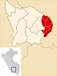
The Abancay Province is one of seven provinces of the Apurímac Region in Peru. The capital of the province is the city of Abancay.

Grau Province is one of the seven provinces of the Apurímac Region in Peru. The capital of the province is the city of Chuquibambilla.

Aymaraes Province is the largest of seven provinces of the Apurímac Region in Peru. The capital of the province is the city of Chalhuanca. The province was founded by General Simón Bolívar on June 21, 1824.
Circa is one of the nine districts of the Abancay Province in the Apurímac Region in Peru.
Qiwllaqucha or Qillwaqucha may refer to:

Choquesafra or Choquezafra is a 5,152-metre-high (16,903 ft) mountain in the Vilcabamba mountain range in the Andes of Peru. It is located in the Cusco Region, La Convención Province, on the border of the districts of Inkawasi and Vilcabamba. Choquesafra lies west of the Panta group and south of a river named Rancahuayco. The Huajchay River originates northwest of the mountain. It flows to the southwest as a right affluent of the Apurímac River.
Qurimarka is an archaeological site in Peru. It is situated in the Apurímac Region, Abancay Province, Huanipaca District.
Incahuasi is a mountain in the Vilcabambamountain range in the Andes of Peru whose summit reaches 4,315 metres (14,157 ft) above sea level. It is situated in the Apurímac Region, Abancay Province, Cachora District. The mountain lies on the bank of the Apurímac River, opposite the archaeological site of Choquequirao. On its northern slope there is a small archaeological site named Inka Raqay. Tourists are also attracted by the viewpoint of Incahuasi which provides good views of the Apurímac valley, Choquequirao and Padreyoc.
Qiwllaqucha is a small lake in Peru located in the Apurímac Region, Abancay Province, Circa District, southwest of the mountain Pituni.
Kiswarani Q'asa is a mountain in the Andes of Peru. Its summit reaches about 4,862.8 m (15,954 ft) above sea level. The mountain is located in the Cusco Region, Espinar Province, Coporaque District.
T'alla Kallanka is a mountain in the Wansu mountain range in the Andes of Peru, about 5,000 metres (16,404 ft) high. It is situated in the Apurímac Region, Antabamba Province, Oropesa District. T'alla Kallanka lies west of Millu and northwest of Mina Q'asa.
Q'illu Pachaka is a mountain in the Wansu mountain range in the Andes of Peru, about 5,000 metres (16,404 ft) high. It is situated in the Apurímac Region, Antabamba Province, Oropesa District. Q'illu Pachaka lies east of Wank'ayuq Saywa and southeast of Hatun Qillqa.
Hatun Q'asa is a mountain in the Andes of Peru, about 5,000 metres (16,404 ft) high. It is situated in the Apurímac Region, Antabamba Province, Oropesa District. It lies south of Mallmanya, northwest of Sura Kallanka and southeast of Kimsaqucha. East of Hatun Q'asa there is a lake named Suraqucha (Soracocha).
Usnu Muqu is an archaeological site in Peru. It is located in the Apurímac Region, Abancay Province, Tamburco District, near the main square of Tamburco.
Q'illu Q'asa is a mountain in the Andes of Peru, about 5,000 metres (16,404 ft) high. It is located in the Apurímac Region, Abancay Province, on the border of the districts of Abancay and Tamburco. Q'illu Q'asa lies southeast of Ampay and west of a lake named Usphaqucha.
Q'urawiri is a mountain in the Andes of Peru, about 5,000 metres (16,404 ft) high. It is located in the Apurímac Region, Abancay Province, Circa District, and in the Grau Province, Chuquibambilla District. Huch'uy Q'urawiri is northwest of it.
Waman Ch'arpa is a mountain in the Andes of Peru, about 4,600 metres (15,092 ft) high. It is located in the Apurímac Region, Abancay Province, Lambrama District, and in the Grau Province, Curpahuasi District. It lies west of the lakes named Chinaqucha and Urququcha.
Sondor (possibly from Aymara sunturu square without a ridge, Quechua suntur circular, is a mountain in the Andes of Peru, about 4,800 metres high. It is located in the Apurímac Region, Abancay Province, Circa District, and in the Antabamba Province, El Oro District. It lies southeast of a mountain named Sunturu.


