This page is based on this
Wikipedia article Text is available under the
CC BY-SA 4.0 license; additional terms may apply.
Images, videos and audio are available under their respective licenses.

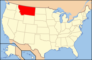
Montana is a landlocked state in the Northwestern United States. Montana has several nicknames, although none are official, including "Big Sky Country" and "The Treasure State", and slogans that include "Land of the Shining Mountains" and more recently "The Last Best Place".

North Carolina is a state in the southeastern region of the United States. It borders South Carolina and Georgia to the south, Tennessee to the west, Virginia to the north, and the Atlantic Ocean to the east. North Carolina is the 28th-most extensive and the 9th-most populous of the U.S. states. The state is divided into 100 counties. The capital is Raleigh, which along with Durham and Chapel Hill is home to the largest research park in the United States. The most populous municipality is Charlotte, which is the second-largest banking center in the United States after New York City.

Helena is the state capital of the U.S. state of Montana and the county seat of Lewis and Clark County.

Nelson County is a county located in the Commonwealth of Virginia. As of the 2010 census, the population was 15,020. Its county seat is Lovingston.

Buchanan County is a United States county in far western Virginia, the only Virginia county to border both West Virginia and Kentucky. The county is part of the Southwest Virginia region and lies in the rugged Appalachian Plateau portion of the Appalachian Mountains. Its county seat is Grundy.

Gallatin County is a county in the U.S. state of Montana. With its county seat in Bozeman, it is the third-most populous county in Montana, with a population of 89,513 in 2010.

Virginia City is a town in and the county seat of Madison County, Montana, United States. In 1961 the town and the surrounding area were designated a National Historic Landmark District, the Virginia City Historic District. The population was 190 at the 2010 census.

The Roanoke River is a river in southern Virginia and northeastern North Carolina in the United States, 410 miles (660 km) long. A major river of the southeastern United States, it drains a largely rural area of the coastal plain from the eastern edge of the Appalachian Mountains southeast across the Piedmont to Albemarle Sound. An important river throughout the history of the United States, it was the site of early settlement in the Virginia Colony and the Carolina Colony. An 81-mile (130 km) section of its lower course in Virginia between the Leesville Lake and Kerr Lake is known as the Staunton River, pronounced, as is the Shenandoah Valley city of that name. It is impounded along much of its middle course to form a chain of reservoirs.

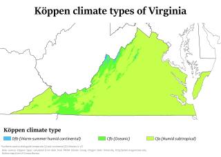
The climate of Virginia, a state on the east coast of the United States, is considered mild compared to other areas of the United States. Most of Virginia east of the Blue Ridge Mountains, the southern part of the Shenandoah Valley, and the Roanoke Valley, has a humid subtropical climate. In the mountainous areas west of the Blue Ridge, the climate becomes humid continental and
maritime temperate. Severe weather, in the form of tornadoes, tropical cyclones, and winter storms, impacts the state on a regular basis. Central Virginia received significant snowfall of 20 inches in December 2009.

Granite Peak, at an elevation of 12,807 feet (3,904 m) above sea level, is the highest natural point in the U.S. state of Montana, and is the tenth highest state high point in the nation. It lies within the Absaroka-Beartooth Wilderness, in Park County very near the borders of Stillwater County and Carbon County. Granite Peak is 10 miles (16 km) north of the Wyoming border, 45 miles (72 km) southwest of Columbus, Montana.

The Kootenai National Forest is a national forest located in the far northwestern section of Montana and the northeasternmost lands in the Idaho panhandle in the United States, along the Canada–US border. Of the 2.2 million acres (8,900 km2) administered by the forest, less than 3 percent is located in the state of Idaho. Forest headquarters are located in Libby, Montana. There are local ranger district offices in Eureka, Fortine, Libby, Trout Creek, and Troy, Montana. About 53 percent of the 94,272-acre (381.51 km2) Cabinet Mountains Wilderness is located within the forest, with the balance lying in neighboring Kaniksu National Forest.
America's Most Endangered Places or America's Most Endangered Historic Places is a list of places in the United States that the National Trust for Historic Preservation considers the most endangered. It aims to inspire Americans to preserve examples of architectural and cultural heritage that could be "relegated to the dustbins of history" without intervention.

The following is an alphabetical list of articles related to the U.S. state of Montana.
Massies Mill is an unincorporated community in Nelson County, Virginia, United States. It is located on State Route 56 adjacent to the headwaters of the Tye River. The head of the Virginia Blue Ridge Railway, a now-defunct short line railroad, was once located at Massies Mill.
Hannah or Hanna may refer to:

The following outline is provided as an overview of and topical guide to the U.S. state of Montana:


