
The Illinois and Michigan Canal connected the Great Lakes to the Mississippi River and the Gulf of Mexico. In Illinois, it ran 96 miles (154 km) from the Chicago River in Bridgeport, Chicago to the Illinois River at LaSalle-Peru. The canal crossed the Chicago Portage, and helped establish Chicago as the transportation hub of the United States, before the railroad era. It was opened in 1848. Its function was largely replaced by the wider and shorter Chicago Sanitary and Ship Canal in 1900, and it ceased transportation operations with the completion of the Illinois Waterway in 1933.

Union County is a county located in the U.S. state of Illinois. According to the 2010 United States Census, it had a population of 17,808. Its county seat is Jonesboro. It is located in the southern portion of Illinois known locally as "Little Egypt".

Madison County is a county in the U.S. state of Illinois. According to the 2010 census, it had a population of 269,282. The county seat is Edwardsville, and its largest city is Granite City.

Lee County is a county located in the U.S. state of Illinois. According to the 2010 census, it has a population of 36,031. Its county seat is Dixon.

Jackson County is a county located in the U.S. state of Illinois with a population of 60,218 at the 2010 United States Census. Its county seat is Murphysboro, and its most populous city is Carbondale, home to the main campus of Southern Illinois University. The county was incorporated on January 10, 1816 and named for Andrew Jackson. The community of Brownsville served as the fledgling county's first seat.
Grundy County is a county in the U.S. state of Illinois. According to the 2010 census, it has a population of 50,063. Its county seat is Morris.

Edgar County is a county located in the U.S. state of Illinois. As of the 2010 United States Census, the population was 18,576. Its county seat is Paris.

DuPage County is a county in the U.S. state of Illinois, and one of the collar counties of the Chicago metropolitan area. As of the 2010 census, the population was 916,924, making it Illinois' second-most populous county. Its county seat is Wheaton. DuPage County has become mostly developed and suburbanized, although some pockets of farmland remain in the county's western and northern parts. The county has a high socioeconomic profile and residents of Hinsdale, Naperville and Oak Brook include some of the wealthiest people in the Midwest. On the whole, the county enjoys above average median household income levels and low overall poverty levels when compared to the national average. In 2018 Niche ranked two DuPage municipalities amongst the top 20 best places to live in America.

Hoffman Estates is a village in Illinois, United States. The village is located primarily in Cook County, with a small section in Kane County. It is a suburb of Chicago. As of the 2010 census, the population was 51,895, and as of 2017 the estimated population was 51,567.
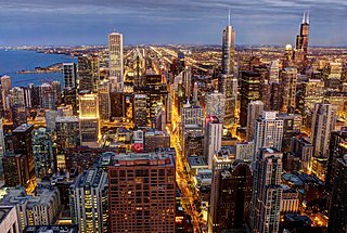
The Chicago metropolitan area, or Chicagoland, is the metropolitan area that includes the city of Chicago, Illinois, and its suburbs. With an estimated CSA population of 9.9 million people and an MSA population of 9.5 million people, it is the third largest metropolitan area in the United States.
Illinois Route 50 (IL 50) is a north–south state road in northeastern Illinois. It runs from the junction with U.S. Route 45 (US 45) in West Kankakee north to U.S. Route 41 in Skokie. This is a distance of 66.49 miles (107.01 km). In Chicago and the suburbs it's known as Cicero Avenue. Before this, Cicero Avenue was previously known as 48th Avenue, owing to its City of Chicago address of 4800 West.
Illinois Route 26 is a north–south state road in central and north-central Illinois. It runs from Illinois Route 116 just north of East Peoria to Highway 69 at the Wisconsin border near Orangeville. This is a distance of 139.35 miles (224.26 km).
Illinois Route 53 (IL 53) is an arterial north–south state highway in northeast Illinois. IL 53 runs from Interstate 55 (I-55) west of historic U.S. Route 66 (US 66) in Gardner to IL 83 in Long Grove, a distance of 82.02 miles (132.00 km). It mainly cuts through the western suburbs of Chicago, passes through Bolingbrook, Romeoville, Crest Hill and Joliet, merging into I-55 at Gardner.
Illinois Route 171 (IL 171) is a north–south state road in northeastern Illinois. It runs from U.S. Route 6 (US 6) in Joliet north to Illinois Route 72 at the Chicago–Park Ridge border. This is a distance of 38.61 miles (62.14 km). The section of IL 171 on Archer Avenue from Joliet to Summit is historically significant, originating as a Native American trail, and later serving for a time as part of the first numbered highway between St. Louis and Chicago.
Interstate 88 (I-88) is an Interstate Highway in the US state of Illinois that runs from an interchange with I-80 near Silvis and Moline to an interchange with I-290 and I-294 in Hillside, near Chicago. I-88 is 140.60 miles (226.27 km) long. This route is not contiguous with I-88 in New York. Since 2010, all of I-88 has been part of the Chicago–Kansas City Expressway. The highway also runs through the cities of Aurora, Naperville, DeKalb, and Dixon. East of Rock Falls, the route is a part of the Illinois Tollway system.
Illinois Route 1 is a state highway in the U.S. state of Illinois. Running parallel to the Indiana border, it is also the longest state road, starting on the south side of Chicago as Halsted Street at an intersection with Interstate 57, south to a free ferry crossing to Kentucky at Cave-in-Rock on the Ohio River. This is a distance of 325.59 miles (523.99 km).
Illinois Route 3 (IL 3) is a major north–south arterial state highway in southwestern Illinois. It has its southern terminus at Cairo Junction at the intersection of Interstate 57 (I-57) and U.S. Route 51 (US 51), and its northern terminus in Grafton at IL 100. This is a distance of 187.44 miles (301.66 km).
Interstate 155 (I-155) is a north–south spur of I-55 that provides an Interstate connection for the Illinois cities of Peoria and Lincoln. The northern terminus is just east of Peoria, at I-74 exit 101 in Morton. The southern terminus, which is northwest of Lincoln, is located on I-55 at exit 127. The highway is 32.13 miles (51.71 km) long.
Interstate 80 (I-80) is a part of the Interstate Highway System that runs from San Francisco, California, to Teaneck, New Jersey. I-80 enters Illinois from Iowa in the west, southwest of Rapids City and runs generally eastward through East Moline, LaSalle and Joliet, before entering Indiana in Lansing. The interstate runs for approximately 163.41 miles (262.98 km) through the state.
Arthur Joseph Jones is an American neo-Nazi. He was the Republican candidate for Illinois's 3rd congressional district in the November 2018 midterm elections, losing to Democrat Dan Lipinski.

