Route information | ||||
---|---|---|---|---|
Maintained by INDOT | ||||
Length | 261.27 mi [1] (420.47 km) | |||
Existed | 1956–present | |||
NHS | Entire route | |||
Major junctions | ||||
South end | I-65 Toll at Kentucky state line | |||
North end | US 12 / US 20 in Gary | |||
Location | ||||
Country | United States | |||
State | Indiana | |||
Counties | Clark, Scott, Jackson, Bartholomew, Shelby, Johnson, Marion, Hendricks, Boone, Clinton, Tippecanoe, White, Jasper, Newton, Lake | |||
Highway system | ||||
| ||||
|
Interstate 65 (I-65) in the US state of Indiana traverses from the south-southeastern Falls City area bordering Louisville, Kentucky, through the centrally located capital city of Indianapolis, to the northwestern Calumet Region of the Hoosier State which is part of the Chicago metropolitan area. The Indiana portion of I-65 begins in Jeffersonville after crossing the Ohio River and travels mainly north, passing just west of Columbus prior to reaching the Indianapolis metro area. Upon reaching Indianapolis, the route alignment of I-65 begins to run more to the northwest and subsequently passes Lafayette on that city's east and north sides. Northwest of there, in west-central Jasper County, the route again curves more northward as it approaches the Calumet Region. Shortly after passing a major junction with I-80 and I-94, I-65 reaches its northern national terminus in Gary at I-90 which is carried on the Indiana East–West Toll Road. I-65 covers 261.27 miles (420.47 km) in the state of Indiana. This is one of the principal Interstate Highways that cross the state, and, more specifically, intersect at the city of Indianapolis, that has given the state the nickname of "Crossroads of America".
I-65 enters the state northbound at Jeffersonville (across the Ohio River from Louisville, Kentucky) on the Abraham Lincoln Bridge; traffic exiting the state travels on the John F. Kennedy Memorial Bridge. I-65 travels past Clark State Forest before reaching Seymour to the north. I-65 intersects with U.S. Highway 50 (US 50), providing access to Seymour to the west. US 31 runs parallel to the Interstate until it reaches Indianapolis. North of Seymour, I-65 passes through Columbus. Just north of Columbus, I-65 runs near Camp Atterbury, an Indiana National Guard training base. The Interstate continues north into Indianapolis.
I-65 crosses the I-465 loop before reaching Indianapolis. The section of I-65 in Downtown Indianapolis overlaps I-70. The junctions are often referred to as the "North Split" and the "South Split", forming a section of Interstate locally known as the "Inner Loop" or "Spaghetti Bowl" due to the visual complexity of the overlapping freeways. The "North Split" was closed for reconstruction in early 2021 and reopened to traffic in May 2023. [2] As part of that reconstruction, the old ramps were replaced with ones that eliminate the lane switching that drivers originally had to perform to stay on I-70 eastbound and I-65 northbound. [3]
In 1999, the 25-mile (40 km) segment of I-65 between the two I-465 interchanges was renamed the Kenneth "Babyface" Edmonds Highway. At milemarker 116, I-65 passes Crown Hill Cemetery, burial site and memorial of former-President Benjamin Harrison. I-65 leaves the I-465 loop on the northwest side of Indianapolis. The highway travels past Eagle Creek Park and it then passes the terminus of I-865 and picks up US 52.
The segment of I-65 north of Indianapolis heads in the direction of Chicago, Illinois. US 52 runs concurrently until the north side of Lebanon; US 52 runs parallel to I-65 from this point to Lafayette, located at about the halfway point between Indianapolis and Chicago. I-65 crosses the Wabash River in Lafayette and passes next to Prophetstown State Park.
North of Lafayette, I-65 parallels US 231 and passes through the open flatlands of northwest Indiana. Protruding from the fields are some of the hundreds of wind turbines of the Benton County Wind Farm and Fowler Ridge Wind Farm. At approximately mile 199.4 is the timezone boundary between Central Time (Jasper County) and Eastern Time (White County). The Indiana Department of Transportation (INDOT) marked change in timezone with a two-sided blue sign in the center median.
Upon crossing into Lake County, over the Kankakee River, the highway is known as the Casimir Pulaski Memorial Highway. [4] It is known as this from that point to its northern terminus. The northern terminus of I-65 is only 0.125 miles (0.201 km) north of I-90 (Indiana Toll Road) in Gary.
This section needs expansionwith: Overall history of route. You can help by adding to it. (December 2016) |
Like all Interstate Highways in Indiana, I-65 was constructed in segments. There were six segments in the southern portion of the state between the Kentucky border and the south leg of I-465 in Indianapolis, nine within the I-465 loop and 11 more that made up the northern portion connecting the northwest side of Indianapolis to the Indiana Toll Road (I-90) in Gary. [5]
The first section of I-65 to be completed in Indiana was the 16 miles (26 km) section between Jefferson and SR 160 in Henryville, which was dedicated and opened by then-Governor Harold W. Handley on September 14, 1960. [6] [7] The 13.39-mile (21.55 km) stretch between a temporary connection with US 52 near Royalton in Boone County (just south of the present-day interchange with I-865) and the US 52 junction northwest of Lebanon opened in December 1960. The initial southern Indiana portion, running 45.71 miles (73.56 km) between then-US 31E (now US 31) in Clarksville and US 50 east of Seymour, saw its first traffic in November 1961. The final of the 17 segments of I-65 outside of I-465, 23.09 miles (37.16 km) from State Road 252 (SR 252) near Edinburgh to Southport Road on Indianapolis's far south side, opened on June 30, 1972. [5] [ page needed ]
Unlike for most of portions of I-70 within the I-465 beltway, several inner sections of I-65 were built throughout the overall project lifespan. [5] However, the final three segments from the south side through the heart of the city, including the common portion of I-65 and I-70 (east leg of the "Inner Belt"), were not finished and opened to traffic until October 1976. [8]
This section needs expansionwith: Overall history of subsequent route improvements. You can help by adding to it. (December 2016) |
Prior to 2004, the interchange from the Indiana Toll Road to southbound I-65 required making a physical left turn onto I-65 via a traffic signal; traffic from northbound I-65 to I-90 bypassed the traffic signal via an isolated right-turn lane. This deficiency has since been corrected by a grade-separation.[ citation needed ]
As part of the Operation Indy Commute project, INDOT began work in 2013 to widen I-65 on both northbound and southbound mainlines from exit 103 at Southport Road northward to the southern junction with I-465 (exit 106), adding auxiliary lanes in this section to improve merging of traffic entering southbound I-65 from I-465 and entering northbound I-65 from westbound Southport Road. To reduce congestion on I-65 South from I-465 west, the loop ramp from westbound I-465 was replaced by a flyover ramp to southbound I-65. The eastbound I-465 exit to southbound I-65 south was also expanded for improved merging with traffic from the new west-to-south flyover. Most of this work was completed in late 2014. [9]
County | Location | mi [10] | km | Exit | Destinations | Notes | ||
---|---|---|---|---|---|---|---|---|
Ohio River | 0.00 | 0.00 | I-65 Toll south (John F. Kennedy Memorial Bridge) – Louisville | Continuation into Kentucky | ||||
Abraham Lincoln Bridge (northbound toll in Kentucky) John F. Kennedy Memorial Bridge (southbound toll in Kentucky) | ||||||||
Clark | Jeffersonville | 0.32 | 0.51 | 0 | Court Avenue / 6th Street | No southbound exit | ||
Jeffersonville–Clarksville line | 0.62– 1.73 | 1.00– 2.78 | 1 | 10th Street / Stansifer Avenue – New Albany US 31 south – Jeffersonville, Clarksville | Northbound signage; US 31 serves as service drives for I-65 through exit 4 Southbound signage; last free exit southbound before toll bridge | |||
2.07 | 3.33 | 2 | Eastern Boulevard | |||||
3.82 | 6.15 | 4 | US 31 north / Lewis & Clark Parkway | Formerly SR 131 | ||||
Clarksville | 5.03 | 8.10 | 5 | Veterans Parkway | ||||
5.70 | 9.17 | 6 | I-265 west / SR 62 / SR 265 east – New Albany | I-265 east exit 7, west exits 7A-B; signed as exits 6A (east) & 6B (west) | ||||
Sellersburg | 7.36 | 11.84 | 7 | SR 60 – Salem | ||||
9.10 | 14.65 | 9 | Charlestown Road – Speed, Sellersburg, New Albany | Formerly SR 311 | ||||
Memphis | 15.78 | 25.40 | 16 | Blue Lick Road | ||||
Henryville | 19.25 | 30.98 | 19 | SR 160 – Charlestown, Henryville | ||||
Scott | Scottsburg | 29.32 | 47.19 | 29 | SR 56 (McClane Avenue) – Scottsburg, Salem | Signed as exits 29A (east) and 29B (west) southbound | ||
Austin | 33.50 | 53.91 | 34 | SR 256 (Main Street) – Austin | Signed as exits 34A (east) and 34B (west) southbound | |||
Jackson | Vernon Township | 36.52 | 58.77 | 36 | US 31 (Armstrong Street) – Crothersville, Austin | |||
41.08 | 66.11 | 41 | SR 250 – Uniontown, Crothersville | |||||
Seymour | 49.55 | 79.74 | 50 | US 50 (Tipton Street) – North Vernon, Seymour, Brownstown | Signed as exits 50A (east) and 50B (west) | |||
Redding Township | 55.32 | 89.03 | 55 | SR 11 – Jonesville, Seymour | ||||
Bartholomew | Columbus | 63.72 | 102.55 | 64 | SR 58 west (450 South) – Walesboro, Ogilville | |||
68.29 | 109.90 | 68 | SR 46 (Jonathan Moore Pike) – Nashville, Columbus, Bloomington | |||||
Taylorsville | 75.74 | 121.89 | 76 | US 31 – Taylorsville, Columbus, Edinburgh | Signed as exits 76A (south) and 76B (north) | |||
Shelby | Jackson Township | 80.06 | 128.84 | 80 | SR 252 (Shelbyville Road) – Edinburgh, Flat Rock | |||
Johnson | Franklin | 89.54 | 144.10 | 90 | SR 44 (King Street) – Shelbyville, Franklin | |||
Pleasant Township | 94.41 | 151.94 | 95 | Whiteland Road – Whiteland | ||||
97.22 | 156.46 | 97 | Worthsville Road | Diverging diamond interchange opened November 23, 2015 | ||||
Greenwood | 99.13 | 159.53 | 99 | Main Street | ||||
Johnson–Marion county line | Greenwood–Indianapolis line | 100.65 | 161.98 | 101 | County Line Road | |||
Marion | Indianapolis | 103.03 | 165.81 | 103 | Southport Road | |||
105.90 | 170.43 | 106 | I-465 / I-74 / US 31 / US 36 / US 40 / SR 37 / SR 67 – Peoria, Cincinnati | I-465 exits 53A-B; future I-69 | ||||
107.05 | 172.28 | 107 | Keystone Avenue | |||||
108.90 | 175.26 | 109 | Raymond Street | |||||
109.97 | 176.98 | 110A | Morris Street, Prospect Street | Northbound exit; Southbound entrance | ||||
110.10 | 177.19 | 110B | I-70 west – St. Louis | Southern end of I-70 concurrency; I-70 east exit 80; northbound left exit to westbound I-70, left entrance by eastbound I-70; access to Indianapolis International Airport | ||||
110.39 | 177.66 | 110A | East Street | Southbound exit only | ||||
110.52 | 177.86 | 111 | Fletcher Avenue | Southbound exit (from C/D lanes) and northbound left entrance (via Calvary Street) | ||||
111.02 | 178.67 | 111 | Washington Street | Northbound exit and southbound entrance (to C/D lanes); formerly US 40/US 52/US 421 | ||||
111.20 | 178.96 | 111 | Ohio Street | Southbound exit (from C/D lanes) and northbound entrance via Pine Street (at Michigan Street) | ||||
111.49 | 179.43 | 111 | New York Street, Michigan Street | Southbound exit (from C/D lanes) via Davidson Street (at North Street) and northbound entrance via Pine Street (at Michigan Street) | ||||
111.60 | 179.60 | 112 | I-70 east – Columbus, Dayton | Northern end of I-70 concurrency; I-70 west exit 83B; split entrance from Pine Street (at Michigan Street) onto eastbound I-70 and left entry onto northbound I-65 | ||||
112.96 | 181.79 | 113 | Pennsylvania Street, Meridian Street, Illinois Street | Split diamond interchange: Northbound exit to 12th Street (at Pennsylvania) and entrance (from 12th at Illinois); southbound exit to 11th Street (at Illinois) and entry (from 11th at Delaware Street); formerly US 31/SR 37 | ||||
113.51 | 182.68 | 114 | Dr. Martin Luther King Jr. Street to West Street | Formerly US 36/US 52/US 421/SR 67 | ||||
114.26 | 183.88 | 115 | 21st Street | |||||
115.32 | 185.59 | 116 | 29th Street, 30th Street | 29th and 30th streets form a one-way pairing; no southbound exit or access from 29th Street to north I-65 | ||||
115.79 | 186.35 | 117 | Dr. Martin Luther King Jr. Street | No northbound exit; formerly US 36/US 421/SR 67 | ||||
118.89 | 191.33 | 119 | 38th Street | Directional access only; 38th Street serves as collector/distributor lanes for interchange with Kessler Boulevard and right-in/right-out access to/from Guion Road (no access to northbound I-65 from Guion) | ||||
120.69 | 194.23 | 121 | Lafayette Road | Formerly US 52 | ||||
122.69– 123.28 | 197.45– 198.40 | 123 | I-465 | Directional access only; airport signed southbound only; I-465 exit 20; access to Indianapolis International Airport | ||||
124.17 | 199.83 | 124 | 71st Street | |||||
Hendricks | No major junctions | |||||||
Boone | Eagle Township | 129.09 | 207.75 | 129 | I-865 east / US 52 east to I-465 east | Southern end of US 52 concurrency; western terminus of I-865; southbound exit and northbound entrance | ||
129.85 | 208.97 | 130 | CR 650 South/Oak Street – Zionsville, Whitestown | Formerly SR 334 | ||||
131.4 | 211.5 | 131 | CR 550 South – Whitestown | Diverging diamond interchange opened on June 26, 2023 | ||||
Perry Township | 133.08 | 214.17 | 133 | SR 267 south – Brownsburg, Whitestown | Diamond interchange rebuilt into a Diverging diamond interchange | |||
Lebanon | 137.44 | 221.19 | 138 | Lebanon | Northbound exit connects to Indianapolis Avenue, southbound exit connects to Hall Baker Road; no access from northbound Hall Baker Road to southbound I-65 | |||
138.61 | 223.07 | 139 | SR 39 (Lebanon Street) – Lizton, Lebanon | |||||
139.88 | 225.12 | 140 | SR 32 (South Street) – Lebanon, Crawfordsville | |||||
141.29 | 227.38 | 141 | Lafayette Avenue | Southbound left-hand exit permanently closed; northbound entrance only | ||||
Center Township | 141.61 | 227.90 | 141 | US 52 west | North end of US 52 concurrency; northbound exit and southbound entrance | |||
Washington Township | 145.61 | 234.34 | 146 | SR 47 – Thorntown, Sheridan | ||||
Clinton | Washington Township | 157.56 | 253.57 | 158 | SR 28 – Frankfort, Attica | |||
Tippecanoe | Dayton | 168.16 | 270.63 | 168 | SR 38 (Walnut Street) – Dayton, Lafayette | |||
Lafayette | 171.73 | 276.37 | 172 | SR 26 east / South Street – Lafayette, Rossville | Western end of eastern segment of SR 26 | |||
174.77 | 281.27 | 175 | SR 25 east / Schuyler Avenue – Lafayette, Delphi | Southern end of the northern segment of SR 25 | ||||
West Lafayette | 177.90 | 286.30 | 178 | SR 43 north / River Road – Brookston, West Lafayette | Southern end of SR 43 | |||
White | Prairie Township | 187.54 | 301.82 | 188 | SR 18 – Brookston, Fowler | |||
West Point Township | 192.96 | 310.54 | 193 | US 231 – Chalmers, Wolcott | Eastern time zone | |||
Jasper | Carpenter Township | 200.94 | 323.38 | 201 | US 24 / US 231 – Wolcott, Remington | Central time zone | ||
204.51 | 329.13 | 205 | US 231 – Remington, Rensselaer | |||||
Newton Township | 214.24 | 344.79 | 215 | SR 114 – Morocco, Rensselaer | ||||
Newton–Union township line | 219.94 | 353.96 | 220 | SR 14 – Winamac | ||||
Keener Township | 229.00 | 368.54 | 230 | SR 10 – Roselawn, Demotte | ||||
Newton | No major junctions | |||||||
Lake | Eagle Creek Township | 239.31 | 385.13 | 240 | SR 2 (181st Avenue) – Lowell, Hebron | Hebron signed northbound only | ||
Crown Point | 246.68 | 396.99 | 247 | US 231 – Crown Point, Hebron | Hebron signed southbound only | |||
249.48 | 401.50 | 249 | 109th Avenue – Crown Point, Winfield | Interchange opened September 30, 2010 | ||||
Merrillville | 252.06 | 405.65 | 253 | US 30 (Lincoln Highway) – Merrillville, Valparaiso, Schererville | ||||
254.57 | 409.69 | 255 | 61st Avenue | |||||
Hobart–Lake Station line | 257.67 | 414.68 | 258 | US 6 Bus. (Ridge Road) | ||||
Gary | 259.06 | 416.92 | 259 | I-80 / I-94 / US 6 (Borman Expressway) – Chicago, Toledo, Detroit | I-80/I-94 east exit 11, west exit 12; signed as exits 259A (west) & 259B (east) | |||
260.59 | 419.38 | 261 | 15th Avenue | |||||
261.22 | 420.39 | 262 | I-90 / Indiana Toll Road – Illinois, Ohio | I-90 exit 17; northbound exit and southbound entrance | ||||
261.27 | 420.47 | 262 | US 12 / US 20 / LMCT (Dunes Highway) – Portage, Gary | At-grade intersection; northern terminus | ||||
1.000 mi = 1.609 km; 1.000 km = 0.621 mi
|
I-65 has three auxiliary routes in Indiana:
Location | Lebanon |
---|---|
Existed | 1959–1995 |
Business Loop 65 (BL 65) is a former business route of I-65 located in Lebanon and was the only business route for the entire route of I-65. The route took over the former alignment of US 52 and traveled up SR 39 (South Lebanon Street) from I-65 and then SR 32 (West South Street) back to I-65.
Interstate 65 (I-65) is a major north–south Interstate Highway in the central United States. As with most primary Interstates ending in 5, it is a major crosscountry, north–south route, connecting between the Great Lakes and the Gulf of Mexico. Its southern terminus is located at an interchange with I-10 in Mobile, Alabama, and its northern terminus is at an interchange with US 12 (US 12), and US 20 in Gary, Indiana, just southeast of Chicago. I-65 connects several major metropolitan areas in the Midwest and Southern US. It connects the four largest cities in Alabama: Mobile, Montgomery, Birmingham, and Huntsville. It also serves as one of the main north–south routes through Nashville, Tennessee; Louisville, Kentucky; and Indianapolis, Indiana, each a major metropolitan area in its respective state.
Interstate 69 (I-69) is an Interstate Highway in the United States currently consisting of 10 unconnected segments with an original continuous segment from Indianapolis, Indiana, northeast to the Canadian border in Port Huron, Michigan, at 355.8 miles (572.6 km). The remaining separated segments are variously completed and posted or not posted sections of an extension southwest to the Mexican border in Texas. Of this extension—nicknamed the NAFTA Superhighway because it would help trade with Canada and Mexico spurred by the North American Free Trade Agreement (NAFTA)—seven pieces in Laredo, Texas; Pharr, Texas; Brownsville, Texas; Corpus Christi, Texas; Houston, Texas; northwestern Mississippi; and Memphis, Tennessee, have been built or upgraded and signposted as I-69. Indiana is currently working on a fifth segment that will extend I-69 through the entire state while a sixth segment of I-69 through Kentucky utilizing that state's existing parkway system and a section of I-24 was established by federal legislation in 2008 with several more parkway segments being upgraded since then. This brings the total length to about 880 miles (1,420 km).
U.S. Route 35 (US 35) is a United States Highway that runs southeast-northwest for approximately 412 miles (663 km) from the western suburbs of Charleston, West Virginia to northern Indiana. Although the highway is physically southeast-northwest, it is nominally north–south. The highway's southern terminus is in Teays Valley, West Virginia, near Scott Depot, at Interstate 64 (I-64). Its northern terminus is near Michigan City, Indiana, at US 20. The West Virginia portion of the highway is mostly expressway, becoming a freeway shortly before it crosses the Ohio River into Ohio. The Ohio portion has been upgraded to a four-lane highway/freeway between the West Virginia state line and Trotwood, west of Dayton.
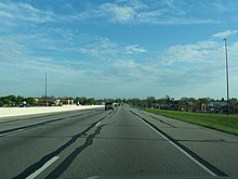
Interstate 465 (I-465), also known as the USS Indianapolis Memorial Highway, is the beltway circling Indianapolis, Indiana, United States. It is roughly rectangular in shape and has a perimeter of approximately 53 miles (85 km). It lies almost completely within the boundaries of Marion County, except for two short sections on the north leg in Boone and Hamilton counties. It intersects with I-65, I-69, I-70, and I-74 and provides additional access to I-65 via I-865.
Interstate 865 (I-865) is an east–west auxiliary Interstate Highway northwest of Indianapolis, Indiana. It is a short connector between I-65 and I-465, running for five miles (8.0 km) and completely concurrent with U.S. Route 52 (US 52). The highway was originally numbered as a branch of I-465 but was renumbered in 2002 to prevent I-465 from intersecting with itself. This section was previously known as the Dog Leg, and the milemarkers ran from 900 to 905.
Interstate 469 (I-469) is an Interstate Highway in northeastern Indiana. It is an auxiliary route of parent I-69 that also carries portions of US Highway 24 (US 24), US 30, and US 33 around the urban parts of Fort Wayne. It is 30.83 miles (49.62 km) in length. The Interstate was originally conceived as a bypass for US 24 around the south and east ends of Fort Wayne. Due to heavy traffic on US 30 through the city, support was gained to connect the bypass to I-69 on the city's north end. I-469 was given the name Ronald Reagan Expressway in 2005.
State Road 1 (SR 1) is a north–south state highway in eastern Indiana, consisting of two segments. Its southern segment begins at U.S. Highway 50 and Interstate 275 in east-central Dearborn County, just east of Lawrenceburg, and ends at Interstate 469 south of Fort Wayne. Its northern segment begins at Interstate 69 on Fort Wayne's north side, and ends at U.S. Route 20 in east-central Steuben County, approximately 6 miles (9.7 km) east of Angola.
State Road 67 in the U.S. State of Indiana cuts a diagonal route from southwest to northeast across the state from the north side of Vincennes to Indianapolis to the Ohio state line, where it becomes State Route 29 east of Bryant.
U.S. Route 30 (US 30) is a road in the United States Numbered Highway System that runs from Astoria, Oregon, to Atlantic City, New Jersey. In Indiana, the route runs from the Illinois state line at Dyer to the Ohio state line east of Fort Wayne and New Haven. The 155.96 miles (250.99 km) of US 30 that lie within Indiana serve as a major conduit. The entire length of U.S. Route 30 in Indiana is included in the National Highway System (NHS). The highway includes four-lane, rural sections, an urbanized, four-lane divided expressway, and several high-traffic, six-lane freeway areas. First designated as a US Highway in 1926, US 30 replaced the original State Road 2 (SR 2) and SR 44 designation of the highway which dated back to the formation of the Indiana State Road system. A section of the highway originally served as part of the Lincoln Highway. Realignment and construction projects have expanded the highway to four lanes across the state, and the road is now part of a long stretch of US 30 from New Lenox, Illinois, to Canton, Ohio, where the road has at least four lanes. There are over 40 traffic signals between I-65 at Merrillville and I-69 at Fort Wayne.
State Road 25 is a highway in the U. S. state of Indiana. Although it is designated a north–south road, in practice it travels generally northeast from its southern terminus at State Road 32 to its northern terminus at State Road 15 in Warsaw.
Interstate 94 (I-94) is a part of the Interstate Highway System that runs from Billings, Montana, to Port Huron, Michigan. I-94 enters Indiana from Illinois in the west, in Munster, and runs generally eastward through Hammond, Gary, and Portage, before entering Michigan northeast of Michigan City. The Interstate runs for approximately 45.8 miles (73.7 km) through the state. The landscape traversed by I-94 includes urban areas of Northwest Indiana, wooded areas, and farmland. The section of I-94 between the Illinois state line and Lake Station is named the Frank Borman Expressway.
U.S. Route 41 (US 41) in the state of Indiana is a north–south US Highway that is parallel to the Illinois state line. It enters the state south of Evansville as a four-lane divided highway passing around Vincennes and traveling north to Terre Haute. In Terre Haute, it is known as 3rd Street. North of Terre Haute, it hooks east and becomes a two-lane surface road. Those wanting to stay on a four-lane divided highway can use State Road 63 to the west. It passes through Rockville, Veedersburg, and Attica before returning to a four-lane divided highway when SR 63 terminates in Warren County. It remains a four-lane divided highway until Lake County, where it becomes a main road known as Indianapolis Boulevard. It overlaps US 12 and US 20 in Hammond and exits Indiana into the South Side of Chicago.
Interstate 70 (I-70) in the US state of Indiana travels east–west across the central portion of the state, passing through the capital of Indianapolis. I-70 crosses from Illinois into Indiana near Terre Haute and departs into Ohio at Richmond. It covers 156.6 miles (252.0 km) in Indiana, paralleling U.S. Highway 40 (US 40), the old National Road.
Interstate 69 (I-69) currently has two discontinuous segments of freeway in the US state of Indiana. The original 157.8-mile-long (254.0 km) highway, completed in November 1971, runs northeasterly from the state capital of Indianapolis, to the city of Fort Wayne, and then proceeds north to the state of Michigan. This original segment is also known as segment of independent utility 1 (SIU 1) in the national plan for expansion of I-69.
U.S. Route 27 (US 27) is a part of the United States Numbered Highway System that runs from Miami, Florida, to Fort Wayne in the U.S. state of Indiana. In Indiana, it is a state road that enters the state in College Corner, Ohio, and West College Corner. The 117.765 miles (189.524 km) of US 27 that lie within Indiana serve as a major conduit. Most of the highway is listed on the National Highway System. Various sections are a rural two-lane highway or an urbanized four-lane divided highway. The northernmost community along the highway is Fort Wayne in the northeast part of the state. The highway ends at an interchange with Interstate 69 (I-69) north of downtown Fort Wayne after serving the east central and northeast regions of Indiana.
Interstate 74 (I-74) in the US state of Indiana traverses central parts of the state from west to east. It connects Champaign, Illinois, with Indianapolis in the center of the state, and Indianapolis with Cincinnati, Ohio. I-74 covers 171.54 miles (276.07 km) across Indiana, a portion of which is concurrently routed through Indianapolis along the southern and western legs of I-465.
Transportation in Indianapolis consists of a complex network that includes a local public bus system, several private intercity bus providers, Amtrak passenger rail service, four freight rail lines, an Interstate Highway System, an airport, a heliport, bikeshare system, 115 miles (185 km) of bike lanes, and 116 miles (187 km) of trails and greenways. The city has also become known for its prevalence of electric scooters.
U.S. Route 31 (US 31) is a part of the United States Numbered Highway System that runs from Spanish Fort, Alabama, to Mackinaw City, Michigan. It enters the U.S. state of Indiana via the George Rogers Clark Memorial Bridge between Louisville, Kentucky, and Clarksville, Indiana. The 266.02 miles (428.12 km) of US 31 that lie within Indiana serve as a major conduit. Some of the highway is listed on the National Highway System. Various sections are rural two-lane highway and urbanized four- or six-lane divided expressway. The northernmost community along the highway is South Bend near the Michigan state line.
U.S. Route 24 (US 24) in Indiana runs east from the Illinois state line to Huntington. At Huntington, US 24 turns northeast and runs to Fort Wayne; it then runs concurrently with Interstate 69 (I-69) and I-469 to bypass the city before entering Ohio at the state line east of Fort Wayne. The segment of US 24 between Logansport and Toledo, Ohio, is part of the Hoosier Heartland Industrial Corridor project of the Intermodal Surface Transportation Efficiency Act.
U.S. Route 231 is the longest numbered highway in Indiana, covering over 284 miles (457 km). It is a main north–south highway in the western part of the state. The southern terminus of US 231 is at the Kentucky state line and the northern terminus is at US 41 just south of St. John. The highway is a mixture of expressway and two-lane roadway. The expressway portions exist mainly in southern Indiana and around the Lafayette area, with the rest mainly being two lanes.