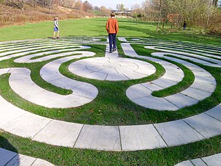
Jo Allyn Lowe Park (32 acres) is a public park, with arboretum, located at the corner of Price Road and Locust Road, Bartlesville, Oklahoma, United States. It is open to the public daily.
The park was created in 1980 and named to honor the founder of the Bartlesville Boys Club. It consists of a lake (with fishing pier), tallgrass prairie, and arboretum. The arboretum contains hundreds of species of trees, mostly planted as memorials.
This is an entrance point to Pathfinder Parkway, a bicycle/jogging/walking path that now extends south into Colonial Housing Addition, but the majority heads north toward Johnstone Park and connects to other parts of the Parkway.

Washington County is a county located in the northeastern part of the U.S. state of Oklahoma. As of the 2010 census, the population was 50,976. Its county seat is Bartlesville. Named for President George Washington, it is the second smallest county in Oklahoma in total area, adjacent to the largest county in Oklahoma, Osage County.

Temple Hills is an unincorporated area and census-designated place (CDP) in Prince George's County, Maryland, United States. Temple Hills borders the communities of Hillcrest Heights, Marlow Heights, Camp Springs and Oxon Hill. As of the 2010 census it had a population of 7,852.
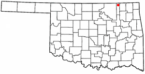
Copan is a town in Washington County, Oklahoma, United States. The population was 733 at the 2010 census, a decrease of 7.9 percent from 796 at the 2000 census.

Stony Creek is a town in Sussex County, Virginia, United States. The population was 198 at the 2010 census.

Bartlesville is a city mostly in Washington County in the U.S. state of Oklahoma. The population was 35,750 at the 2010 census, with a 2018 estimate of 36,423 according to the U.S. Census Bureau. Bartlesville is 47 miles (76 km) north of Tulsa and 18 miles (29 km) south of the Kansas border. It is the county seat of Washington County. The Caney River runs through Bartlesville.

The Baltimore–Washington Parkway is a highway in the U.S. state of Maryland, running southwest from Baltimore to Washington, D.C. The road begins at an interchange with U.S. Route 50 (US 50) near Cheverly in Prince George's County at the D.C. border, and continues northeast as a parkway maintained by the National Park Service (NPS) to MD 175 near Fort Meade, serving many federal institutions. This portion of the parkway is dedicated to Gladys Noon Spellman, a representative of Maryland's 5th congressional district, and has the unsigned Maryland Route 295 (MD 295) designation. Commercial vehicles, including trucks, are prohibited within this stretch. This section is administered by the NPS's Greenbelt Park unit. After leaving park service boundaries the highway is maintained by the state and signed with the MD 295 designation. This section of the parkway passes near Baltimore–Washington International Thurgood Marshall Airport. Upon entering Baltimore, the Baltimore Department of Transportation takes over maintenance of the road and it continues north to an interchange with Interstate 95 (I-95). Here, the Baltimore–Washington Parkway ends and MD 295 continues north unsigned on Russell Street, which carries the route north into downtown Baltimore. In downtown Baltimore, MD 295 follows Paca Street northbound and Greene Street southbound before ending at US 40.
The Hutchinson River Parkway is a north–south parkway in southern New York in the United States. It extends for 18.71 miles (30.11 km) from the massive Bruckner Interchange in the Throggs Neck section of the Bronx to the New York–Connecticut state line at Rye Brook. The parkway continues south from the Bruckner Interchange as the Whitestone Expressway (Interstate 678) and north into Greenwich, Connecticut, as the Merritt Parkway. The roadway is named for the Hutchinson River, a short 10 mile (16 km)-long stream in southern Westchester County that the road follows alongside. The river, in turn, was named for English colonial religious leader Anne Hutchinson.

Northeast is the northeastern quadrant of Washington, D.C., the capital of the United States. It encompasses the area located north of East Capitol Street and east of North Capitol Street.

Washington Park is a public park in Seattle, Washington, United States, most of which is taken up by the Washington Park Arboretum, a joint project of the University of Washington, the Seattle Parks and Recreation, and the nonprofit Arboretum Foundation. Washington Park also includes a playfield and the Seattle Japanese Garden in its southwest corner. The entire length of Arboretum Creek is within the park.
The Itha T. Krumme Memorial Arboretum is an arboretum located at West 25th and Stanton Lake Park Road, next to Stanton Lake Park, northwest of Falls City, Nebraska. It is open without charge during daylight hours.
The Kentucky Horse Park Arboretum is a newly certified arboretum located on the grounds of the Kentucky Horse Park, 4089 Iron Works Parkway, Lexington, Kentucky, United States. An admission fee is charged for the Horse Park. Guided tours of the arboretum are given at 3:00 p.m. on the last Sunday of each month, but self-guided tours may be taken at any time.
Lake Erie Arboretum is a young arboretum located within Frontier Park, at the intersection of West 8th Street and Bayfront Parkway, Erie, Pennsylvania, United States. It is open to the public daily free of charge.
The Heckscher State Parkway is an 8.24-mile-long (13.26 km) parkway on Long Island, New York, in the United States. The parkway, located entirely within the Suffolk County town of Islip, begins at the south end of the Sagtikos State Parkway in West Islip, from where it continues west as the Southern State Parkway. It proceeds east as a six-lane parkway through Brentwood and Central Islip, loosely paralleling New York State Route 27 (NY 27). At Islip Terrace, the Heckscher Parkway turns southward, crossing NY 27 before ending at the toll barrier for Heckscher State Park in Great River. The parkway comprises the eastern portion of New York State Route 908M (NY 908M), an unsigned reference route, with the Southern State Parkway occupying the western section. In order to avoid confusion, the highway is signed as an extension of the Southern State Parkway west of the NY 27 interchange.
Pathfinder Parkway is a 12-mile (19 km) walking, jogging and biking trail that traverses Bartlesville, Oklahoma.

The Osage Hills is a hilly area in Oklahoma, commonly known as The Osage. The name refers to the broad rolling hills and rolling tallgrass prairie and Cross Timbers encompassing Osage County and surrounding areas, including portions of Mayes, Tulsa, Washington and Kay Counties. The Osage is the southern extension of the Flint Hills of Kansas.
Tidewater Arboretum, sometimes also called Hampton Roads Arboretum, is an arboretum maintained by Virginia Tech's Hampton Roads Agricultural Research and Extension Center. It is located at 1444 Diamond Springs Road, Virginia Beach, Virginia, and open daily without charge.

Bartlesville High School is a public high school located in Bartlesville, Oklahoma. Built in 1939, it was originally called College High School, and until 1950 housed a junior college as well as the high school. Its Streamline Moderne building was designed by Tulsa architect John Duncan Forsyth. In 1982 Sooner High School and College High School unified to create Bartlesville High School at the former College High School site. The first graduating class of Bartlesville High School was in 1983.
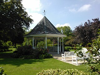
Duck Creek Park and Golf Course is located on the east side of Davenport, Iowa, United States. The property was originally a private arboretum south of Duck Creek. It was developed in the 1930s as a public works project during the Great Depression. The 211-acre (0.85 km2) park features picnic shelters, tennis courts, playground, a public golf course and Duck Creek Lodge. The Stampe Lilac Garden and Gazebo is a popular location for weddings. The park connects with the Duck Creek Parkway.

La Mesilla is a census-designated place in Río Arriba County, New Mexico, United States. Its population was 1,772 as of the 2010 census.