Jomalig

Last updated

Jomalig
Municipality of Jomalig
Panoramic Paradise.jpg
Lingayen Cove
Flag of Jomalig, Quezon.png
Jomalig, Quezon Official Seal.png
Ph locator quezon jomalig.png
Map of Quezon with Jomalig highlighted
OpenStreetMap
Jomalig
Philippines location map (square).svg
Red pog.svg
Jomalig
Location within the Philippines
Coordinates: 14°41′46″N122°19′52″E / 14.696°N 122.331°E / 14.696; 122.331
Country Philippines
Region Calabarzon
Province Quezon
District 1st district
Founded June 18, 1961 [1]
Barangays 5 (see Barangays)
Government
[2]
  Type Sangguniang Bayan
   Mayor Nelmar T. Sarmiento
   Vice Mayor Charito A. Manlangit
   Representative Wilfrido Mark M. Enverga
   Municipal Council
Members
   Electorate 5,231 voters (2022)
Area
[3]
  Total56.65 km2 (21.87 sq mi)
Elevation
0 m (0 ft)
Highest elevation
96 m (315 ft)
Lowest elevation
0 m (0 ft)
Population
 (2020 census) [4]
  Total7,667
  Density140/km2 (350/sq mi)
   Households
1,834
Demonym Jomaligin
Economy
   Income class 5th municipal income class
   Poverty incidence
25.77
% (2018) [5]
   Revenue 63.3 million (2020)
   Assets 97.02 million (2020)
   Expenditure 51.94 million (2020)
   Liabilities 39.56 million (2020)
Service provider
  ElectricityQuezon 2 Electric Cooperative (QUEZELCO 2)
Time zone UTC+8 (PST)
ZIP code
4342
PSGC
IDD : area code +63(0)42
Native languages Tagalog

Jomalig, officially the Municipality of Jomalig (Tagalog : Bayan ng Jomalig), is a 5th class municipality in the province of Quezon, Philippines. According to the 2020 census, it has a population of 7,667 people. [4]

Contents

It is the least populated municipality in the province. It is part of the Polillo Islands.

History

Aerial view of Jomalig island, 1933 Landing Fields - Philippines - Jomalig Island - NARA - 68160566.jpg
Aerial view of Jomalig island, 1933
A beach in Jomalig Golden Paradise of the South East.jpg
A beach in Jomalig

Although many old Jomaligins (its people) do not know or could not remember where Jomalig derived its name, there are few old residents who still remember the legend from their ancestors. Based on the story, there was a Datu who lived in island and had a beautiful daughter. A young man from a neighboring island wanted to marry the princess but Datu didn't agree with it. The Datu said that he will only give his daughter if the young man can roam the island in just one day and successfully shoot three fishes in every pond on the island. The young man took the Datu's challenge. After he roamed the island, he almost finished the marathon, but in the end, failed to do so because he nearly died. He arrived at the finish line hopelessly and at this point, he requested the princess to kiss him as the only reward he could receive. The people in island witnessed what happened she kissed the young man and they shouted: "humalik" (They kissed). From that time on, the people on the island named the island "Humalik". Many years passed and the Humalik become Jomalig. Many old residents say that the Americans changed it when they conquered the Philippines.

Due to the geographical location of Jomalig, the district found it difficult to be recognized and established which further contributed to its slow development. It was only in the year 1952 when Jomalig, Quezon was subdivided for agricultural and residential lots sponsored by Mayor Mamerto P. Azarias and the Municipal Council.

Only through the inauguration by then Congressman Manuel S. Enverga did the civic leaders geared towards self-reliance. It instigated them towards development in agriculture and with this, many people from the Bicol Region migrated for richer pastures and an uplifted livelihood.

Jomalig Island was a former barrio of Polillo, but on January 22, 1961, with the enactment of Republic Act. No. 3372, Jomalig Island was separated from the municipal district of Polillo, Quezon.

Geography

Jomalig Island is about 75 nautical miles (139 km) southeast of Polillo Islands. Mostly, the land of Jomalig is cultivated for agricultural land use. Most of the inhabitants of this island depend on coconut products, rice, fish and other root crops. Considered one of the smallest and farthest island municipalities of Quezon Province, its land area is at 5,665 hectares (14,000 acres). Some of its land have been alienated and is dedicated mostly on coconut land which is at 3,104.0 hectares with 2,605 hectares which comprises forests, swamps and grassland.

The inhabitants of this municipality originates from different ethnic groups similar to those of from Eastern Samar, Bohol, Sorsogon, Catanduanes, Camarines Sur and Camarines Norte and mostly from Quezon Province.

Barangays

Jomalig is politically subdivided into 5 barangays. Each barangay consists of puroks and some have sitios.

Climate

Climate data for Jomalig, Quezon
MonthJanFebMarAprMayJunJulAugSepOctNovDecYear
Average high °C (°F)26
(79)
27
(81)
29
(84)
31
(88)
31
(88)
30
(86)
29
(84)
29
(84)
29
(84)
29
(84)
28
(82)
27
(81)
29
(84)
Average low °C (°F)22
(72)
22
(72)
22
(72)
23
(73)
24
(75)
24
(75)
24
(75)
24
(75)
24
(75)
24
(75)
24
(75)
23
(73)
23
(74)
Average precipitation mm (inches)51
(2.0)
35
(1.4)
37
(1.5)
39
(1.5)
91
(3.6)
131
(5.2)
168
(6.6)
132
(5.2)
162
(6.4)
184
(7.2)
166
(6.5)
101
(4.0)
1,297
(51.1)
Average rainy days13.410.511.812.019.824.126.725.125.323.921.217.6231.4
Source: Meteoblue [6]

Demographics

Population census of Jomalig
YearPop.±% p.a.
1970 2,862    
1975 4,014+7.02%
1980 3,972−0.21%
1990 4,542+1.35%
1995 4,371−0.72%
2000 5,817+6.32%
2007 6,111+0.68%
2010 6,884+4.43%
2015 7,417+1.43%
2020 7,667+0.65%
Source: Philippine Statistics Authority [7] [8] [9] [10]

Economy


See also

Related Research Articles

<span class="mw-page-title-main">Mabini, Batangas</span> Municipality in Batangas, Philippines

Mabini, officially the Municipality of Mabini, is a 1st class municipality in the province of Batangas, Philippines. According to the 2020 census, it has a population of 50,858 people.

<span class="mw-page-title-main">Real, Quezon</span> Municipality in Quezon, Philippines

Real, officially the Municipality of Real, is a 1st class municipality in the province of Quezon, Philippines. According to the 2020 census, it has a population of 38,678 people.

<span class="mw-page-title-main">Polillo, Quezon</span> Municipality in Quezon, Philippines

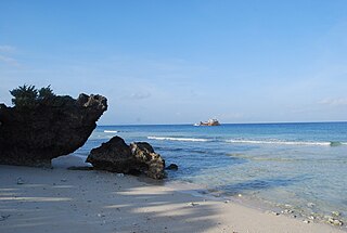
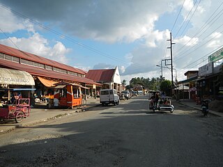
Polillo, officially the Municipality of Polillo, is a 3rd class municipality in the province of Quezon, Philippines. According to the 2020 census, it has a population of 31,908 people.

<span class="mw-page-title-main">San Pascual, Batangas</span> Municipality in Batangas, Philippines

San Pascual, officially the Municipality of San Pascual, is a 1st class municipality in the province of Batangas, Philippines. According to the 2020 census, it has a population of 69,009 making it as the 9th most populous municipality in the province.

<span class="mw-page-title-main">Alitagtag</span> Municipality in Batangas, Philippines

Alitagtag, officially the Municipality of Alitagtag, is a 4th class municipality in the province of Batangas, Philippines. According to the 2020 census, it has a population of 26,819 people.

<span class="mw-page-title-main">Balete, Batangas</span> Municipality in Batangas, Philippines

Balete, officially the Municipality of Balete, is a 5th class municipality in the province of Batangas, Philippines. According to the 2020 census, it has a population of 24,055 people. The people from Balete is called Baleteños.

<span class="mw-page-title-main">Cuenca, Batangas</span> Municipality in Batangas, Philippines

Cuenca, officially the Municipality of Cuenca, is a 4th class municipality in the province of Batangas, Philippines. According to the 2020 census, it has a population of 36,235 people.

<span class="mw-page-title-main">Lobo, Batangas</span> Municipality in Batangas, Philippines

Lobo, officially the Municipality of Lobo, is a 3rd class municipality in the province of Batangas, Philippines. According to the 2020 census, it has a population of 40,736 people.

<span class="mw-page-title-main">Padre Garcia</span> Municipality in Batangas, Philippines

Padre Garcia, officially the Municipality of Padre Garcia, is a 2nd class municipality in the province of Batangas, Philippines. According to the 2020 census, it has a population of 51,853 people.

<span class="mw-page-title-main">San Luis, Batangas</span> Municipality in Batangas, Philippines

San Luis, officially the Municipality of San Luis, is a 4th class municipality in the province of Batangas, Philippines. According to the 2020 census, it has a population of 36,172 people.

<span class="mw-page-title-main">Santa Teresita, Batangas</span> Municipality in Batangas, Philippines

Santa Teresita, officially the Municipality of Santa Teresita, is a 5th class municipality in the province of Batangas, Philippines. According to the 2020 census, it has a population of 21,559 people.

<span class="mw-page-title-main">Taysan</span> Municipality in Batangas, Philippines

Taysan, officially the Municipality of Taysan, is a 2nd class municipality in the province of Batangas, Philippines. According to the 2020 census, it has a population of 40,146 people.

<span class="mw-page-title-main">Tingloy</span> Municipality in Batangas, Philippines

Tingloy, officially the Municipality of Tingloy, is a 5th class municipality in the province of Batangas, Philippines. According to the 2020 census, it has a population of 19,215 people.

<span class="mw-page-title-main">Burdeos</span> Municipality in Quezon, Philippines

Burdeos, officially the Municipality of Burdeos, is a 4th class municipality in the province of Quezon, Philippines. According to the 2020 census, it has a population of 24,644 people.

<span class="mw-page-title-main">Panukulan</span> Municipality in Quezon, Philippines

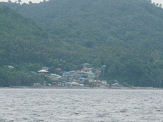
Panukulan, officially the Municipality of Panukulan, is a 4th class municipality in the province of Quezon, Philippines. According to the 2020 census, it has a population of 16,376 people. It is located in the northwestern part of the island of Polillo in the Polillo Islands.

<span class="mw-page-title-main">Patnanungan</span> Municipality in Quezon, Philippines

Patnanungan, officially the Municipality of Patnanungan, is a 5th class municipality in the province of Quezon, Philippines. According to the 2020 census, it has a population of 15,052 people.

<span class="mw-page-title-main">Quezon, Quezon</span> Municipality in Quezon, Philippines

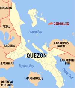
Quezon, officially the Municipality of Quezon, is a 5th class municipality in the province of the same name. According to the 2020 census, it has a population of 15,886 people.

<span class="mw-page-title-main">San Andres, Quezon</span> Municipality in Quezon, Philippines

San Andres, officially the Municipality of San Andres, is a 4th class municipality in the province of Quezon, Philippines. According to the 2020 census, it has a population of 37,454 people.

<span class="mw-page-title-main">San Francisco, Quezon</span> Municipality in Quezon, Philippines

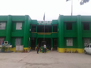
San Francisco, officially the Municipality of San Francisco, is a 2nd class municipality in the province of Quezon, Philippines. According to the 2020 census, it has a population of 62,097 people.

<span class="mw-page-title-main">Tagkawayan</span> Municipality in Quezon, Philippines

Tagkawayan, officially the Municipality of Tagkawayan, is a 1st class municipality in the province of Quezon, Philippines. According to the 2020 census, it has a population of 54,003 people.

References

  1. "R.A. No. 3372: An Act Creating the Municipal District of Jumalig in the Province of Quezon". June 18, 1961.
  2. Municipality of Jomalig | (DILG)
  3. "2015 Census of Population, Report No. 3 – Population, Land Area, and Population Density" (PDF). Philippine Statistics Authority. Quezon City, Philippines. August 2016. ISSN   0117-1453. Archived (PDF) from the original on May 25, 2021. Retrieved July 16, 2021.
  4. 1 2 Census of Population (2020). "Region IV-A (Calabarzon)". Total Population by Province, City, Municipality and Barangay. Philippine Statistics Authority . Retrieved July 8, 2021.
  5. "PSA Releases the 2018 Municipal and City Level Poverty Estimates". Philippine Statistics Authority. December 15, 2021. Retrieved January 22, 2022.
  6. "Jomalig: Average Temperatures and Rainfall". Meteoblue. Retrieved January 27, 2020.
  7. Census of Population (2015). "Region IV-A (Calabarzon)". Total Population by Province, City, Municipality and Barangay. Philippine Statistics Authority . Retrieved June 20, 2016.
  8. Census of Population and Housing (2010). "Region IV-A (Calabarzon)". Total Population by Province, City, Municipality and Barangay. National Statistics Office . Retrieved June 29, 2016.
  9. Censuses of Population (1903–2007). "Region IV-A (Calabarzon)". Table 1. Population Enumerated in Various Censuses by Province/Highly Urbanized City: 1903 to 2007. National Statistics Office.
  10. "Province of". Municipality Population Data. Local Water Utilities Administration Research Division. Retrieved December 17, 2016.
  11. "Poverty incidence (PI):". Philippine Statistics Authority. Retrieved December 28, 2020.
  12. "Estimation of Local Poverty in the Philippines" (PDF). Philippine Statistics Authority. November 29, 2005.
  13. "2003 City and Municipal Level Poverty Estimates" (PDF). Philippine Statistics Authority. March 23, 2009.
  14. "City and Municipal Level Poverty Estimates; 2006 and 2009" (PDF). Philippine Statistics Authority. August 3, 2012.
  15. "2012 Municipal and City Level Poverty Estimates" (PDF). Philippine Statistics Authority. May 31, 2016.
  16. "Municipal and City Level Small Area Poverty Estimates; 2009, 2012 and 2015". Philippine Statistics Authority. July 10, 2019.
  17. "PSA Releases the 2018 Municipal and City Level Poverty Estimates". Philippine Statistics Authority. December 15, 2021. Retrieved January 22, 2022.