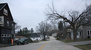
Taylor County is a county in the U.S. state of Wisconsin. As of the 2010 census, the population was 20,689. Its county seat is Medford.

Ruby is a town in Chippewa County in the U.S. state of Wisconsin. The population was 494 at the 2010 census. The unincorporated communities of Arnold and Ruby are located in the town.

Roxbury is a town in Dane County, Wisconsin, United States. The population was 1,700 at the 2000 census. The unincorporated communities of Alden Corners and Roxbury are located in the town. The unincorporated community of Lutheran Hill is also located partially in the town.

Red River is a town in Kewaunee County, Wisconsin, United States. The population was 1,476 at the 2000 census. The unincorporated communities of Bay View, Duvall, Frog Station, Thiry Daems, and Tonet are located in the town. The census-designated place of Dyckesville is also located partially in the town.

The Peshtigo fire was a very large forest fire that took place on Sunday, October 8, 1871, in northeastern Wisconsin, including much of the Door Peninsula, and adjacent parts of the Upper Peninsula of Michigan. The largest community in the affected area was Peshtigo, Wisconsin. It burned approximately 1,200,000 acres (490,000 ha) and was the deadliest wildfire in American history, with the estimated deaths of around 1,500 people, and possibly as many as 2,500.

The Dells of the Wisconsin River, also called the Wisconsin Dells, is a 5-mile (8-km) gorge on the Wisconsin River in south-central Wisconsin, USA. It is noted for its scenic beauty, in particular for its unique Cambrian sandstone rock formations and tributary canyons.

Jump River is an unincorporated census-designated place located in the towns of Jump River and McKinley in Taylor County, Wisconsin, United States. It is located on the north bank of the Jump River, from which the hamlet takes its name. As of the 2010 census, its population was 52.

North American telephone area codes 715 and 534 are state of Wisconsin area codes covering most of the northern part of the state.

Alpha is an unincorporated community in the town of Wood River, Burnett County, Wisconsin, United States. The community is located in the western part of the county, in northwestern Wisconsin. There are fewer than a dozen households in the community.

Sinsinawa is an unincorporated community in Grant County, Wisconsin, United States. The community is in the towns of Jamestown and Hazel Green, one mile north of the border with Illinois. The community is 7 1⁄2 miles (12.1 km) east of Dubuque, Iowa, and 6 1⁄2 miles (10.5 km) west of the village of Hazel Green, Wisconsin. The town is best known for being the mother house of the Sinsinawa Dominican Sisters.

Victory is an unincorporated community in the Town of Wheatland in Vernon County, Wisconsin. It is located 4.5 miles north of De Soto and 6.2 miles south of Genoa on the Mississippi River along the Great River Road.

The Gogebic Range is an elongated area of iron ore deposits located within a range of hills in northern Michigan and Wisconsin just south of Lake Superior. It extends from Lake Namakagon in Wisconsin eastward to Lake Gogebic in Michigan, or almost 80 miles. Though long, it is only about a half mile wide and forms a crescent concave to the southeast. The Gogebic Range includes the communities of Ironwood in Michigan, plus Mellen and Hurley in Wisconsin.

Franklin is an unincorporated community in the town of Herman in Sheboygan County, Wisconsin, United States. Franklin is located at the intersection of County M and the Sheboygan River about 1 mile (1 km) from Lakeland College. The Franklin Feed Mill is listed on the National Register of Historic Places. The town hall for Herman is located inside the community.

Hayton is an unincorporated community in the town of Charlestown, Calumet County, Wisconsin, United States. It is located a few miles (kilometers) east of Chilton at the intersection of U.S. Route 151 and County T.

Rib Falls is an unincorporated community located in the town of Rib Falls, Marathon County, Wisconsin, United States. Rib Falls is located on the Big Rib River at the junction of County Highways S and U, 4.5 miles (7.2 km) northwest of Marathon City. The community was named for the river, which takes its name from the English translation of the original Ojibwa name O-pik-wun-a Se-be.

Black River is an unincorporated community located in the town of Superior, Douglas County, Wisconsin, United States.

Sinnipee is a former settlement in Grant County, Wisconsin, United States. Sinnipee was a port community on the Mississippi River at the mouth of the Sinnipee Creek; it played a significant role in the lead trade. The community was first settled prior to 1832 by Payton Vaughan of North Carolina and was founded by the Sinnipee Company in 1835. A hotel called the Old Stone House opened in the community in 1839; both US president Zachary Taylor and Confederate president Jefferson Davis stayed at the hotel during its operation. The community suffered a flood and an outbreak of fever in 1840, which hurt the town's businesses; all but two families left Sinnipee, and by 1859, only one building remained in the town's business district. After a fire, the hotel was dismantled to build a dam on the Mississippi River. The community was located in the town of Jamestown. In 1934, the site of the community was flooded due to the construction of Lock and Dam No. 11 on the Mississippi.


