Kuderewszczyzna is a village in the administrative district of Gmina Dąbrowa Białostocka, within Sokółka County, Podlaskie Voivodeship, in north-eastern Poland. It lies approximately 9 kilometres (6 mi) north-west of Dąbrowa Białostocka, 37 km (23 mi) north-west of Sokółka, and 64 km (40 mi) north of the regional capital Białystok.
Chyszówki is a village in the administrative district of Gmina Dobra, within Limanowa County, Lesser Poland Voivodeship, in southern Poland.

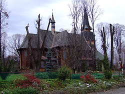
Dobra is a village in Limanowa County, Lesser Poland Voivodeship, in southern Poland. It is the seat of the gmina called Gmina Dobra. It lies approximately 13 kilometres (8 mi) west of Limanowa and 45 km (28 mi) south-east of the regional capital Kraków.
Gruszowiec is a village in the administrative district of Gmina Dobra, within Limanowa County, Lesser Poland Voivodeship, in southern Poland. It lies approximately 5 kilometres (3 mi) west of Dobra, 17 km (11 mi) west of Limanowa, and 45 km (28 mi) south-east of the regional capital Kraków.
Półrzeczki is a village in the administrative district of Gmina Dobra, within Limanowa County, Lesser Poland Voivodeship, in southern Poland. It lies approximately 6 kilometres (4 mi) south of Dobra, 15 km (9 mi) west of Limanowa, and 49 km (30 mi) south-east of the regional capital Kraków.
Przenosza is a village in the administrative district of Gmina Dobra, within Limanowa County, Lesser Poland Voivodeship, in southern Poland. It lies approximately 9 kilometres (6 mi) north-west of Dobra, 21 km (13 mi) west of Limanowa, and 37 km (23 mi) south-east of the regional capital Kraków.
Stróża is a village in the administrative district of Gmina Dobra, within Limanowa County, Lesser Poland Voivodeship, in southern Poland. It lies approximately 17 kilometres (11 mi) west of Limanowa and 40 km (25 mi) south-east of the regional capital Kraków.
Wilczyce is a village in the administrative district of Gmina Dobra, within Limanowa County, Lesser Poland Voivodeship, in southern Poland. It lies approximately 7 kilometres (4 mi) south-west of Dobra, 18 km (11 mi) west of Limanowa, and 46 km (29 mi) south-east of the regional capital Kraków.
Wola Skrzydlańska is a village in the administrative district of Gmina Dobra, within Limanowa County, Lesser Poland Voivodeship, in southern Poland. It lies approximately 19 kilometres (12 mi) west of Limanowa and 39 km (24 mi) south-east of the regional capital Kraków.

Nowe Rybie is a village in the administrative district of Gmina Limanowa, within Limanowa County, Lesser Poland Voivodeship, in southern Poland. It lies approximately 12 kilometres (7 mi) north-west of Limanowa and 42 km (26 mi) south-east of the regional capital Kraków.
Roztoka is a village in the administrative district of Gmina Łukowica, within Limanowa County, Lesser Poland Voivodeship, in southern Poland. It lies approximately 3 kilometres (2 mi) west of Łukowica, 10 km (6 mi) south of Limanowa, and 62 km (39 mi) south-east of the regional capital Kraków.

Glisne is a village in the administrative district of Gmina Mszana Dolna, within Limanowa County, Lesser Poland Voivodeship, in southern Poland. It lies approximately 3 kilometres (2 mi) west of Mszana Dolna, 29 km (18 mi) west of Limanowa, and 45 km (28 mi) south of the regional capital Kraków.
Zamieście is a village in the administrative district of Gmina Tymbark, within Limanowa County, Lesser Poland Voivodeship, in southern Poland. It lies approximately 2 kilometres (1 mi) east of Tymbark, 7 km (4 mi) north-west of Limanowa, and 47 km (29 mi) south-east of the regional capital Kraków.
Wielgolas is a village in the administrative district of Gmina Obryte, within Pułtusk County, Masovian Voivodeship, in east-central Poland. It lies approximately 4 kilometres (2 mi) south of Obryte, 11 km (7 mi) east of Pułtusk, and 55 km (34 mi) north of Warsaw.
Krosna is a village in the administrative district of Gmina Laskowa, within Limanowa County, Lesser Poland Voivodeship, in southern Poland. It lies approximately 7 kilometres (4 mi) east of Laskowa, 12 km (7 mi) north-east of Limanowa, and 53 km (33 mi) south-east of the regional capital Kraków.
Dąbrowica is a village in the administrative district of Gmina Dobra, within Turek County, Greater Poland Voivodeship, in west-central Poland. It lies approximately 8 kilometres (5 mi) north-east of Dobra, 15 km (9 mi) south-east of Turek, and 131 km (81 mi) south-east of the regional capital Poznań.
Rzechta is a village in the administrative district of Gmina Dobra, within Turek County, Greater Poland Voivodeship, in west-central Poland. It lies approximately 6 kilometres (4 mi) east of Dobra, 19 km (12 mi) south-east of Turek, and 133 km (83 mi) south-east of the regional capital Poznań.
Gorazdowo is a village in the administrative district of Gmina Kołaczkowo, within Września County, Greater Poland Voivodeship, in west-central Poland. It lies approximately 5 kilometres (3 mi) east of Kołaczkowo, 14 km (9 mi) south-east of Września, and 56 km (35 mi) east of the regional capital Poznań.
Krawno is a village in the administrative district of Gmina Piecki, within Mrągowo County, Warmian-Masurian Voivodeship, in northern Poland. It lies approximately 11 kilometres (7 mi) south-west of Piecki, 21 km (13 mi) south of Mrągowo, and 50 km (31 mi) east of the regional capital Olsztyn.
Krzemienna is a village in the administrative district of Gmina Dobra, within Łobez County, West Pomeranian Voivodeship, in north-western Poland. It lies approximately 6 kilometres (4 mi) west of Dobra, 27 km (17 mi) west of Łobez, and 47 km (29 mi) east of the regional capital Szczecin.