
Yorkshire and the Humber is one of nine official regions of England at the first level of ITL for statistical purposes. The population in 2011 was 5,284,000 with its largest settlements being Leeds, Sheffield, Bradford, Hull, and York.

Wakefield is a cathedral city in West Yorkshire, England located on the River Calder. The city had a population of 109,766 in the 2021 census, up from 99,251 in the 2011 census. The city is the administrative centre of the wider City of Wakefield metropolitan district, which had a 2021 population of 353,368, the 23rd most populous district in England. It is part of the West Yorkshire Built-up Area and the Yorkshire and The Humber region.
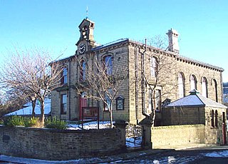
Darton is a large village in the Metropolitan Borough of Barnsley, on the border with West Yorkshire, England. At the time of the 2001 UK census, it had a population of 14,927, increasing to 21,345 for both Darton Wards at the 2011 Census.

Darfield is a village within the Metropolitan Borough of Barnsley, South Yorkshire, England. It is historically part of the West Riding of Yorkshire. The village is situated approximately 4 miles (6 km) east from Barnsley town centre. Darfield had a population of 8,066 at the 2001 UK Census, increasing to 10,685 at the 2011 Census.

Hatfield is a town and civil parish in the City of Doncaster in South Yorkshire, England. It had a population of 17,236 at the 2011 Census. The town is located on the A18 road between Doncaster and Scunthorpe, and to the west of the M18 motorway. It shares a railway station with Stainforth on the line between Goole and Scunthorpe, and Doncaster. Recorded history in the parish extends as far back as 730, when Bede wrote about the Northumbrian King, Edwin, being killed in battle in the area.

Royston is a suburban village within the Metropolitan borough of Barnsley, in South Yorkshire, England. Historically, the village formed part of the West Riding of Yorkshire, but was incorporated into the Metropolitan borough of Barnsley in 1974 and is now on the border with West Yorkshire. It is part of the Barnsley Central borough constituency, and has a population of 10,728. It is situated 4 miles (6.4 km) north-east of Barnsley, and 6 miles (9.7 km) south-east of Wakefield.

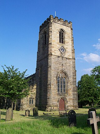
Darton railway station is a railway station in Darton, in the Metropolitan Borough of Barnsley, South Yorkshire, England. Train services are provided by Northern.
Kirkby Overblow is a village and civil parish in the Harrogate district of North Yorkshire, England. It is situated between Wetherby and Harrogate and lies to the west of Sicklinghall and the east of Leeds Bradford International Airport. It has a church called All Saints and a Church of England primary school affiliated with the church. Kirkby Overblow has a bus stop, but no railway station or post office.
Whitley is a village in the Selby district of North Yorkshire, England, close to the Aire and Calder Navigation and the M62 motorway. The population of the village at the 2001 census was recorded as being 574, which had risen to 1,021 by the time of the 2011 census. In 2015, North Yorkshire County Council estimated the population to have risen again to 1,110. It was historically part of the West Riding of Yorkshire until 1974.

Bishop Monkton is a village and civil parish in the Harrogate district of North Yorkshire, England, about five miles south of Ripon. According to the 2001 census it had a population of 775, increasing slightly to 778 at the 2011 Census. In 2015, North Yorkshire County Council estimated the population to be 760.

Burton Leonard is a village and civil parish in the Harrogate district of North Yorkshire, England, and approximately 7 miles (11 km) south from Ripon. In the 2001 Census, the population of the village was 654, which had risen to 690 by the time of the 2011 Census. In 2015, North Yorkshire County Council estimated the population had dropped to 670.

Staincross was a Wapentake (Hundred), which is an administrative division, in the historic county of the West Riding of Yorkshire. It consisted of seven parishes, and included the towns of Barnsley and Penistone
Lofthouse is a village between the cities of Wakefield and Leeds in West Yorkshire, England. The village falls within the Ardsley and Robin Hood ward of the City of Leeds Council. It is in the City of Leeds metropolitan borough but with a Wakefield postal address (WF3). It is mentioned as Locthuse, also as Loftose in the 1086 Domesday Book.
Cottingley is a suburban village within the City of Bradford in West Yorkshire, England between Shipley and Bingley. It is known for the Cottingley Fairies, which appeared in a series of photographs taken there during the early 20th century.

Woolley Edge services is a motorway service station on the M1 motorway within the borough of the City of Wakefield, West Yorkshire, England. It lies between junctions 38 and 39 close to West Bretton and west of the village of Woolley.
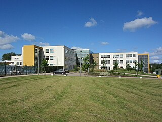
Darton Academy is a coeducational secondary school located in Darton in the Metropolitan Borough of Barnsley, South Yorkshire, England. The school provides education for more than 1,200 pupils in Years 7 to 11.

Thorpe on the Hill is a small village in West Yorkshire, England. The village falls within the Ardsley and Robin Hood ward of the Leeds Metropolitan Council. It was mentioned as "Torp" in the Domesday Book together with neighbouring Carlton, Lofthouse, Middleton, and Rothwell as part of the Morley Hundred in the West Riding.

Sandal Magna or Sandal is a suburb of Wakefield, West Yorkshire, England with a population in 2001 of 5,432. An ancient settlement, it is the site of Sandal Castle and is mentioned in the Domesday Book. It is 2 mi (3.2 km) south from Wakefield, 8 mi (13 km) north of Barnsley. The Battle of Wakefield was fought here in the 15th century during the Wars of the Roses.
Woolley is a village and civil parish in the City of Wakefield in West Yorkshire, England. It had a population of 575 in 2001, which increased to 1,339 at the 2011 Census. It is 6 miles (10 km) north of Barnsley, and 7 miles (11 km) south of Wakefield.

Branton is a village in South Yorkshire, England. It is about 4 miles (6.4 km) east of Doncaster. At the 2011 census, it had a population of 1,992.

