
Gozdanin is a village in the administrative district of Gmina Zgorzelec, within Zgorzelec County, Lower Silesian Voivodeship, in south-western Poland, close to the German border.
Zalesie is a village in the administrative district of Gmina Stolno, within Chełmno County, Kuyavian-Pomeranian Voivodeship, in north-central Poland. It lies 13 kilometres (8 mi) north-east of Stolno, 16 km (10 mi) east of Chełmno, and 40 km (25 mi) north of Toruń.
Bagno is a settlement in the administrative district of Gmina Gródek, within Białystok County, Podlaskie Voivodeship, in north-eastern Poland, close to the border with Belarus.
Głęboka is a village in the administrative district of Gmina Kocmyrzów-Luborzyca, within Kraków County, Lesser Poland Voivodeship, in southern Poland. It lies approximately 18 km (11 mi) north-east of the regional capital Kraków. The village is located in the historical region Galicia.
Strzeżów Drugi is a village in the administrative district of Gmina Miechów, within Miechów County, Lesser Poland Voivodeship, in southern Poland. It lies approximately 4 kilometres (2 mi) north of Miechów and 37 km (23 mi) north of the regional capital Kraków.
Rzechów-Kolonia is a village in the administrative district of Gmina Rzeczniów, within Lipsko County, Masovian Voivodeship, in east-central Poland.
Drewnowo-Ziemaki is a village in the administrative district of Gmina Boguty-Pianki, within Ostrów Mazowiecka County, Masovian Voivodeship, in east-central Poland.
Kolonia Wolanów is a village in the administrative district of Gmina Wolanów, within Radom County, Masovian Voivodeship, in east-central Poland.
Bartosz is a village in the administrative district of Gmina Sokołów Podlaski, within Sokołów County, Masovian Voivodeship, in east-central Poland. It lies approximately 3 kilometres (2 mi) south-west of Sokołów Podlaski and 86 km (53 mi) east of Warsaw.
Paciorkowa Wola Stara is a village in the administrative district of Gmina Zwoleń, within Zwoleń County, Masovian Voivodeship, in east-central Poland.
Dziewczopólko is a village in the administrative district of Gmina Przedecz, within Koło County, Greater Poland Voivodeship, in west-central Poland.
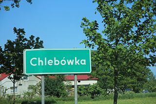
Chlebówka is a village in the administrative district of Gmina Nowy Staw, within Malbork County, Pomeranian Voivodeship, in northern Poland. It lies approximately 3 kilometres (2 mi) east of Nowy Staw, 12 km (7 mi) north of Malbork, and 38 km (24 mi) south-east of the regional capital Gdańsk.
Troszki is a village in the administrative district of Gmina Dębnica Kaszubska, within Słupsk County, Pomeranian Voivodeship, in northern Poland. It lies approximately 7 kilometres (4 mi) east of Dębnica Kaszubska, 18 km (11 mi) south-east of Słupsk, and 89 km (55 mi) west of the regional capital Gdańsk.
Przytuły is a village in the administrative district of Gmina Ełk, within Ełk County, Warmian-Masurian Voivodeship, in northern Poland. It lies approximately 13 kilometres (8 mi) north of Ełk and 125 km (78 mi) east of the regional capital Olsztyn.
Kiersztanowo is a village in the administrative district of Gmina Grunwald, within Ostróda County, Warmian-Masurian Voivodeship, in northern Poland. It lies approximately 19 kilometres (12 mi) south-east of Ostróda and 35 km (22 mi) south-west of the regional capital Olsztyn.
Biesiekierz is a village in Koszalin County, West Pomeranian Voivodeship, in north-western Poland. It is the seat of the gmina called Gmina Biesiekierz. It lies approximately 11 kilometres (7 mi) south-west of Koszalin and 125 km (78 mi) north-east of the regional capital Szczecin.
Mosina is a village in the administrative district of Gmina Dobrzany, within Stargard County, West Pomeranian Voivodeship, in north-western Poland. It lies approximately 6 kilometres (4 mi) north-west of Dobrzany, 23 km (14 mi) east of Stargard, and 52 km (32 mi) east of the regional capital Szczecin.
Reckenfeld is a railway station located in Reckenfeld, Germany.
Lakeside No. 338 is a rural municipality, established in 1910, in east-central Saskatchewan, Canada encompassing 646.8 square kilometers in area. The rural municipality has within its boundaries the incorporated communities of Watson, and Quill Lake, and its offices are in Quill Lake. The rural municipality in conjunction with the provincial government is in charge of maintenance of highways in its area. As well, the municipality provides policing, fire protection and municipal governance for the rural district, with a reeve as its administrator. The economy of the rural municipality is predominantly agricultural.

Jhajha Station, station code JAJ, is the railway station serving the city of Jhajha in the Jamui district in the Indian state of Bihar. The Jhajha railway station is the easternmost station on the mainline section of the Danapur division of the East Central Railway Zone. Jhajha Station is connected to metropolitan area of India by Howrah–Delhi main line via Patna–Mughalsarai section. It is located at 24°46′21″N86°23′11″E and has an average elevation of 143 metres (469 ft). It is located in front of a large red soil hill and is surrounded many forests. The station has scenic beauty.


