Koch Hajo

Last updated
Koch Hajo
1581–1616
Capital Hajo
Bijni
Dumuria
Jogighopa
Abhayapuri
History
Government
Maharaja  
 1581-1603
Raghudev
 1603-1616
Parikshit Narayan
History 
 Established by Raghudev
1581
 Annexed to Mughal Empire
1616
Succeeded by
Mughal Empire Blank.png
Today part of India

Koch Hajo [1] (1581-1616) was the kingdom under Raghudev and his son Parikshit Narayan of the Koch dynasty that stretched from Sankosh river in the west to the Bhareli river in the east on the north bank of the Brahmaputra river. It was created by dividing the Kamata kingdom [2] then under Nara Narayan in medieval Assam. The Sankosh river divided the two new kingdoms, and it is roughly the boundary between the present-day Assam and West Bengal. The western half of the Kamata kingdom emerged as Koch Bihar whereas the eastern half emerged as Koch Hajo. The name Hajo comes from the legendary king Hajo, a Koch tribal chief and an ancestor of the Koch dynasty, who ruled over the Rangpur division in present-day Bangladesh and some regions of present-day Assam. [3]

Contents

Division of Kamata kingdom

After the Koch–Ahom conflicts that saw Chilarai briefly occupy Garhgaon, the capital of the Ahom kingdom, Koch rule was consolidated between the Sankosh river in the west and the Subansiri river [4] on the east under the governorship of Chilarai. Chilarai's son, Raghudev, was the heir apparent to the childless Nara Narayan. A son (Lakshmi Narayan) born late to Nara Narayan dashed Raghudev's hopes of becoming the king. Raghudev, accompanied by some trusted state officers, traveled east on a purported hunting trip and declared himself king of the eastern portion at a place called Barnagar near the Manas river. Nara Narayana did not react aggressively, and the kingdom was divided amicably with Raghudev promising to pay an annual tribute. This division occurred in 1581. [5] When Nara Narayan died in 1587, Raghudev stopped paying tribute and declared himself independent. [6]

Koch Hajo territory

The kingdom under Raghudev included the region between Sankosh and Bhareli rivers on the northern bank of the Brahmaputra river, and on the south the region west of the Kallang river [7] that followed the course of the Brahmaputra as it bends south and right up to the forests of Mymensingh region, now in Bangladesh. [8]

Raghudev Narayan

Raghudev's declaration of independence established a Koch Bihar-Koch Hajo conflict that was to result in Koch Bihar losing its independence to the Mughal Empire and Koch Hajo losing its very existence both within three decades. Lakshmi Narayan tried to instigate Parikshit, a son of Raghudev, against his father. [9] The plot was detected and Parikshit managed to escape to Koch Bihar. This led to an armed conflict between the two kingdoms, but which maintained the status quo. [8]

The first major defeat for Raghudev was at the hands of Isa Khan, an Afghan chief from Mymensingh. Raghudev fortified Jangalbari in Mymensingh, but ultimately lost the region south of Rangamati sometime before 1594. [10] After Man Singh became the Subahdar of the Mughal Empire for Bengal in 1594 he led a campaign against Isa Khan and took possession of his territories; and when Isa Khan and others rallied the next year in 1596 they were effectively by Himmat Singh the son of Man Singh, forcing Isa Khan to ally with Raghudev. [11] Raghudev, with the help of Isa Khan, attacked Bahirbandh in Koch Bihar, and Lakshmi Narayan submitted on his own accord to vassalage of the Mughal Empire. [12] Under these circumstances, Raghudev transferred his capital from Barnagar to North Guwahati. [13]

The Koch Bihar-Mughal alliance defeated Raghudev in May 1597, but in the same year Raghudev was able to recoup his losses with the help of Isa Khan. Isa Khan, who was able to rout the Mughal army and kill its commander Durjan Singh, a son of Man Singh, released the war prisoners and himself submitted himself to Akbar. [14]

Having lost the alliance of Isa Khan, Raghudev was then forced to forge an alliance with the Ahom kingdom. Raghudev offered his daughter Mangaldoi to Prataap Singha in 1603, and the Ahom king accepted on the possibility of using Raghudev as a buffer against the Mughals. [15] But this did not happen because Raghudev died within the same year after the marriage between Pratap Singha and Mangaldoi. [16]

Parikshit Narayan

Parikshit the eldest son of Raghudev returned to the capital in 1603 to stake his claim to the kingdom. In the war of succession that followed, Man Singha, a son of Raghudev was offered refuge in Namrup by the Ahom king. [17] Though Parikshit had earlier taken shelter with Lakshminarayan against his father Raghudev, he invaded Bahirbandh, a region under Koch Bihar and occupied it sometime between 1603 and 1608; and in the ensuing negotiations, won back the royal insignia that Raghudev had earlier lost to Lakhsminarayan. Lakshmi Narayan saw no recourse but to submit in person to Islam Khan in 1609. [18] Parikshit could ward off the first Mughal expedition under Abdul Wahid. [19]

The second expedition under Mukarram Khan was massive. He tried to enlist the Ahoms into the war but was unsuccessful.

Koch Hajo-Mughal war

The Mughal army and navy began its expedition from near Dhaka in the July 1612. [20]

Mughal rule

Since the declaration of independence, the rulers of Koch Hajo and the rulers of Koch Bihar have maintained hostilities against each other. The Subahdar of Bengal, Islam Khan I, led an expedition into Hajo alongside the Amil of Sylhet, Muhammad Zaman Karori of Tehran in the early 17th century. [21] In 1602 the Nawab of Dhaka (governor for the Mughals) moved by Lakshmi Narayan (ruler of Koch Bihar) and others attacked Parikshit Narayan, the ruler of Koch Hajo. Parikshit, defeated at Dhubri, sued for peace. But he soon continued with the hostilities and in 1614 was driven up to Pandu, now in Guwahati. Here, Parikshit surrendered and agreed to become a vassal of the Mughal Empire. But before he could take up this assignment he died. The Mughals then appointed Kabisekhar as the Qanungoh and instructed Sheikh Ibrahim Karori to set up a Mughal system of administration. The Mughals appointed Bijit Narayan, son of Parikshit Narayan, as the zamindar of the region between river Sankosh and Manas, and he became the founder of the Bijni branch of the Koch royal family which finally settled in Abhayapuri. In 1657, Lutfullah Shirazi, the faujdar of Shujabad, built the hilltop mosque in Hajo known as Powa-Makkah Barmaqam. [22]

Mughal divisions

The Mughal divided the kingdom of Koch Hajo into four sarkars. They were:

  1. Uttarkol or Dhekeri, north of the Brahmaputra.
  2. Dakhinkol, south of Brahmaputra.
  3. Kamrup (or Shujabad), containing Guwahati and Hajo.
  4. Bangalahbhumi, containing Bahirbund and Bhitarbund.

The four sarkars were further divided into parganas, and traces of this revenue system exists till today.

The Mughal influence in Kamrup ended in 1682. The Mughal political influence on Koch Hajo lasted for eighty years.

Darrang

With the Mughals reaching the doorsteps of the Ahoms, hostilities ensued. These finally led to a large Mughal army attacking the Ahom kingdom in 1615-1616. On January 27, 1616, the Ahoms, under the king Pratap Singha, attacked the Mughals before dawn and massacred a major portion of the Mughal army. The Ahoms defeated the Mughals in the Bharali war and re-occupied Darrang from the Mughals. After the region was cleared of the Mughals, Pratap Singha establishedBalinarayan, the brother of Parikshit Narayan, as the Raja of Darrang. The intention of Pratap Singha in installing Balinarayan aas a tributary king of Darrang was to create a buffer state between Ahom kingdom and Mughal Empire. Pratap Singha sent many gifts to the newly installed Koch prince Bali Narayan as well as a new wife and even a new name (Dharmanarayan), implying that the Darrangi King was to remain subservient to the Ahom king. [23]

This Balinarayan had nothing to do with Raghudeva brother of Lakhsminarayan of Koch Bihar. The Ahoms, with the help of Bali Narayan, then moved against the remnant of the Mughals ruling in Hajo. After many battles the Ahoms and Bali Narayan's army finally conquered Hajo and removed their influence from Goalpara. Bali Narayan began his rule from Hajo.

This did not last for long and the Mughals maintained their attack on Koch Hajo. Beginning with 1637 the Ahoms faced a number of reverses, including the death of Balinarayan in Singari battle in 1638. His son ascended the throne and became the king of Darrang (excluding Tezpur). On the other hand, the Ahoms ruled the eastern part of Darrang (the present Sonitpur) through Kalia Bhomora Borphukan, stationed at Kaliabor. In 1639 by the Treaty of Asurar Ali between the Ahom general Momai Tamuli Borbarua and the Mughal commander Allahyar Khan the river Barnadi was fixed as the boundary between the Mughal empire and the Ahom kingdom. Darrang remained with the Ahoms ruled by Mahendra Narayan, son of Bali Narayan. Mahendra Narayan was succeeded by Chandra Narayan and then by Surya Narayan.

Kamrup

Following the war of succession after Shah Jahan in 1657, the Ahoms reoccupied Kamrup. Again, this possession did not last long. In 1662 the Mughal general Mir Jumla marched up to Gargaon, the Ahom capital, and set up camp. But he could not consolidate Mughal rule in the region. Nevertheless, he struck an agreement with the Ahom king that included war indemnities; but he died on his journey back to Dhaka. The Ahoms again captured Kamrup in 1667, and fended off an entrenched Mughal attack led by Ram Singh in 1671 in the celebrated Battle of Saraighat. In March 1679, the Ahom viceroy in Guwahati, Laluksola Borphukan, handed over Kamrup to Nawab Mansur Khan, the deputy of Azam Shah, the son of Aurangzeb and the then governor of Bengal.

Mansur Khan attacked Darrang in 1682, captured Surya Narayan and installed his 5-year-old brother as the ruler of Darrang. But that influence did not last for long. In that year itself, the Ahoms, under the kingship of Gadadhar Singha, attacked Kamrup and removed the Mughals for good. In the meantime, the influence of the Raja of Darrang decreased, and the Ahoms took possession of Kamrup till the end of their rule.

Bijni

The Bijni branch of the Koch dynasty controlled its feudatory from the present-day Bijni town from 1671 till 1864 when it was attacked by Jhawlia Mech, a chieftain from Bhutan. This resulted in the capital moving to Dumuria. The earthquake of 1897 destroyed the royal palaces and the capital moved again, first to Jogighopa and then finally to Abhayapuri in 1901. The control of the Bijni branch ended after the Indian government took direct control of the region in 1956.

See also

Notes

  1. Called Koch Hajo in Persian chronicles, Kamrup in local sources ( Nath 1989 :86).
  2. ( Nath 1989 :85)
  3. ( Sircar 1990 :171)
  4. The Ahoms pushed back the Koch control from the Subansiri to the Bhareli river within a few years.
  5. ( Nath 1989 :83–85)
  6. ( Nath 1989 :92)
  7. ( Nath 1989 :87)
  8. 1 2 ( Nath 1989 :93)
  9. ( Nath 1989 :92)
  10. ( Nath 1989 :93)
  11. ( Nath 1989 :93–94)
  12. ( Nath 1989 :92–94)
  13. ( Nath 1989 :97)
  14. ( Nath 1989 :94)
  15. ( Nath 1989 :95)
  16. ( Nath 1989 :95–96)
  17. ( Nath 1989 :97)
  18. ( Nath 1989 :98)
  19. ( Nath 1989 :99)
  20. ( Nath 1989 :100)
  21. Inayat Khan, Shah Jahan Nama, trans. A. R. Fuller, ed. W. E. Begley and Z. A. Desai (Delhi: Oxford University Press, 1990), 235.
  22. Syed Mohammad Ali. "A chronology of Muslim faujdars of Sylhet". The Proceedings Of The All Pakistan History Conference. Vol. 1. Karachi: Pakistan Historical Society. pp. 275–284.
  23. ( Chaudhury 1997 :213)

Related Research Articles

<span class="mw-page-title-main">Battle of Saraighat</span> 17th century battle in Assam

The Battle of Saraighat was a naval battle fought in 1671 between the Mughal Empire, and the Ahom Kingdom on the Brahmaputra river at Saraighat, now in Guwahati, Assam, India. The Ahoms, smarting from the occupation of the capital by Mir Jumla and the harsh conditions of Treaty of Ghilajharighat, decided to lure a Mughal imperial force to Saraighat and take a stand there. Although weaker, the Ahom Army defeated the Mughal Army by massive army, clever diplomatic negotiations to buy time, guerrilla tactics, psychological warfare, military intelligence and by exploiting the weakness of the Mughal forces—its navy.

<span class="mw-page-title-main">Bongaigaon district</span> District of Assam in India

Bongaigaon district (Prpn:ˈbɒŋgaɪˌgãʊ) is an administrative district in the state of Assam in northeastern India. The district headquarters are located at Bongaigaon. The district occupies an area of 1,093 km2.

<span class="mw-page-title-main">Sonitpur district</span> District of Assam in India

Sonitpur district [Pron: ˌsə(ʊ)nɪtˈpʊə or ˌʃə(ʊ)nɪtˈpʊə] is an administrative district in the state of Assam in India. The district headquarters is located at Tezpur.

<span class="mw-page-title-main">Dooars</span> Alluvial floodplains in eastern-northeastern India

The Dooars or Duars are the alluvial floodplains in eastern-northeastern India that lie south of the outer foothills of the Himalayas and north of the Brahmaputra River basin. This region is about 30 km (19 mi) wide and stretches over about 350 km (220 mi) from the Teesta River in West Bengal to the Dhansiri River in Assam. The region forms the gateway to Bhutan. It is part of the Terai-Duar savanna and grasslands ecoregion.

<span class="mw-page-title-main">Koch dynasty</span> Indian dynasty of Assam and Bengal

The Koch dynasty ruled parts of eastern Indian subcontinent in present-day Assam and Bengal. Biswa Singha established power in the erstwhile Kamata Kingdom which had emerged from the decaying Kamarupa Kingdom. The dynasty came to power by removing the Baro-Bhuyans, who had earlier removed the short-lived rule established by Alauddin Hussain Shah.

<span class="mw-page-title-main">Kamata Kingdom</span> Medieval Kingdom in Assam and nearby areas

The Kamata Kingdom emerged in western Kamarupa probably when Sandhya, a ruler of Kamarupanagara, moved his capital west to Kamatapur sometime after 1257 CE. Since it originated in the old seat of the Kamarupa kingdom, and since it covered most of the western parts of it, the kingdom is also sometimes called as Kamarupa-Kamata.

<span class="mw-page-title-main">Susenghphaa</span> Chaopha Swargadeo of Ahom Kingdom

Susenghphaa or Pratap Singha, was the 17th and one of the most prominent kings of the Ahom kingdom. As he was advanced in years when he became king, he is also called the burha Raja. His reign saw an expansion of the Ahom kingdom to the west, the beginning of the Ahom-Mughal conflicts, and a reorganization of the kingdom with an expanded Paik system and reoriented village economy designed by Momai Tamuli Borbarua. His expansion to the west is underlined by the two new offices that he created: that of the Borbarua and the Borphukan. The alliances he formed with the rulers of Koch Hajo resulted in formation that successfully thwarted Mughal expansion. The administrative structure that he created survived until the end of the Ahom kingdom in 1826.

Abhayapuri is a town in Bongaigaon district and 21 km away from Bongaigaon city. It is the headquarters of North Salmara sub-division. It is surrounded by natural forests and hills, and is located on the National Highway 31, about 200 km west of Guwahati. Its nearest airport is at Azara,Guwahati and at Rupsi and nearest railway station is Abhayapuri Railway Station.

Sapatgram is a town and a Municipality Board Area in Dhubri district in the Indian state of Assam.

<span class="mw-page-title-main">Ahom–Mughal conflicts</span> 17th-century conflict in Assam

Ahom–Mughal conflicts (1616–1682) refers to the series of 17th-century conflicts between the Ahoms and the Mughals over the control of the Brahmaputra valley. It began soon after the eastern branch of the Kamata kingdom then under the Koch dynasty, Koch Hajo, collapsed after a sustained Mughal campaign bringing it face-to-face with the eastern Ahoms. After nearly seventy years of sustained efforts, the Mughals were finally ousted in the Battle of Itakhuli in 1682. The Mughals since then maintained interest to the region west of the Manas river via zamindars, till they were ousted from Bengal by the British about a hundred years later.

<span class="mw-page-title-main">Biswa Singha</span> 16th-century ruler in South Asia

Biswa Singha (1515–1540) was the progenitor king of the Koch dynasty of the Kamata kingdom. He was able to unify different Bodo-Kachari tribes, replace the Baro-Bhuyans of Kamata kingdom, and establish a dynasty the remnant of which still exists today.

<span class="mw-page-title-main">Nara Narayan</span> King of the Koch kingdom, Assam (India)

Naranarayan was the last ruler of the undivided Koch dynasty of the Kamata Kingdom. He succeeded his father, Biswa Singha. Under him the Koch kingdom reached its cultural and political zenith. Under his rule, and under the military command of his brother Chilarai, he was able to subjugate the entire Brahmaputra valley, including the Ahom kingdom; besides the Kachari, Tripura kingdoms, as well as the Khyrem, Jaintia and others. This influence was halted when he faced Suleman Karranni, the Sultan of Bengal.

Mir Jumla II invaded the Ahom kingdom in January 1662 and left it in January–February 1663. He was able to occupy Garhgaon, the Ahom capital, before the beginning of the rainy season, but he and his army were confined mostly to Garhgaon and Madhupur during that period. The Ahom king Sutamla had to take flight and hide in Namrup during Mir Jumla's occupation of the capital. The defection of Baduli Phukan, a high ranking Ahom commander, precipitated the Treaty of Ghilajharighat in January 1663, with the Ahom king accepting tributary status. Mir Jumla died on his way back before he could reach Dhaka, his capital.
<span class="mw-page-title-main">Sutamla</span> 20th king of the Ahom kingdom

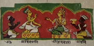
Sutamla (1648–1663) Jayadhwaj Singha was the 20th king of the Ahom kingdom. During his reign the Mughal viceroy at Bengal Mir Jumla II invaded and occupied his capital Garhgaon as a result of which he had to retreat to the Namrup area, and because of this flight he is also known as the Bhagania Roja in the Buranjis. In the days of Jayadhwaj Singha Auniati Satra and Dakhinpat Satra was established. He formally accepted the initiation of Niranjan Bapu and settled him as the as Satradhikar in the Auniati Satra. He even exempted disciples of satra from personal labour to the state.

Beltola is a prime residential area in the southern part of Guwahati, Assam. It is an adjoining area of the Dispur capital complex. During Ahom reign, Beltola was a small Koch kingdom, whose ruler assisted in the administration of the Borphukan in Guwahati, the Ahom viceroy of Lower Assam and in maintaining relations with the communities of Khasi Hills. The kingdom of Beltola survived under the British rule and existed till 1947 when it finally joined the Union of India.

<span class="mw-page-title-main">Kamrup region</span> Region in India

Kamrup is the modern region situated between two rivers, the Manas and the Barnadi in Western Assam, with the same territorial extent as the Colonial and post-Colonial "Undivided Kamrup district". It was the capital region of two of the three dynasties of Kamarupa and Guwahati, the current political center of Assam, is situated here. It is characterized by its cultural artifacts.

The Koch–Ahom relations (1532–1571) refer to the diplomatic, strategic and military relationships between the Koch and the Ahom kingdoms over the control of the Brahmaputra Valley. Though an initial contact between the Ahoms and Koch occurred during Biswa Singha's reign, the relationship became belligerent with Nara Narayana ascending to power and consolidating his hold over the western portion of Assam; and it ended with the failure of Chilarai's campaign against Sulaiman Karrani. This was followed by an alliance that soon gave way to a fierce conflict between the Ahoms and the Mughals.
<span class="mw-page-title-main">Gohain Kamal Ali</span>

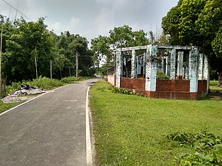
Gohain Kamal Ali was an embanked road that connected the capital of the Koch dynasty, Cooch Behar in North Bengal to heart of Agomani in Dhubri and Narayanpur in Lakhimpur district in Assam, and ran along the foot of the Bhutan hills and the Dafla (Nishi) hills. This was constructed under the supervision of Gohain Kamal Ali, the step-brother of the king, Nara Narayan and was completed in 1547. This was the road that the Koch general Chilarai used soon after for his invasion of the Ahom kingdom, and attacked the Ahom fort at Pichala, which was not a success, but a later movement in 1562 was greatly successful.

<span class="mw-page-title-main">Battle of Samdhara</span> Battle between Mughals and Ahoms in 1616

Battle of Samdhara was the first battle fought between Mughals and the Ahoms in 1616

<span class="mw-page-title-main">Balinarayan</span> King of the Darrang Kingdom, 1616 to 1638

Balinarayan alias Dharmanarayan or Baldeo of Mughals was the son of Koch King Raghudev and younger brother of King Parikshit and the first King of Darrang Desa. He was the chief conductor of the operations conducted against the Mughals during their occupation of Kamrupa erstwhile fallen Koch Hajo which got annexed to Mughal domains after the defeat of the latter.

References