
Muvattupuzha is a town, municipality in the midlands directly to the east of Kochi in Ernakulam district, Kerala, India. It is located about 36 km (22 mi) from downtown Kochi, and is a growing urban centre in central Kerala. The town is also the starting point of the Muvattupuzhayar, which is a confluence formed by three rivers: the Thodupuzhayar, Kaliyar, and Kothayar.
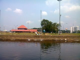
Aluva is a municipality in the Ernakulam district of Kerala, India. Aluva is situated 14.5 km (9.0 mi) from Kochi, along the banks of the Periyar River, and is a part of the Kochi metropolitan area. Aluva is a transportation hub, connecting North Malabar and Central Kerala to Kochi. The Cochin International Airport at Nedumbassery, located 11.7 km (7.3 mi) from Aluva, is an aviation hub hosting both domestic and international flights. Aluva is also the northern terminus of the Kochi Metro.

Perumbavoor is a place located at the bank of Periyar in Ernakulam District in the Indian state of Kerala. It is a part of the Kochi metropolitan area. It lies in the northeastern tip of the Greater Cochin area and is also the headquarters of Kunnathunad Taluk. Perumbavoor is famed in the state for wood industries and small-scale industries. Ernakulam lies 30 km southwest of Perumbavoor. The town lies between Angamaly and Muvattupuzha on the Main Central Road (MC), which connects Thiruvananthapuram to Angamaly through the old Travancore part of Kerala.

Thrippunithura is a municipality in the Ernakulam district of Kerala, India. Thrippunithura is located about 7.1 km (4.4 mi) east of the Kochi city centre, and is a major satellite town of the city. Tripunithura being a prominent historical residential region in Kochi, was the capital of the erstwhile Kingdom of Cochin. The Hill Palace situated in Tripunithura was the palace of Maharaja of Cochin, the ruler of Kingdom of Cochin. Thrippunithura is known for its rich culture which includes the annual Vrishchikotsavam festival that takes place at the Sree Poornathrayeesa Temple.
Edappally is a ward of Kochi, Kerala. The name is also used to refer to adjacent wards of Kalamassery and Thrikkakkara municipalities. Edappally is a major commercial centre as well as a prominent residential region. Edappally junction is one of the busiest junctions in the city.
North Paravur. formerly known as Paravur or Paravoor or Parur, is a municipality and suburb in Ernakulam district in the Indian state of Kerala. It is a northern suburb of the city of Kochi and is situated around 20 km from the city centre. It is also the first place in India to use electronic voting machine during the by-elections in 1982.

Piravom is a municipality in Ernakulam district and a suburb of Kochi in the Indian state of Kerala. It is located with in 31 km southeast of Kochi city center, at the boundary of the Ernakulam and Kottayam districts. Piravom is famous for its Hindu temples and Christian churches. Piravom has a river-front, verdant hills, and paddy fields.

Thalayolaparambu is a town situated in Kottayam district in Kerala, India. Spanning over an area of 19.3 square kilometres with a population of 22,571 people, this mini-town is home to some of the well-known personalities such as the former Chief minister of Travancore-Cochin A. J. John, Anaparambil, the late Malayalam novelist/writer Vaikom Muhammed Basheer, the former Chief Justice of India K. G. Balakrishnan. Thalayolaparambu also hosts the major market established during the administration of Velu Thampi Dalawa, and is one of those few Keralite markets that still retains its old-world charm till date.
Eloor is a municipality in the Ernakulam district of Kerala, India. It is an industrial area situated around 13 kilometres north of the Kochi city centre, and is a part of the Kochi metropolitan area. It is an island of 14.21 km2 formed between two distributaries of river Periyar and is the largest industrial belt in Kerala. The neighbouring places of Eloor are Kalamassery industrial hub, Aluva, Cheranalloor and Paravur.

Puthukkad is a town on the banks of Kurumali River, also known as Mupliyam River, in Kerala. The town is 15 km (9.3 mi) to the south of Thrissur, 16 km (9.9 mi) to the north of Chalakudy, and 1.2 km (0.75 mi) west of Cheruval. The National highway NH 544 passes through thi town.

The Kochi metropolitan area or Kochi urban agglomeration is a metropolitan area consisting of Kochi and its satellite towns in Ernakulam district, Kerala, India. With a population of more than 2.1 million within an area of 440 km², it is the most populous metropolitan area in Kerala.
Mannar is a census town in Chengannur Taluk in Alappuzha District of Kerala state, India, on State Highway 6. It is also known as the Bell Metal Town.
Thirumarady is situated in the eastern part of Ernakulam District in Kerala, South India. Thirumarady is the headquarters of Thirumarady Grama Panchayath which won an award for the "Best Panchayat in the State" two times for its commendable achievements in the rural area.
Perumpilly, also Perumpally, is a village in Kanayannur taluk of Ernakulam district in Kerala state, south India. It is 22 km (14 mi) south-east of Ernakulam city. Perumpilly is famous for historic Christian churches and Hindu temples. The village lies 14 km (8.7 mi) from Piravom. The nearest town is Mulanthuruthy.
Nedumkandam is the headquarters of Udumbanchola taluk which is situated in Idukki district of the Indian state of Kerala. Nedumkandam is among the fastest growing towns in the Idukki district. Nedumkandam is well known for its spices production and is a major contributor to the production of spices like cardamom and pepper. This town situated an average elevation of 900 meter above sea level and maximum elevation respectively 1190 meter 1100 meter and 975 meter and is a destination for economical stay and shopping for tourists in the popular Kumily-Munnar tourist route.

Kadamattom Church is an ancient Malankara Syriac Orthodox Church, located in Kadamattom near Kolenchery, in Ernakulam district, Kerala, India.
Puthenkurish is a town in Ernakulam district in the Indian state of Kerala near Kolenchery town en route to Muvattupuzha. It is a part of the Greater Cochin area. Puthencruz is one of the fastest developing villages in Ernakulam district. Puthencruz plays a pivotal role in connecting different smaller villages and other surrounding towns to Ernakulam as it lies in the outer ring of Ernakulam City. Puthencruz is rapidly developing into a city and will be at the pivot of expansion of the Ernakulam municipal area.

Chengara is a small village situated in the Pathanamthitta district in Kerala, India. It is known for its natural environment, hills and climate, and was found to have the cleanest air, in terms of concentration of dust particles. Chengara is surrounded on three sides by Harrisons Malayalam Limited, a rubber plantation company.

Mar Athanasius Memorial Higher Secondary School (MAMHSS) is a school situated in Puthencruz, Ernakulam district, Kerala. The school is affiliated with Kerala State Education Board, SCERT.
Valakom is a fastest growing town located on Kerala State highway One, in the Kollam district of Kerala, India, with population 17928. It lies within Kottarakkara municipal town, Ummannoor and edamulackal Panchayat.


