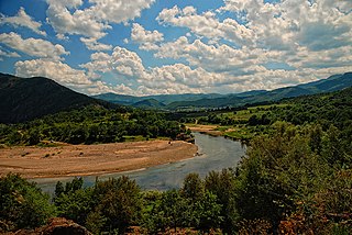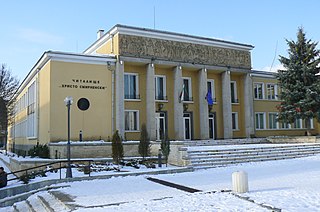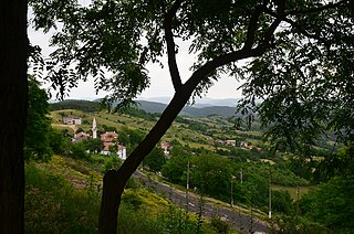
The Arda is a 290-kilometre (180 mi) long river in Bulgaria and Greece. It is a tributary of the Maritsa. Its source lies in the Bulgarian Rhodope Mountains near the village Arda, part of the municipality of Smolyan. It flows eastward past Rudozem, Kardzhali and Ivaylovgrad and enters Greece in the northern part of the Evros regional unit. It flows into the Maritsa on the border of Greece and Turkey, between the Greek village Kastanies and the Turkish city Edirne. In the Bulgarian section there are three hydroelectric and irrigation dams, Kardzhali Dam, Studen Kladenets and Ivaylovgrad Dam. The Bulgarian section is 229 kilometres (142 mi) long, making the Arda the longest river in the Rhodopes. The medieval Dyavolski most arch bridge crosses the river 10 kilometres (6 mi) from Ardino.

Opaka is a town in Targovishte Province in northeast Bulgaria. As of December 2009, the town had a population of 2,873 and covers an area of 57 square kilometres (22 sq mi). It is 70 kilometres (43 mi) south of the city of Rousse on the border with Romania and 250 kilometres (160 mi) northeast of the Bulgarian capital, Sofia. Archeologists have found evidence of Thracian, Roman and Slavonic settlements in the area. Near the village of Krepcha, a stone monastery is the site of the oldest known Old Bulgarian Cyrillic inscription, dated from around 920 CE. A 2nd century Thracian tumulus containing various artifacts, including six leaves of a golden wreath and bronze figurines, was excavated in 2011.

Zlatitsa is a town and the seat of the Zlatitsa Municipality in southern Bulgaria located in the Zlatitsa-Pirdop valley. It lies between Stara Planina to the north and Sredna Gora to the south at 680 metres (2,230 ft) above sea level. It is situated immediately south in the lap of the Zlatitsa -Teteven Mountain. Zlatitsa is situated 75 kilometres (47 mi) east of Sofia, 27 kilometres (17 mi) south of Etropole, 32 kilometres (20 mi) north of Panagiurishte, 2 kilometres (1.2 mi) west of Pirdop and 32 kilometres (20 mi) northwest of Koprivshtitsa. The population is 5,286.

Krushari is a village in northeastern Bulgaria, part of Dobrich Province. It is the administrative centre of Krushari Municipality, which lies in the northwestern part of the province. Krushari is located 32 kilometres from the provincial capital of Dobrich, 85 kilometres from Varna and around 70 kilometres from Balchik and Silistra.

Koniewo is a village in the administrative district of Gmina Lidzbark Warmiński, within Lidzbark County, Warmian-Masurian Voivodeship, in northern Poland. It lies approximately 6 kilometres (4 mi) north of Lidzbark Warmiński and 43 km (27 mi) north of the regional capital Olsztyn.

Koniewo is a village in the administrative district of Gmina Wolin, within Kamień County, West Pomeranian Voivodeship, in north-western Poland. It lies approximately 6 kilometres (4 mi) south-east of Wolin, 21 km (13 mi) south-west of Kamień Pomorski, and 43 km (27 mi) north of the regional capital Szczecin.

Avramovo is a village in Ardino Municipality, Kardzhali Province, in southern-central Bulgaria. It is located 187.5 kilometres (116.5 mi) from Sofia, roughly 14 kilometres (8.7 mi) by road southwest of the city of Kardzhali, and roughly 20 kilometres (12 mi) by road east of the municipal town of Ardino.Boyno lies just to the east along the 865 road. It covers an area of 6.197 square kilometres (2.393 sq mi) and as of 2007 had a population of 6 people. Until 1934, the settlement had the name Ibrahimler.

Chubrika is a village in Ardino Municipality, Kardzhali Province, southern-central Bulgaria. It is located 199.97 kilometres (124.26 mi) from Sofia, roughly 21.3 kilometres (13.2 mi) by road southwest of the city of Kardzhali, and roughly 13 kilometres (8.1 mi) by road east of the municipal town of Ardino. To the north is Yabalkovets and to the northeast is Kobilyane, along the 865 road. It covers an area of 5.782 square kilometres (2.232 sq mi) and as of 2007 had a population of 153 people. It was formerly called Fakrŭ Bunar.

Yabalkovets is a mountain village in Ardino Municipality, Kardzhali Province, southern-central Bulgaria. It is located 199.97 kilometres (124.26 mi) from Sofia, and roughly 16 kilometres (9.9 mi) by road northeast of the municipal town of Ardino. To the southeast is Chubrika. It covers an area of 11.232 square kilometres and as of 2013 had a population of 204 people.

Sinchets is a small mountain village in Ardino Municipality, Kardzhali Province, southern-central Bulgaria. It is located 199.967 kilometres (124.254 mi) from Sofia. It lies at altitude of 770 metres (2,530 ft), 9.8 kilometres (6.1 mi) by winding road to the southeast of Ardino, and north of Tsarkvitsa. It covers an area of 8.602 square kilometres and as of 2007 had a population of 70 people.

Gurbishte is a mountain village in Ardino Municipality, Kardzhali Province, southern-central Bulgaria. It is located 196.78 kilometres (122.27 mi) from Sofia and 13.6 kilometres (8.5 mi) by winding road south of Ardino. It lies to the southwest of Sinchets, and northeast of Padina. It covers an area of 14.494 square kilometres and as of 2007 had a population of 183 people. The village contains a village hall.

Padina is a village in Ardino Municipality, Kardzhali Province, southern-central Bulgaria, located in a valley at the foot of Mount St. Elias (1001m). It is located 195.32 kilometres (121.37 mi) from Sofia,14.8 kilometres (9.2 mi) southwest of Ardino, and 4.8 kilometres (3.0 mi) by road south of Byal izvor. It covers an area of 10.411 square kilometres and as of 2007 had a population of 1030 people, although the population is rapidly declining and 851 were reported in 2010.

Glavnik is a village in Ardino Municipality, Kardzhali Province, southern-central Bulgaria. It is located 200.247 kilometres (124.428 mi) from Sofia. It covers an area of 1.795 square kilometres and as of 2007 had a population of 127 people.

Latinka is a village in Ardino Municipality, Kardzhali Province, southern-central Bulgaria. It is located 193.336 kilometres (120.133 mi) southeast of Sofia. It covers an area of 10.652 square kilometres and as of 2007 it had a population of 22 people.

Rusalsko is a village in Ardino Municipality, Kardzhali Province, southern-central Bulgaria. It is about 185 kilometres (115 mi) southeast of Sofia. It covers an area of about 7.9 square kilometres (3.1 sq mi), and as of 2007 it had a population of 60 people.

Svetulka is a village in Ardino Municipality, Kardzhali Province, southern-central Bulgaria. It is located 192.393 kilometres (119.547 mi) southeast of Sofia. It covers an area of 7.624 square kilometres and as of 2007 it had a population of 182 people.

Spoluka is a village in Ardino Municipality, Kardzhali Province, southern-central Bulgaria. It is located 183.076 kilometres (113.758 mi) southeast of Sofia. It covers an area of 3.4 square kilometres and as of 2013 it had a population of 18 people.

Tsarvaritsa or Tsurvaritsa is a village in the municipality of Nevestino, located in the Kyustendil Province of western Bulgaria. The village, in a mountainous region near the border with the Republic of Macedonia, covers an area of 41.137 square kilometres (15.883 sq mi) and is located 78.4 kilometres (48.7 mi) from Sofia. As of 2007, the village had a population of 84 people.

The Bulgaria–Turkey border is a 269 km (167 mi) long international border between the Republic of Bulgaria and the Republic of Turkey. It is the third longest border of Turkey, after Syria and Iran, and the shortest border of Bulgaria.


