
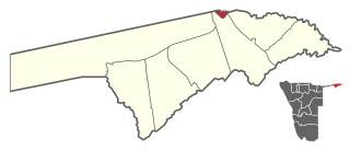
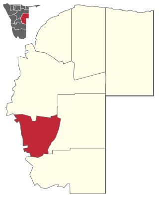
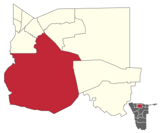
Kongola is the westernmost electoral constituency of Zambezi Region of Namibia, and the largest by area. It is located near the Kwando River. The administrative centre is Kongola. As of 2020, the constituency had 5,565 registered voters. [1]
Kongola is the westernmost electoral constituency of Zambezi Region of Namibia, and the largest by area. It is located near the Kwando River. The administrative centre is Kongola. As of 2020, the constituency had 5,565 registered voters. [1]
Besides Kongola some of the settlements in this constituency are Chetto, Pipo, Kachenje, Nxtohei, Omega 3, Poca, Mashambo, Mwanzi, Izwi, Mulanga, Munguza, Kahunikwa, Queensland, Kakuwa, and Mitondo. [2] Its population was 7,366 at the 2011 Census. [3]
The area is populated by members of the Mafwe and Mashi tribes, and thus governed by two traditional authorities. [4] A large area on the western side of the constituency falls under the Bwabwata National Park where approximately 1,900 Khwe San people reside.
The 2015 regional election was won by David Siyayo Muluti of the SWAPO Party with 1,227 votes, followed by Justings Musupi Kutembeka of the Rally for Democracy and Progress (RDP) with 495 votes. [5] The 2020 regional election was won by Bennety Likulela Busihu, an independent candidate. He received 1,236 votes. SWAPO's Muluti came second with 538 votes, followed by Albius Silwabubi Walubita of the Popular Democratic Movement (PDM, 384 votes) and Adams Manyando Lusepani from the Independent Patriots for Change (IPC, an opposition party formed in August 2020) with 333 votes. [1]

Sibinda Constituency is an electoral district of Namibia that is located in the Zambezi Region. Its centre is Sibinda which is a settlement 63 kilometres out of Katima Mulilo. The constituency has a population of 11,112 people. In the 2020 Regional Council Elections, there were 6,248 registered voters.
Katima Mulilo UrbanConstituency is an electoral district in Namibia. It is situated in the Zambezi Region. The region's capital, Katima Mulilo, is in this constituency. The constituency has a population of 28,362 people. In the 2020 Regional Council Elections, there were 13,860 registered voters.

Katima Mulilo Rural is a constituency in the Zambezi Region of Namibia. It comprises the area south of the town of Katima Mulilo, the regional capital. As of 2020, the constituency had 6,712 registered voters.

Samora Machel Constituency is a constituency in Windhoek in the Khomas Region of central Namibia. The constituency is located across four northern suburbs of Windhoek: Wanaheda, Greenwell Matongo, Goreangab, and part of Havana. It had a population of 50,110 in 2011, up from 29,382 in 2001. As of 2020 it had 45,962 registered voters.

Windhoek Rural is a constituency in the Khomas Region of Namibia. Its district capital is the settlement of Groot Aub. It had a population of 22,254 in 2011, up from 20,212 in 2001. As of 2020, it has 13,625 registered voters.

John Pandeni constituency, formerly known as Soweto is a constituency in the Khomas Region of Namibia. In 2008, it was renamed after John Pandeni, a member of the South West Africa People's Organization (SWAPO) and its militant wing, the People's Liberation Army of Namibia (PLAN). Pandeni was the first regional councilor for the former Soweto constituency and the first governor of Khomas. This constituency is inside the city of Windhoek in the formerly all-Black suburb of Katutura. It had a population of 15,121 in 2011, up from 13,865 in 2001. As of 2020, it has 14,758 registered voters.
Gobabis Constituency is an electoral constituency in the Omaheke Region of Namibia. As of December 2019 it had 13,457 registered voters. The constituency covers the rural area southeast of Gobabis and the town itself, except its Nossobville suburb. Gobabis is also the administrative centre of the constituency.

Anamulenge Constituency is an electoral constituency in the Omusati Region of northern Namibia. It had 12,470 inhabitants in 2004 and 11,186 registered voters in 2020. Its district capital is the settlement of Anamulenge.

Ogongo Constituency is an electoral constituency in the Omusati Region northern part of Namibia. It had 18,498 inhabitants in 2004 and 9,140 registered voters in 2020. Its district capital is the settlement of Ogongo. The constituency further contains the settlements of Eengolo, Eendombe, Pyamukuyu, Iipanda, Ombathi, and Omuthitu.

Ruacana Constituency is an electoral constituency in the Omusati Region of Namibia on the border to Angola. It had 10,722 inhabitants in 2004 and 9,285 registered voters in 2020. Its district capital is the town of Ruacana.

Okatana Constituency is an electoral constituency in the Oshana Region of Namibia. It had 15,562 inhabitants in 2004 and 9,111 registered voters in 2020. Its district capital is the settlement of Okatana.

Ongwediva Constituency is an electoral constituency in the Oshana Region of Namibia. It had 27,396 inhabitants and 22,061 registered voters in 2020. Its district capital is the town of Ongwediva.

Okankolo Constituency is an electoral constituency in the Oshikoto Region of Namibia. It had 12,926 inhabitants in 2004 and 8,487 registered voters in 2020. The district capital is the settlement of Okankolo. Settlements in this constituency include Onkumbula, Omeyantalala, Omakango, Omunduta, Omhuuda, and Omutwewomedi.

Olukonda Constituency is an electoral constituency in the Oshikoto Region of Namibia. It had 9,094 inhabitants in 2004 and 7,495 registered voters in 2020. The district capital is the settlement of Olukonda.
Omuthiyagwiipundi Constituency is an electoral constituency in the Oshikoto Region of Namibia. It had 21,884 inhabitants in 2004 and 15,220 registered voters in 2020. The constituency contains the settlements of Omuthiya and Iipundi. The area is predominantly rural.

Okahandja Constituency is an electoral constituency in the Otjozondjupa Region of Namibia. It had 18,155 inhabitants in 2004 and 18,109 registered voters in 2020. The constituency consists of the town of Okahandja and the surrounding rural area.

Okakarara Constituency is an electoral constituency in the Otjozondjupa Region of Namibia. It had 21,336 inhabitants in 2004 and 16,221 registered voters in 2020. The constituency consists of the town of Okakarara and the surrounding rural area.

Otavi Constituency is an electoral constituency in the Otjozondjupa Region of Namibia. It had 11,620 inhabitants in 2004 and 9,608 registered voters in 2020. The constituency consists of the town of Otavi and the surrounding rural area.

Tsumkwe Constituency is an electoral constituency in the Otjozondjupa Region of Namibia. It had 8,823 inhabitants in 2004 and 7,075 registered voters in 2020. About 2,400 San people live in this constituency. The constituency consists of the settlement of Tsumkwe and the surrounding rural area.

Windhoek West Constituency is an electoral constituency in the Khomas Region of Namibia. It contains the affluent suburbs of Hochland Park, Pioneers Park, Academia, Cimbebasia, Rocky Crest, Windhoek North and Windhoek West. It had a population of 53,438 in 2011, up from 42,201 in 2001. As of 2020, it has 33,556 registered voters.
Constituencies in the Zambezi Region of Namibia | ||
|---|---|---|
17°58′S23°17′E / 17.967°S 23.283°E
| | This article about government in Namibia is a stub. You can help Wikipedia by expanding it. |