
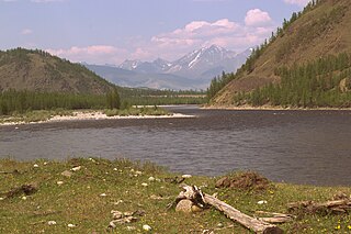
Ulan-Ude is the capital city of the Republic of Buryatia, Russia; it is located about 100 kilometers (62 mi) southeast of Lake Baikal on the Uda River at its confluence with the Selenga. According to the 2010 Census, 404,426 people lived in Ulan-Ude; up from 359,391 recorded in the 2002 Census, making the city the third-largest in the Russian Far East by population.
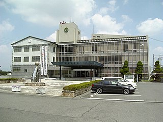
Kōryō is a town located in Kitakatsuragi District, Nara Prefecture, Japan. It served as Japan's temporary capital from 640-642 AD, the Kudara Palace. Kudara is a reference to the Korean kingdom of Baekje and "Koryo" is a reference to Korea. However, the kanji making up the town's name literally translate to 'many tombs', as the town has one of the highest concentrations of kofun in Japan.

The Republic of Buryatia is a federal subject of Russia, located in Siberia in Asia. Formerly part of the Siberian Federal District, it is part of the Russian Far East since 2018. Its capital is the city of Ulan-Ude. Its area is 351,300 square kilometers (135,600 sq mi) with a population of 972,021.
The Kudara no Konikishi was a Japanese clan whose founder Zenkō was a son of King Uija, the last king of Baekje in southwestern Korea.

The Head of the Republic of Buryatia, formerly President of the Republic of Buryatia, is the highest office within the Government of Republic of Buryatia, Russia. Since the dissolution of the Soviet Union, three people have served in this position.

Bauntovsky District is an administrative and municipal district (raion), one of the twenty-one in the Republic of Buryatia, Russia. It is located in the northeast of the republic. The area of the district is 66,816 square kilometers (25,798 sq mi). Its administrative center is the rural locality of Bagdarin. As of the 2010 Census, the total population of the district was 9,667, with the population of Bagdarin accounting for 49.0% of that number.

Bichursky District is an administrative and municipal district (raion), one of the twenty-one in the Republic of Buryatia, Russia. It is located in the south of the republic. The area of the district is 6,201 square kilometers (2,394 sq mi). Its administrative center is the rural locality of Bichura. As of the 2010 Census, the total population of the district was 25,352, with the population of Bichura accounting for 36.1% of that number.

Dzhidinsky District is an administrative and municipal district (raion), one of the twenty-one in the Republic of Buryatia, Russia. It is located in the south of the republic. The area of the district is 8,600 square kilometers (3,300 sq mi). Its administrative center is the rural locality of Petropavlovka. As of the 2010 Census, the total population of the district was 29,352, with the population of Petropavlovka accounting for 25.4% of that number.

Ivolginsky District is an administrative and municipal district (raion), one of the twenty-one in the Republic of Buryatia, Russia. It is located in the center of the republic. The area of the district is 2,660 square kilometers (1,030 sq mi). Its administrative center is the rural locality of Ivolginsk. As of the 2010 Census, the total population of the district was 37,983, with the population of Ivolginsk accounting for 19.4% of that number.
Okinsky District is an administrative and municipal district (raion), one of the twenty-one in the Republic of Buryatia, Russia. It is located in the west of the republic. The area of the district is 26,012 square kilometers (10,043 sq mi). Its administrative center is the rural locality of Orlik. As of the 2010 Census, the total population of the district was 5,353, with the population of Orlik accounting for 47.7% of that number.

Tunkinsky District is an administrative and municipal district (raion), one of the twenty-one in the Republic of Buryatia, Russia. It is located in the west of the republic. The area of the district is 11,791.62 square kilometers (4,552.77 sq mi). Its administrative center is the rural locality of Kyren. As of the 2010 Census, the total population of the district was 22,672, with the population of Kyren accounting for 23.8% of that number.

Zakamensky District is an administrative and municipal district (raion), one of the twenty-one in the Republic of Buryatia, Russia. It is located in the southwest of the republic. The area of the district is 15,320 square kilometers (5,920 sq mi). Its administrative center is the town of Zakamensk. As of the 2010 Census, the total population of the district was 28,453, with the population of Zakamensk accounting for 40.5% of that number.

The state flag of the Republic of Buryatia, or simply flag of Buryatia, is one of the official symbols of the Republic of Buryatia—a subject of the Russian Federation.
Buddhism in Buryatia—a regional form of Buddhism.
The Anthem of the Republic of Buryatia is one of the state symbols of the Republic of Buryatia together with the flag and the coat of arms.

Kudara is a rural locality in Kabansky District, Republic of Buryatia, Russia. The population was 2,058 as of 2010. There are 21 streets.
Bolshaya Kudara is a rural locality in Kyakhtinsky District, Republic of Buryatia, Russia. The population was 740 as of 2010. There are 17 streets.
Kudara-Somon is a rural locality in Kyakhtinsky District, Republic of Buryatia, Russia. The population was 1,371 as of 2010. There are 21 streets.
Malaya Kudara is a rural locality in Kyakhtinsky District, Republic of Buryatia, Russia. The population was 278 as of 2010. There are 5 streets.