Kuhl irrigation (Himachal Pradesh)

Last updated

The Kuhl irrigation system in the Kangra Valley of Himachal Pradesh is a remarkable example of traditional community-managed gravity flow irrigation. This system plays a crucial role in supporting agriculture in the region, allowing farmers to efficiently utilize water resources in the challenging Himalayan terrain.

Contents

The Kangra Valley, situated at the base of the Dhauladhar mountain range, features forested alluvial plains sloping down from the mountains. The valley is intersected by small streams known as nalas and perennial rivers, or khads, which are fed by glacial melts from the Dhauladhar range and eventually join the Beas River.

The Kuhl irrigation system involves a sophisticated network of canals and channels that crisscross the landscape. These canals are designed to utilize gravity for the flow of water, allowing it to reach various agricultural fields in a controlled and organized manner. The term "Kuhl" is derived from the local dialect and signifies the interconnected nature of these canals, which are carefully managed by the local communities.

The success of the Kuhl system lies in its ability to harness water from small streams and rivers, distributing it effectively to support crop cultivation. This traditional water management system not only addresses the challenges posed by the Himalayan terrain but also represents the collective wisdom and ingenuity of the local communities.

Similar water management systems, such as the Kuls of Spiti and Guls of Kashmir, highlight the diversity of approaches employed by different regions to address their specific water needs. These systems, rooted in local knowledge and practices, contribute significantly to sustaining agriculture and livelihoods in their respective areas.

History

The kulhs have a history that is 300 years old. They are believed to have started during the rule of the Katoch family who is said to have sponsored the largest kuhl systems. The names of these kuhls often find their origins in 'raja' (king) and 'rani' (queen) after the royalty who sponsored the construction of the kuhls. Since all communities benefited from the kuhls, its construction can be seen as an exercise to garner political power and acceptance.The kuhl management fell under the purview of a family appointed by the ruler, and was often a hereditary post. Upon this appointed Kohli falls the prime responsibility of managing the system of kuhls, ensuring that the distribution of water is fair and leading the maintenance of the kuhls.... [1]  

Colonial rule saw support extended to the kuhls for economic reasons. This included generating revenues  and averting famines.   Baker in the opening of his book highlights how the British government was aware of the importance of the Kuhl system to the socio-economic fabric of the valley.  The response of the British rulers to the earthquake of 1905 that happened preceding the rice planting season, illustrates the awareness of the government of the importance of the kuhl system to the socio-economic fabric of the valley. [2] The earthquake resulted in the complete destruction of the irrigation canals. A troupe of soldiers in the military engineering units were mobilized immediately to work on the repair of the canal and a potential famine, from the failure of the paddy crop, was averted.

The British also codified the existing system and its customary laws in a document called the Riwaj-I-Abpashi [2] which mentions the names, histories and locations of the kuhls, its water sharing rules, and the measures needed to be taken to resolve conflicts.

Post-independence saw a change in the system of kuhl management. There was a bureaucratization of the earlier system of hereditarily appointed kohlis. A new system of elected kuhl committees headed by a Kohli was put in place. These committees work in liaison with the government for tasks including managing the grants needed for the maintenance of kuhl and facilitating the relationship with the companies that built small hydro-power projects in the rivers of the valley. These committees are still exclusively organised by men as women have been traditionally excluded from any processes related to the kuhls. [3]

The government also used a number of International Development Assistance programmes to bring in resources to maintain and change the nature of kuhals and their management. Since this was done through IPH department, which was primarily an irrigation assets construction and maintenance entity made of civil engineers, many of whom being local residents and knowing the history and customary kuhal management systems, assisted a process of centralised and bureaucratized version of kuhal management which further alienated this centuries old resilient and community driven water commons. The study of Lower Baijnath Kuhal (see reference documents), shows how this process unfolded and with what consequences.

Functions

Irrigation is the primary function of the kuhls. As of 2002, it irrigated about 30,000 hectares of the valley. [4] The Riwaj-I-Abpashi in 1918 notes that there were around 715 major and  over 2500 minor kuhls in the valley. Unsurprisingly, the irrigation through the Kuhls along with rain patterns heavily affect the cropping patterns of Kangra. Dependence on the Kuhl waters peaks twice a year, right before the sowing of the kharif (summer) and rabi (winter) crops.

Water from the river is diverted through canals that are made out digging land and pitching stones. This rubble masonry is called Danga. Dangas are not permanent structures. This makes it easier to channel water for new and additional needs like someone starting to farm a new piece of land. Diversions are made of grass, stones or sticks. It keeps the cost of maintaining the system negligible. Intensive maintenance work on the Dangas happens during spring as the glacial melt and winter storms usually cause damage to the structures. Traditionally, under the leadership of the Kohli, the community comes together to repair it every year. This is called Khana.

Since these canals are unlined they  also recharge underground water through the areas it flows through seepage. They also support the growth of riparian ecosystems along its course. The water from the Kuhls is also used to wash dishes, clothes and livestock and in instances when the tap water runs dry it is used for drinking purposes too.  However, domestic dependence of the Kuhls have reduced considerably since the availability of tap water.

It also caters to other livelihoods to the communities and families that run the watermills (Gherats) and the shepherds (Gaddis).  Since the water mills run without electric power and operate with the force of water, the community gets to grind grains at a really low cost.  Systems of informality are prevalent here and often the Gherats are paid in grain when the families don't have money to pay for the services of the water mills .

Present Day

Changes in the past few decades have posed a challenge to the functioning of the kuhls. This includes a sharp decline in dependence on agriculture and out-migration. This has resulted in the fall in available collective labor to perform annual maintenance tasks and the general interest in the maintenance of the kuhls.

In the recent years, the government has started to manage these structures and construct them out of concrete. Apart from making the repairs to damages costlier and unaffordable to the people of the valley, it has made it difficult to divert the canal according to changing needs. The cementing on the kuhl is executed through MNREGA program. [5] The villagers participate in this for the wages, despite being in disagreement with the cementing of the kuhls. In many villages, the Department of Irrigation and Public manages the kulhs. All of these changes can be seen as a complete perversion of the earlier systems of management and community ownership that surrounded the kuhl. [3]

509 Small Hydro Electric Projects (up to 5 MW capacity) with an aggregate capacity of 1299 MW have been allotted in Himachal Pradesh till March 2011. [6] These  proposed projects that are now in various stages of development in most river systems of Himachal Pradesh are affecting the river basins and the communities dependent on it. [7] Studies have shown that the new projects are affecting kuhls of the Kangra Valley too. It has been noted that there has been significant decline in the flow of water and soil moisture which has affected the remaining agricultural fields of the valley. [8] Kuhls are now seen to be running dry, when the water is stored in the weir and flooded, when the water is released when generating hydro-power [9]

Kuhls as Commons

The persistence of the kuhl regime while many other community managed irrigation systems in India have collapsed under socio-economic changes, destroyed under environmental disturbances or been privatized, is a rich field in understanding theories including commons management

The organisation of the kuhl system and its management can be understood using Elinor Ostrom’s concept of self organizing system of a common-pool resource (CPRs). Ostrom’s work is posited against Garret Hardin’s ‘tragedy of the commons’ which argues that individuals are rational economic actors whose actions propelled by their self interest can inflict damage and deteriorate the common good. Hardin ignores that these commons are situated within communities where access and management of it are negotiated.

Ostrom elaborates 8 design principles for self governing institutions that manage resources. It highlights the importance of the need for the institution to be fair, flexible and accountable. [10] The functioning of the kuhls resonate with this theory of self-organizing systems.

But it needs to be highlighted that these systems often operate outside of rational incentives. They are sites where prestige, power and memory are played out. [11] Additionally conceptions of state and market and the role that they play in facilitating/ hindering the persistence of a CPR also need to be understood [2] [12]

Related Research Articles

<span class="mw-page-title-main">Himachal Pradesh</span> State in northern India

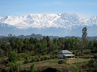
Himachal Pradesh is a state in the northern part of India. Situated in the Western Himalayas, it is one of the thirteen mountain states and is characterised by an extreme landscape featuring several peaks and extensive river systems. Himachal Pradesh is the northernmost state of India and shares borders with the union territories of Jammu and Kashmir and Ladakh to the north, and the states of Punjab to the west, Haryana to the southwest, Uttarakhand to the southeast and a very narrow border with Uttar Pradesh to the south. The state also shares an international border to the east with the Tibet Autonomous Region in China. Himachal Pradesh is also known as Dev Bhoomi or Dev Bhumi, meaning 'Land of Gods' and Veer Bhoomi which means 'Land of the Brave'.

<span class="mw-page-title-main">Beas River</span> River in north India

The Beas River is a river in north India. The river rises in the Himalayas in central Himachal Pradesh, India, and flows for some 470 kilometres (290 mi) to the Sutlej River in the Indian state of Punjab. Its total length is 470 kilometres (290 mi) and its drainage basin is 20,303 square kilometres (7,839 sq mi) large.

<span class="mw-page-title-main">Dharamshala</span> Winter capital of Himachal Pradesh, India

Dharamshala is a town in the Indian state of Himachal Pradesh. It serves as the winter capital of the state and the administrative headquarters of the Kangra district since 1855. The town also hosts the Tibetan Government-in-exile. Dharamshala was a municipal council until 2015, when it was upgraded to a municipal corporation.

<span class="mw-page-title-main">Acequia</span> Community-operated watercourse

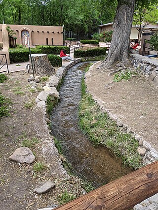
An acequia or séquia is a community-operated watercourse used in Spain and former Spanish colonies in the Americas for irrigation. Acequias are found in parts of Spain, the Andes, northern Mexico, and the modern-day American Southwest.

<span class="mw-page-title-main">Ravi River</span> River in India and Pakistan

The Ravi River is a transboundary river crossing northwestern India and eastern Pakistan. It is one of five rivers associated with the Punjab region.

<span class="mw-page-title-main">Kangra district</span> District in Himachal Pradesh, India

Kangra district is the most populous district of the Indian state of Himachal Pradesh. Dharamshala is the administrative headquarters of the district.

<span class="mw-page-title-main">Dhauladhar</span> Himalayan mountain range

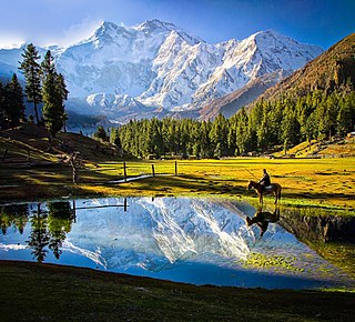
Dhauladhar is a mountain range which is part of a lesser Himalayan chain of mountains. It rises from the Shivalik hills, to the north of Kangra and Mandi. Dharamsala, the headquarters of Kangra district and the winter capital of Himachal Pradesh, lies on its southern spur in the Kangra Valley. Chamba lies to the North of this range.

<span class="mw-page-title-main">Bhakra Dam</span> Dam in Himachal Pradesh, India

Bhakra Nangal Dam is a concrete gravity dam on the Satluj River in Bhakra Village in Bilaspur district, Himachal Pradesh in northern India. The dam forms the Gobind Sagar reservoir. Nangal Dam is another dam at Nangal in Punjab downstream of Bhakra Dam. However, sometimes both the dams together are called Bhakra-Nangal Dam though they are two separate dams.

Palampur is a hill station and a municipal corporation situated in the Kangra District in the Indian state of Himachal Pradesh.

<span class="mw-page-title-main">Geography of Himachal Pradesh</span>

The state of Himachal Pradesh is spread over an area 55,673 km2 (21,495 sq mi) and is bordered by Jammu and Kashmir and Ladakh on the north, Punjab on the southwest, Haryana on the south, Uttarakhand on the southeast, a small border with Uttar Pradesh in the south, and Tibet on the east. Entire Himachal Pradesh lies in the mountainous Himalaya region, rich in natural resources

<span class="mw-page-title-main">Maharana Pratap Sagar</span> Reservoir in India

Maharana Pratap Sagar, also known as Pong Reservoir or Pong Dam Lake is a large reservoir in Fatehpur, Jawali and Dehra tehsil of Kangra district of the state of Himachal Pradesh in India. It was created in 1975, by building the highest earthfill dam in India on the Beas River in the wetland zone of the Siwalik Hills. Named in the honour of Maharana Pratap (1540–1597), the reservoir or the lake is a well-known wildlife sanctuary and one of the 49 international wetland sites declared in India by the Ramsar Convention. The reservoir covers an area of 24,529 hectares, and the wetlands portion is 15,662 hectares.

<span class="mw-page-title-main">Hydroelectric power in Himachal Pradesh</span>

The Indian state Himachal Pradesh has a large number hydroelectricity resources, about twenty five percent of the national potential. About 27,436 MW of hydroelectric power can be generated in the state by the construction of various hydroelectric projects on the five perennial river basins. Out of total hydroelectric potential of the state, 10,519 MW is harnessed so far, out of which 7.6% is under the control of Himachal Pradesh Government while the rest is exploited by the Central Government. The state government has been giving the highest priority for its development, since hydroelectric generation can meet the growing need of power for industry, agriculture and rural electrification. It is also the biggest source of income to the state as it provides electricity to other states.

<span class="mw-page-title-main">Kangra Valley</span> River valley in Himachal Pradesh, northern India

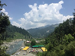
Kangra Valley is a river valley situated in the Western Himalayas. It lies in the state of Himachal Pradesh in India, and is a popular tourist destination. The Kangri language is spoken there. Dharamshala, the headquarters of Kangra district and the main city of the valley, lies on the southern spur of Dhauladhar.

<span class="mw-page-title-main">Lift irrigation</span> Method of irrigation

Lift irrigation is a method of irrigation in which water is not transported by natural flow, but is lifted with pumps or surge pools etc.

<span class="mw-page-title-main">Barot, Himachal Pradesh</span> Town Valley in Himachal Pradesh, India

Barot, a village originally developed in the 1920s for Shanan Hydel Project, is now a tourist location in Mandi district in the Indian state of Himachal Pradesh. Barot was difficult to access until 1975, when a road was opened. It is situated 40 km from Jogindernagar and 65 km from Mandi, the district headquarter. The road to Barot branches off at Jogindernagar-Mandi Highway and from Jogindernagar the distance is 40 km. It is sometimes possible to use the funicular trolley from Jogindernagar which reduces the distance to 12 km. The road route includes terraced fields and thick cedar forests, rising to Jhatingri at the hilltop. The remains of the summer palace of the former rulers of Mandi are located here. Through the small village of Tikkan, the road carries on to Barot. The town has a range of outdoor activities, including a trout breeding centre, from where fish are released into the Uhl river. A 30 km section of the river is used for angling.

<span class="mw-page-title-main">Kangra Valley Railway</span> Indian narrow gauge railway line

The Kangra Valley Railway is a 2 ft 6 in gauge railway that runs from Pathankot, Punjab to Jogindernagar in Himachal Pradesh. It runs through the sub-Himalayan region of Kangra Valley and is 164 km (101.9 mi) long. It is on the UNESCO World Heritage Sites tentative list. The railway is part of the Firozpur division of Northern Railway. It is the longest Narrow Gauge line in India and also the longest 2 ft 6 in Gauge Railway in the World. The highest point on this line is Ahju station at an elevation of 1,290 meters (4,230 ft). There are 33 stops and 950 bridges.

Kotla is a small hill town situated on the Pathankot–Dharamshala road, in Himachal Pradesh, India. It is located in the Kangra district. The town is about 45 kilometres (28 mi) from Pathankot and the same distance from Dharamshala. Its geographical coordinates are 32° 15' 0" North, 76° 2' 0" East.

Irrigation is the artificial exploitation and distribution of water at project level aiming at application of water at field level to agricultural crops in dry areas or in periods of scarce rainfall to assure or improve crop production.
This article discusses organizational forms and means of management of irrigation water at project (system) level.

<span class="mw-page-title-main">Uhl River</span> River in Himachal Pradesh, India

The Uhl is a Himalayan river which is part of the watershed of Beas river. The river originates at the Thamsar Glacier in the Dhauladhar range of the Himalayas, flows through the Uhl valley crossing the villages Bada Gran (Baragram) and Barot. In its lower course, it is also known as Tiun Nala and the Uhl valley is known as Chohar valley. After passing the Chohar valley, the Uhl meets the Beas river 5 km downstream from Pandoh.

<span class="mw-page-title-main">Western Himalayas</span> Western section of the Himalayas

The Western Himalayas refers to the western half of the Himalayas, in northwestern India and northern Pakistan. Four of the five tributaries of the Indus River in Punjab rise in the Western Himalayas; while the fifth, the Sutlej cuts through the range after rising in Tibet.

References

  1. "Digital Library Of The Commons". dlc.dlib.indiana.edu. Retrieved 2020-07-27.
  2. 1 2 3 Baker, J Mark (2005). The Kuhls of Kangra: community-managed irrigation in the western Himalaya. The University of Washington Press.
  3. 1 2 "Irrigation in Kangra valley: no longer kuhl". People's Archive of Rural India. 2019-05-13. Retrieved 2020-07-27.
  4. "HimalDoc". lib.icimod.org. Retrieved 2020-07-27.
  5. "Kuhl, kohli and a lost tradition". www.indiawaterportal.org. Retrieved 2020-07-27.
  6. "Small projects, big impacts: Micro and mini hydel projects of Himachal Pradesh". www.indiawaterportal.org. Retrieved 2020-07-27.
  7. Sandrp (2014-10-04). "Hydropower in Himachal: Do we even know the costs?". SANDRP. Retrieved 2020-07-27.
  8. "HP 'Kulhs' bear the brunt of small hydro projects". The Statesman. 2018-05-07. Retrieved 2020-07-27.
  9. "Amit Tandon | Connecting Social and Physical Boundaries of the Commons : Case study : Kuhl Irrigation Systems of Kangra. Rural. - ppt télécharger". slideplayer.fr. Retrieved 2020-07-27.
  10. Ostrom, Elinor (23 September 2015). Governing the commons : the evolution of institutions for collective action. ISBN   978-1-107-56978-2. OCLC   1096208988.
  11. Mosse, David (1997). "The Symbolic Making of a Common Property Resource: History, Ecology and Locality in a Tank-irrigated Landscape in South India". Development and Change. 28 (3): 467–504. doi:10.1111/1467-7660.00051. ISSN   1467-7660.
  12. De Angelis, M. (2010). The beginning of history : value struggles and global capital. Pluto. ISBN   978-1-78371-657-9. OCLC   1030391313.